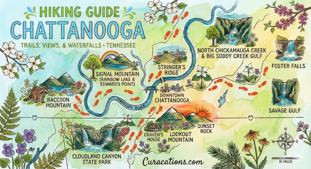
In this comprehensive guide, you’ll find detailed information on the best hikes in Chattanooga, including iconic downtown trails, Signal Mountain adventures, hidden urban gems, Georgia neighbors, and longer day trips. Each trail is described with difficulty level, distance, seasonal tips, parking guidance, and key landmarks, ensuring you can plan your hike confidently.
For anyone who loves exploring nature on foot, this area offers an exceptional variety of trails. Whether you’re a beginner looking for a short, family-friendly hike, a local wanting a quick escape after work, or an experienced hiker seeking strenuous climbs and waterfalls, Chattanooga has something for you. This guide is designed for locals, weekend adventurers, visiting families, and even photographers or history enthusiasts who want to make the most of the area’s outdoor opportunities.
You’ll also discover specialized hikes, like waterfall trails near the city, historic Civil War paths, and scenic overlooks with incredible sunset views. The guide covers Glen Falls Trail, the “Big Daddy” Loop, Sunset Rock, Rainbow Lake, and even less-known gems like Audubon Acres and Ritchie Hollow, with tips on what to expect during each season.
Additionally, we’ve answered the most frequently asked questions to address the most common questions about hiking in Chattanooga, such as whether trails are family-friendly, the easiest hikes, and which mountains are iconic. By the end of this guide, you’ll know where to park, what gear to bring, and which hikes fit your schedule and skill level.
Whether you are looking for a short nature escape, a strenuous endurance hike, or a scenic photography trip, this article is your ultimate roadmap to exploring Chattanooga’s trails safely and enjoyably.
Quick Guide: Top Chattanooga Hikes by Category
| Category | Top Pick | Distance | Difficulty | Why It’s The Best |
| Best Overall View | Sunset Rock | 3.0 miles | Moderate | Iconic sunset overlook of the Tennessee River & downtown. |
| Best Waterfall | Cloudland Canyon | 2.0 miles | Strenuous | Two massive waterfalls (Cherokee & Hemlock) in one hike. |
| Best for Families | Glen Falls | 2.0 miles | Easy | Short, flat, features a rock tunnel and cascading pools. |
| Best Urban Hike | Stringer’s Ridge | 1.5 miles | Easy | Best skyline view of the city; located in North Shore. |
| Best Workout | Big Daddy Loop | 10.0 miles | Hard | The ultimate trail-running loop on Lookout Mountain. |
| Best Photo Op | Rainbow Lake | 2.3 miles | Moderate | Famous suspension bridge and creek views. |
The Chattanooga Classics: Best Lookout Mountain Hikes

Best Sunset Hike: Sunset Rock via Kravitz Trail
Difficulty: Moderate
Distance: ~3 miles round trip (from Cravens House)
Best For: Sunset views, Civil War history
The Sunset Rock hike begins at the Cravens House and winds through shaded forested paths before opening onto the dramatic overlook known as Sunset Rock. The trail climbs steadily with moderate elevation gain, featuring exposed roots and occasional rocky sections. Along the way, hikers will pass through hardwoods and pine, with intermittent glimpses of downtown Chattanooga and the Tennessee River below. Sunset Rock itself offers a panoramic view ideal for photography or a relaxing rest before heading back.
The trail is particularly beautiful in late afternoon light when the sun casts long shadows across the cityscape. Its proximity to downtown makes it accessible yet feels removed from urban noise. Trail conditions vary seasonally, with muddy sections in spring and dry, firm footing in summer and fall.
Local’s Tip: Arrive early on weekends for parking near Cravens House. Avoid the tiny upper parking lot on West Brow Road, as it is strictly enforced, and towing is common.
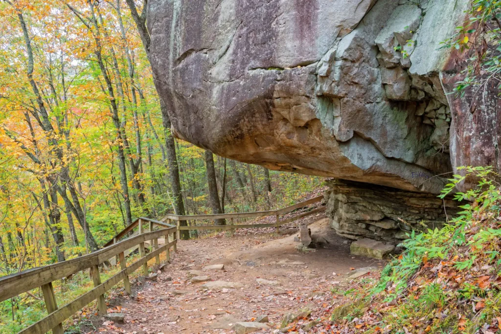
Best Historic Trail: Point Park to Cravens House Loop
Difficulty: Moderate (Steep stairs)
Distance: 1.5-2 miles
Best For: History buffs, Civil War sites
This loop connects the historic Point Park area with the Cravens House, descending the famous “Steps” past Civil War rifle pits. The trail includes paved sections, stone steps, and occasional wooden bridges, offering hikers a mix of easy walking and steep climbs. Views from various overlooks reveal Chattanooga’s river valley and surrounding ridges, blending natural beauty with historical significance. Along the route, informational plaques detail the park’s Civil War history, making it an engaging hike for both adults and school-age children.
While the trail is short, it is strenuous in sections, particularly the staircases. The mixture of sun-exposed overlooks and shaded paths keeps the hike comfortable across seasons.
Local’s Tip: Wear sturdy shoes for the steep stairs and bring water, especially on sunny days.
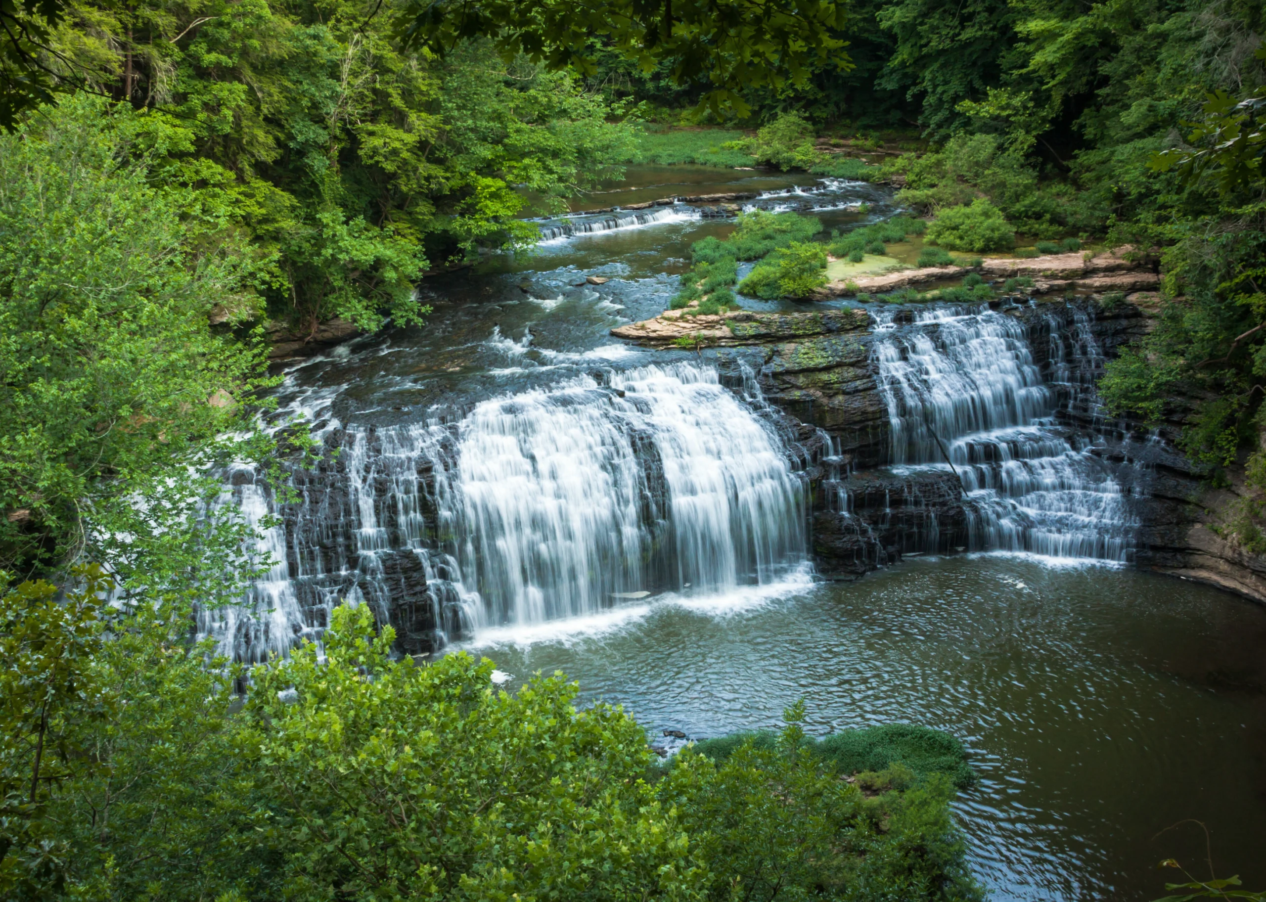
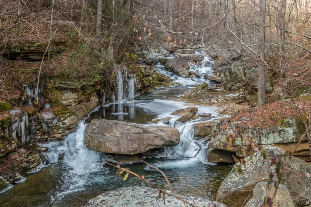
Best Family Waterfall Hike: Glen Falls Trail
Difficulty: Easy
Distance: 2 miles round trip
Best For: Families, wet-weather hiking, waterfalls
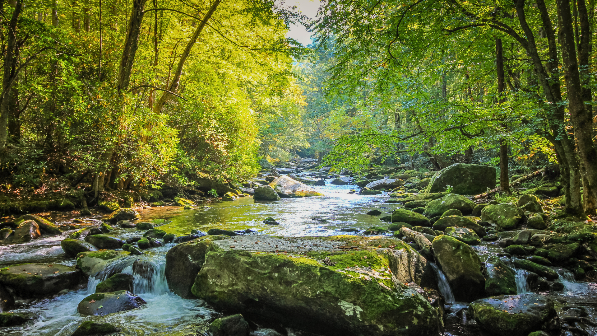
Glen Falls Trail offers a short, accessible hike just minutes from downtown Chattanooga. The trail begins with a gradual ascent through red clay and forest undergrowth, quickly immersing hikers in the sounds of rushing water. Midway, you encounter the iconic rock tunnel, cut into a sandstone fin, followed by stone steps that lead to a cascading waterfall. The waterfall drops roughly 30 feet into a shallow basin, creating a scenic and photogenic destination. The terrain is mostly dirt and sandstone, with moss-covered rocks and roots along the path. While easy, the trail can be slippery in wet conditions, so careful footing is necessary. The forest canopy provides shade, making it a pleasant hike in warm weather, and the short length makes it ideal for families or visitors looking for a quick outdoor escape.
Local’s Tip: Visit after rainfall for the best waterfall flow and be cautious on wet rocks.
Best Endurance Hike: The “Big Daddy” Loop
Difficulty: Strenuous
Distance: 10+ miles
Best For: Endurance hikers, trail runners
The Big Daddy Loop combines multiple trails to create an extended exploration of Lookout Mountain. Hikers traverse rugged terrain, including ridges, valleys, and creek crossings, while enjoying a variety of ecosystems: from dense hardwoods to open bluffs.
The trail is well-marked but physically demanding, requiring stamina for long climbs and descents. Scenic highlights include panoramic city views, rock outcroppings, and isolated hollows that feel far removed from urban life.
Due to its length and difficulty, this hike is best suited for experienced hikers or trail runners who are prepared with adequate water, food, and navigation tools. Seasonal variations significantly affect the trail, with slippery rocks in winter and thick undergrowth in late summer.
Local’s Tip: Start early and plan for at least half a day. Carry navigation maps or GPS, as some forks can be confusing.
Best Signal Mountain & Gorge Hiking Trails
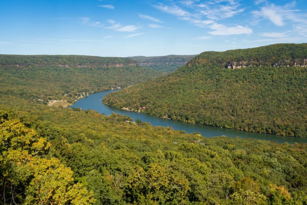
Best Suspension Bridge: Rainbow Lake to Edwards Point
Difficulty: Moderate to Strenuous
Distance: 2.3-6 miles round trip
Best For: Suspension bridge photography, Tennessee River Gorge views
The Rainbow Lake to Edwards Point trail system offers a combination of lakefront hiking and cliff-edge viewpoints. The Rainbow Lake section is relatively flat and suitable for a moderate walk, while Edwards Point involves steeper climbs and rocky ledges. Along the way, hikers encounter mixed hardwood forests, small creeks, and open meadows.
The Edwards Point overlook provides sweeping views of the Tennessee River Gorge, making it one of the area’s most scenic spots. The trail passes several smaller streams and wetlands, which support diverse wildlife, including songbirds and turtles. Hikers should watch footing on narrow sections and near cliff edges.
Local’s Tip: Photography enthusiasts should schedule hikes for early morning or late afternoon to capture the best light.
Best River Gorge View: Signal Point to Julia Falls
Difficulty: Moderate/Hard
Distance: 2.5 miles round trip
Best For: Dramatic gorge views
This trail features a steep descent famously known as “The Mousetrap,” leading hikers to Julia Falls across the gorge. The path is rocky, uneven, and sometimes muddy, requiring sturdy footwear. Hikers are rewarded with views of cascading water and the river gorge below.
The trail’s short length makes it manageable, but the intensity of the elevation changes provides a challenging workout. Seasonal considerations are important, as wet conditions can make rocks extremely slippery. Despite the effort, the dramatic natural features and secluded atmosphere make this trail highly rewarding for adventurous hikers.
Local’s Tip: Hike early to avoid slippery rock conditions and to enjoy quieter trails.
Best Geological Feature: Mushroom Rock via Suck Creek
Difficulty: Moderate
Distance: 4 miles
Best For: Geological curiosity, suspension bridge crossing
Mushroom Rock is an unusual geological formation. It’s a massive rock balanced on a narrow stem that makes this hike unique. The trail includes a swinging footbridge over Suck Creek and wooded terrain with mixed elevations. Hikers navigate uneven dirt paths, exposed roots, and occasional rocky ledges.
The highlight is the rock formation itself, perfect for photography or a brief rest. Wildlife is common along this route, including deer and small birds. The trail is moderately challenging but manageable for most hikers in good health. Conditions vary depending on rainfall; wet weather can make creek crossings slippery.
Local’s Tip: Park in the designated hiker lot on the left side of Suck Creek Road. Do not park on the roadside, as it is dangerous and ticketing can occur.
Best Hikes Near Chattanooga (Georgia Side)
Best Canyon Views: Cloudland Canyon West Rim Loop
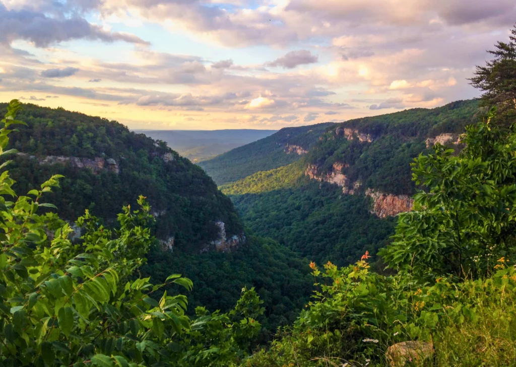
Difficulty: Moderate
Distance: 5 miles
Best For: Canyon views, panoramic landscapes
The West Rim Loop at Cloudland Canyon offers expansive overlooks into one of Georgia’s most dramatic canyons. Trails traverse mixed forests and rock outcrops, with several steep sections and switchbacks. Hikers encounter deep ravines and cliffs, with minor creek crossings adding interest. The trail is well-marked and maintained, making it accessible to moderate-level hikers.
Seasonal variations bring colorful foliage in fall and vibrant greenery in spring. The loop is popular for photography and birdwatching, with hawks and small mammals frequently observed along the path. The elevation gain is noticeable but manageable with breaks.
Local’s Tip: Start the loop clockwise for smoother climbs and prime sunset viewpoints.
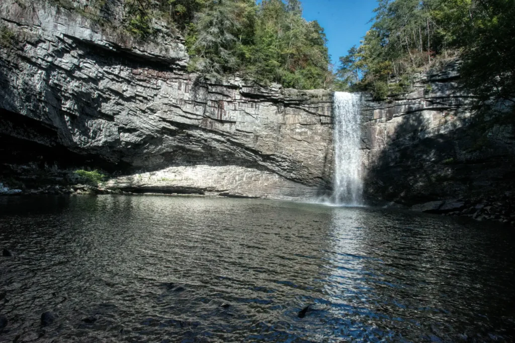
Best Waterfall Workout: Cloudland Canyon Waterfalls Trail
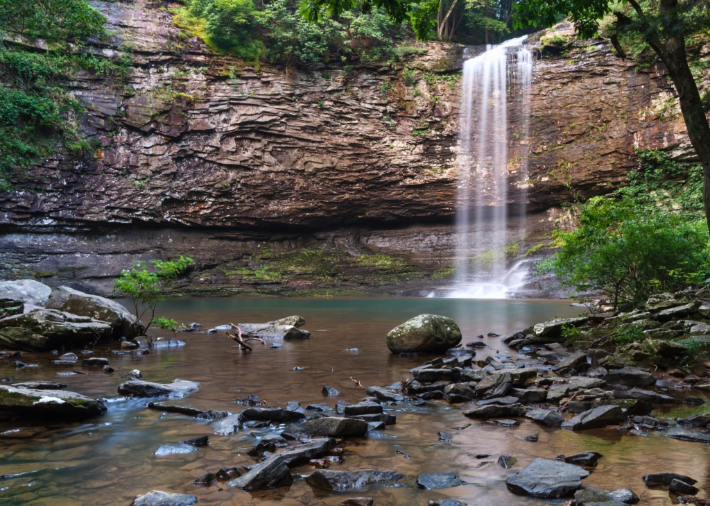
Difficulty: Strenuous (600 stairs)
Distance: 2 miles round trip
Best For: Cherokee and Hemlock Falls
This trail features a rapid elevation drop via carved stairs leading to two impressive waterfalls. The path is rocky and often wet near cascades, demanding careful footing. Both Cherokee and Hemlock Falls offer excellent photo opportunities, with accessible rock ledges and shallow pools.
Hikers will experience the canyon’s microclimate, with cooler temperatures and damp air near the water. The short distance belies the physical effort required due to steep steps and occasional loose rock. It’s ideal for hikers seeking waterfall experiences without committing to a long trek.
Local’s Tip: Bring water and use hiking poles if you need extra stability on the stairs.
Best Exclusive Hike: Lula Lake Land Trust
Difficulty: Easy/Moderate
Distance: 4.5 miles
Best For: Turquoise waters, reservation-only access
The Lula Lake Land Trust preserves pristine landscapes with waterfalls, creeks, and natural pools. The Core Preserve Loop winds through hardwood forests, across boardwalks, and past small waterfalls that feed turquoise pools. The trail is relatively flat, suitable for families and casual hikers. Access is limited to weekends, and reservations are required, ensuring a quiet experience with minimal crowding.
Seasonal highlights include wildflowers in spring and colorful foliage in fall. Wildlife sightings are frequent, including songbirds, turtles, and deer.
Local’s Tip: Reservations are mandatory and often sell out 2–3 weeks in advance. Plan ahead: walk-ins are strictly turned away.
Best Historic Walk: Chickamauga Battlefield
Difficulty: Easy (Flat)
Distance: 1-7 miles (varied loops)
Best For: History, casual walking, biking
Chickamauga Battlefield combines history with light outdoor activity. Trails meander through open fields, forests, and past historical monuments. Terrain is flat, making it accessible for all skill levels.
Hikers can explore short loops or connect multiple trails for longer walks. Interpretive signs highlight battle events and cannon placements. The expansive fields and wooded areas provide quiet escapes, wildlife viewing, and casual biking. The open landscape also makes this a good spot for photography and family outings.
Local’s Tip: Wear sun protection for open fields; bring binoculars for birdwatching.
Best Urban & Hidden Gem Hikes in Chattanooga
Best City Skyline Views: Stringer’s Ridge

Difficulty: Easy
Distance: 1-3 miles
Best For: Skyline views, city access
Stringer’s Ridge offers a quick escape within Chattanooga city limits. The trail ascends gently through forested paths and overlooks the downtown skyline. Hikers will enjoy a mix of gravel and dirt paths, moderate inclines, and shaded forest. The trail is ideal for short hikes, morning runs, or sunset views. Wildlife is limited but includes squirrels, songbirds, and occasional deer.
Local’s Tip: Visit during golden hour for the best skyline photography.
Best Family Nature Park: Enterprise South
Difficulty: Easy/Moderate
Distance: Varies (network of trails)
Best For: Families, WWII history
This park features wide, maintained trails suitable for hiking, walking, and biking. The landscape includes former TNT bunkers from WWII, creeks, and wooded areas. Trails are generally flat with some moderate hills, making it accessible for children and beginners. Seasonal wildflowers and birdwatching opportunities add to the appeal.
Local’s Tip: Bring bikes for longer exploration; trails connect to several picnic areas.
Best Swimming Hole Hike: Big Soddy Creek Gulf
Difficulty: Easy
Distance: 2-4 miles
Best For: Swimming, summer hikes
Big Soddy Creek Gulf is a gentle hike along a gravel path next to a creek. Flat terrain makes it accessible to all levels, and summer swimming holes and blue pools are highlights. Large boulders provide climbing fun for kids. The trail is shaded by a mature forest canopy, keeping temperatures cooler in hot months.
Local’s Tip: Bring water shoes for swimming and hiking near the creek.
Best Birdwatching Hike: Audubon Acres
Difficulty: Easy
Distance: 3-5 miles
Best For: Birdwatching, creek-side walks
Audubon Acres features wooded trails along a small creek with a swinging footbridge and quiet forest paths. Hikers can spot a variety of birds, squirrels, and other wildlife.
The terrain is flat with a few gentle inclines, making it suitable for casual hikers and families. Note that, as a private sanctuary, a small admission fee is required for non-members.
Local’s Tip: Early morning hikes increase chances of bird sightings.
Adventure & Day Trips
Best Rugged Wilderness: Laurel-Snow State Natural Area
Difficulty: Strenuous
Distance: 6-10 miles
Best For: Rugged terrain, Laurel Falls
Laurel-Snow features rugged trails with steep ascents and descents through dense forest. Hikers encounter historic mining areas and large waterfalls, including the 80-foot Laurel Falls. Terrain is rocky, and roots are prevalent, requiring careful footing. It is a full-day hike for most, rewarding visitors with remote wilderness and panoramic views.
Local’s Tip: Bring plenty of water and snacks; the trail is remote with limited cell service.
Best Solitude Hike: Ritchie Hollow Trail
Difficulty: Strenuous
Distance: 8 miles
Best For: Solitude, Blowing Wind Falls
Ritchie Hollow offers a challenging hike through a relatively untouched portion of the River Gorge. The trail includes creek crossings, steep ridges, and rugged rock formations. Highlights include the 30-foot Blowing Wind Falls and quiet forest solitude. Hikers should be prepared for strenuous terrain and limited signage.
Local’s Tip: Plan for an early morning departure to maximize daylight. The trail is not well-marked in some sections.
People Also Ask
Yes, Chattanooga offers a wide variety of hiking options, from urban trails to challenging mountain loops, suitable for all skill levels.
Lookout Mountain is the most famous, offering historic sites, scenic overlooks, and numerous hiking trails.
Moderate. The trail includes a steady climb and some rocky sections, but it is accessible to most hikers with average fitness.
For Chattanooga area hikers, Sunset Rock, Glen Falls, and Cloudland Canyon trails are among the top-rated due to scenery, accessibility, and variety.
In Conclusion
Chattanooga offers a hiking experience unlike most mid-sized cities in the U.S. From urban trails minutes from downtown to secluded waterfalls hidden in the forests, every type of hiker can find a trail that fits their skill level and schedule.
The “Chattanooga Classics” like Sunset Rock and Glen Falls offer quick escapes with iconic views, while Signal Mountain and nearby Georgia trails provide more strenuous adventures and dramatic landscapes.
This guide also highlights hidden gems within city limits, such as Stringer’s Ridge and Enterprise South Nature Park, perfect for families, photographers, and casual walkers.
For those seeking adventure, longer day trips like Laurel-Snow State Natural Area or Ritchie Hollow Trail allow hikers to explore rugged terrain and secluded waterfalls just a short drive from the city.
Seasonality plays a significant role. Winter hikes bring quieter trails and icy beauty, spring showcases wildflowers and rushing waterfalls, summer trails provide shade and creek access, and fall reveals brilliant foliage. Hikers are encouraged to plan according to weather, check trail conditions, and respect private property.
Accessibility and safety are key. While some trails are easy and family-friendly, others require sturdy shoes, water, and awareness of slippery rocks or steep descents. Chattanooga’s trails reward preparation with panoramic views, serene waterfalls, historical markers, and wildlife encounters, making each outing memorable.
Ultimately, these trails reflect Chattanooga’s unique blend of urban convenience and natural beauty. Whether you’re a local wanting a weekend escape, a visitor looking for iconic photography spots, or a seasoned hiker seeking endurance challenges, Chattanooga provides an incredible variety of options. Lace up your shoes, pack your water bottle, and explore! The trails are ready to welcome you.