Category: Travel Guides

  • ATV Rental Miami Florida: The Insider’s Guide

    ATV Rental Miami Florida: The Insider’s Guide

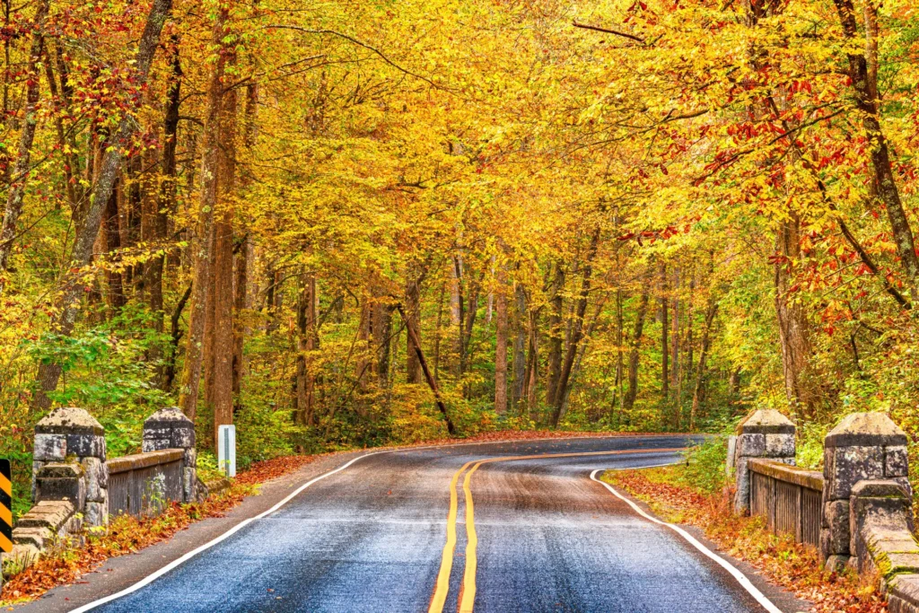
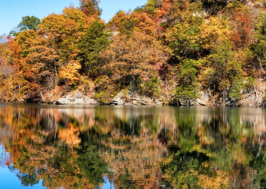
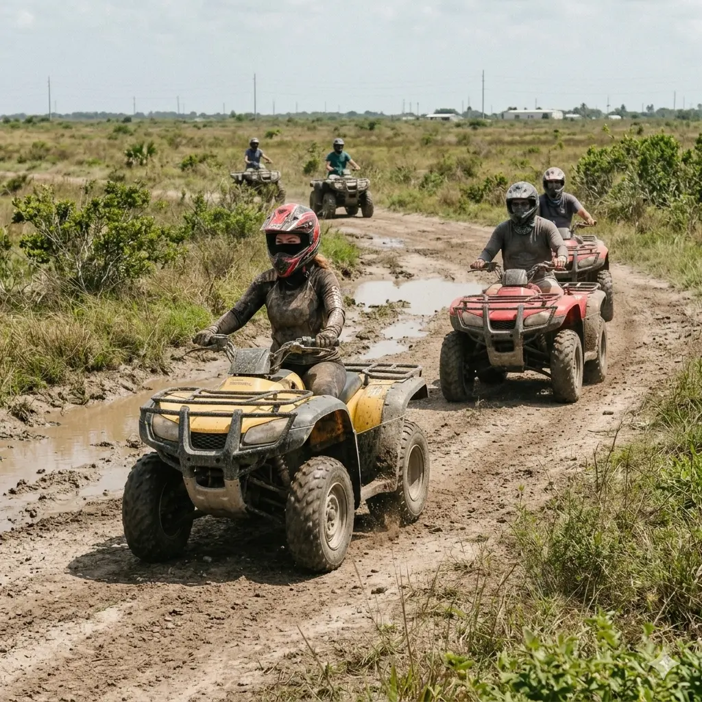
    Miami keeps its best secret in plain sight. Forty minutes southwest of the Art Deco hotels and the cold-pressed juice bars, past the last traffic light on Krome Avenue, the city simply stops. What takes over is flat open land, a sky that goes on longer than seems reasonable, and a riding culture built around the fact that the Everglades starts here. ATV rental in Miami, Florida draws a different kind of traveler to this end of the map — one who already knows that the most interesting version of a destination is rarely the one on the brochure.

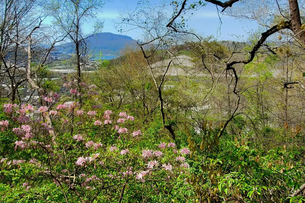
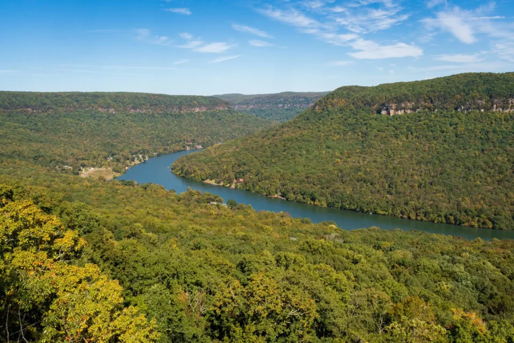
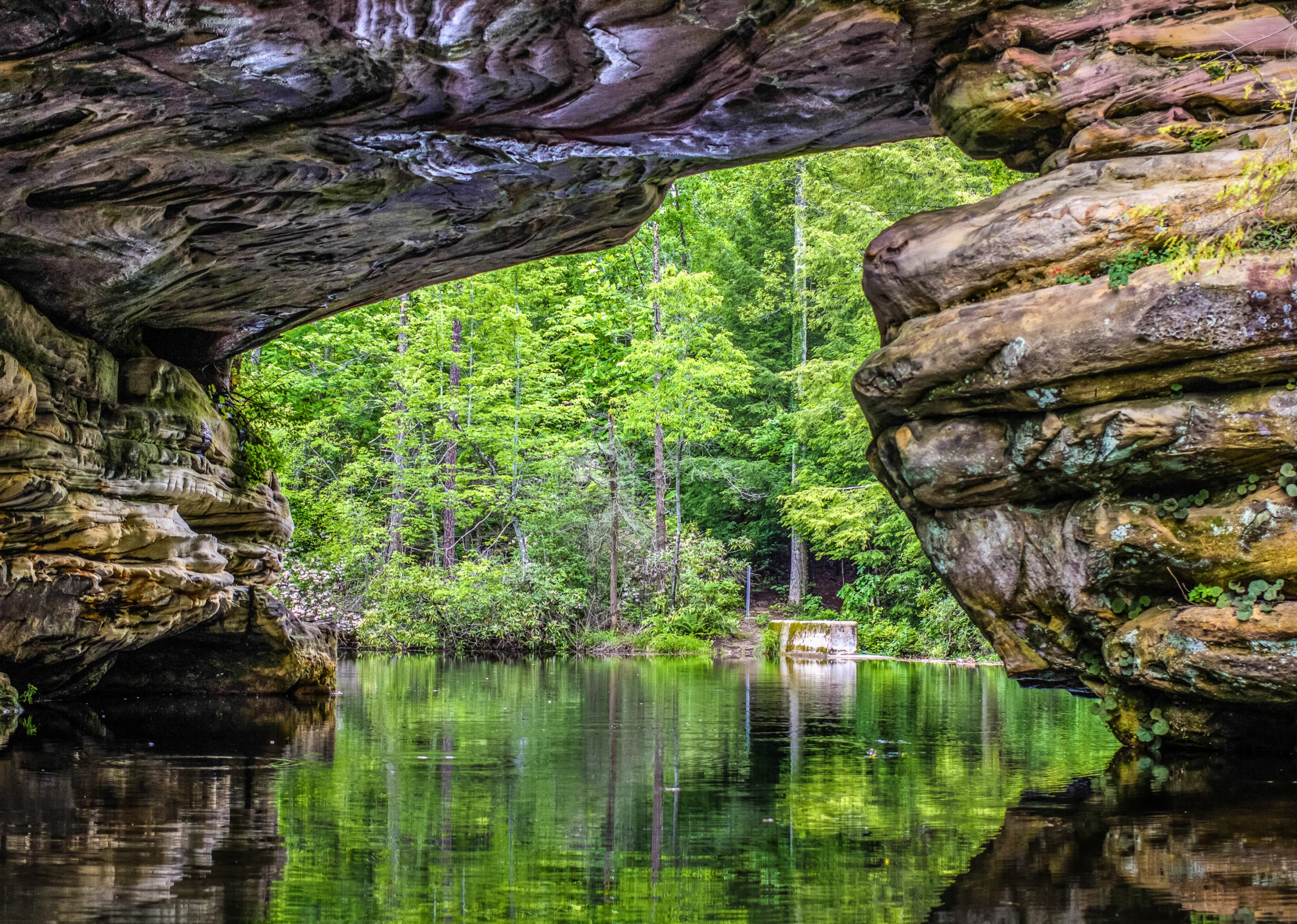
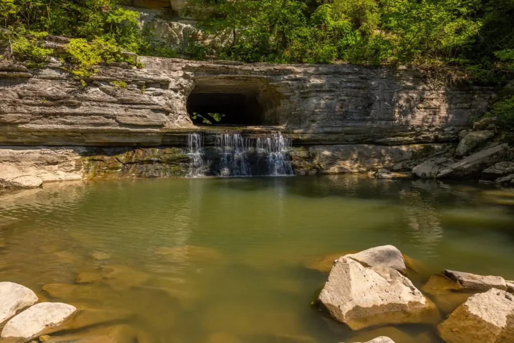
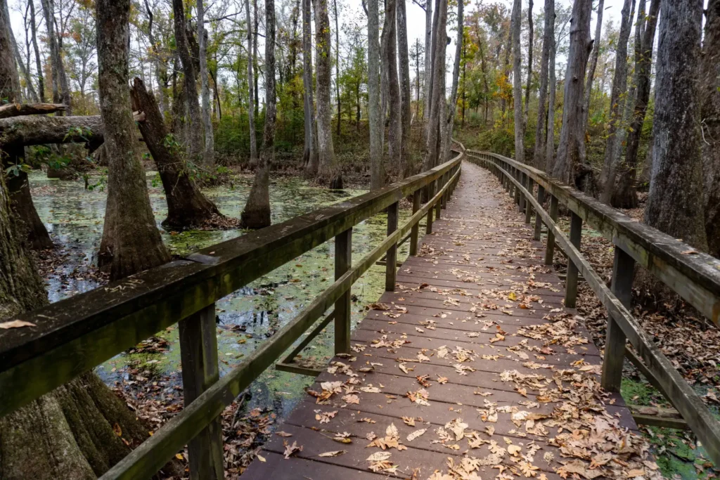
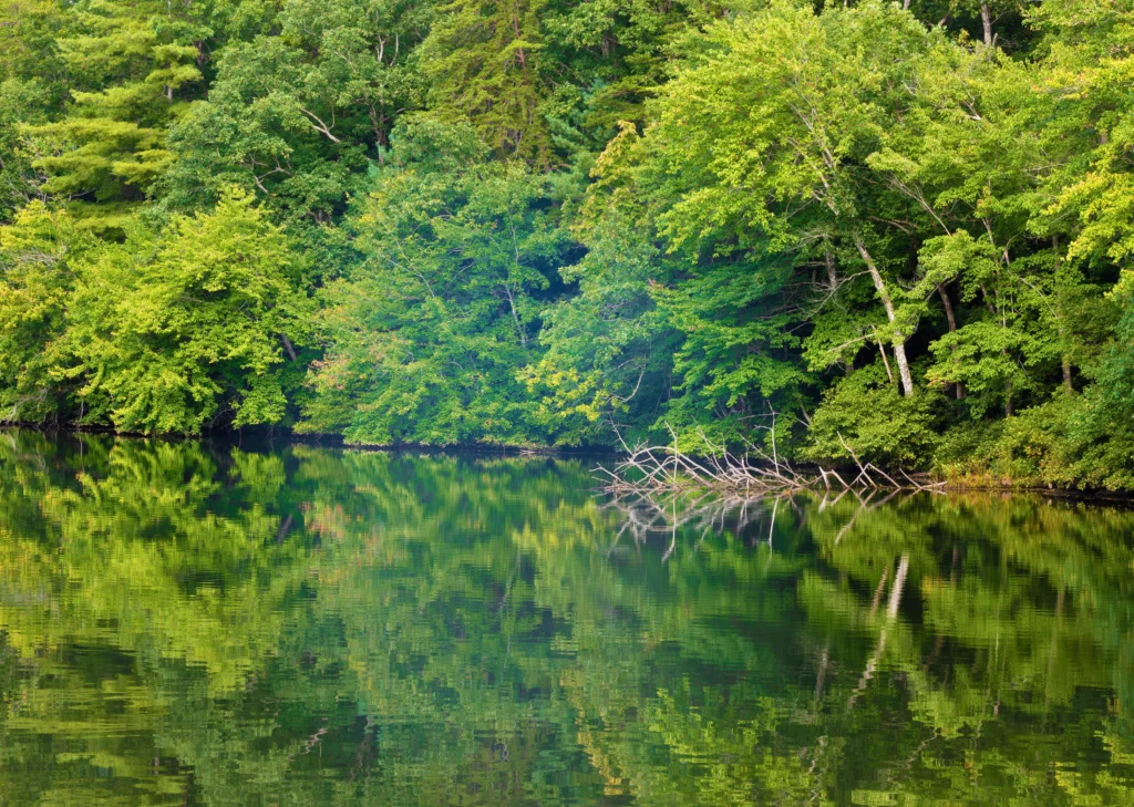
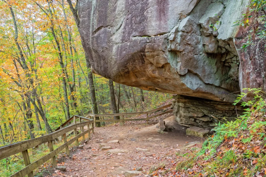
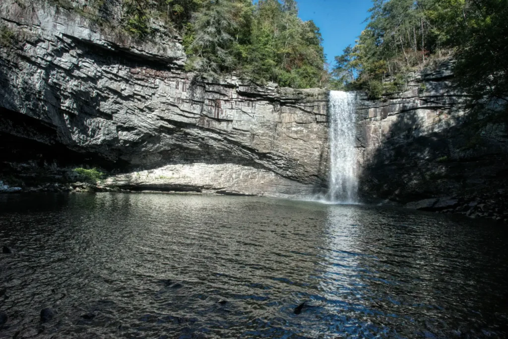
    The South Dade corridor is one of those places that rewards the decision to keep driving. It sits between Everglades National Park to the south, Biscayne National Park to the east, and the Big Cypress Preserve to the west. You can ride through saw palmetto and open field in the morning, walk a trail beside a mangrove estuary in the afternoon, and be back at a decent restaurant in Homestead before the light fades. That is not a bad day by any standard.

    This guide covers how to build that trip from the ground up: which operators to book, where to stay, what to do on either side of the ride, and how the seasons change everything. The riding comes first. The rest follows from there.

    What the ATV Riding Experience Near Miami Actually Delivers

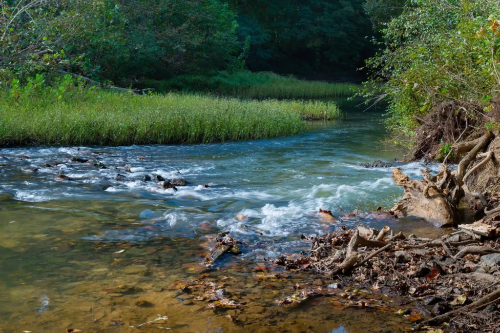
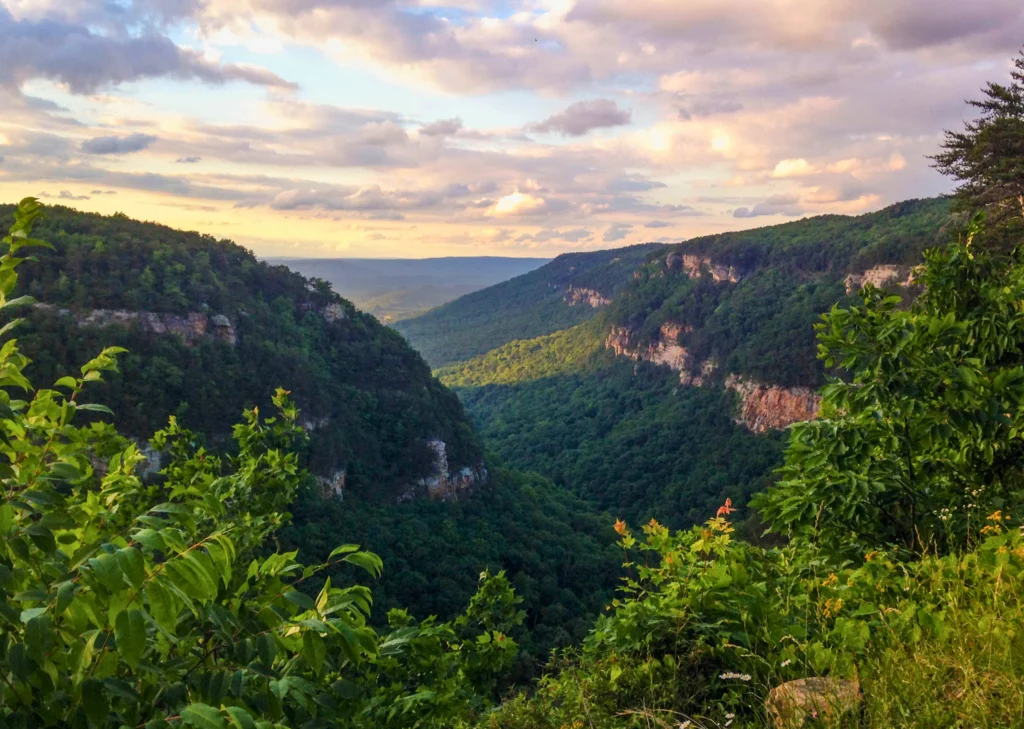
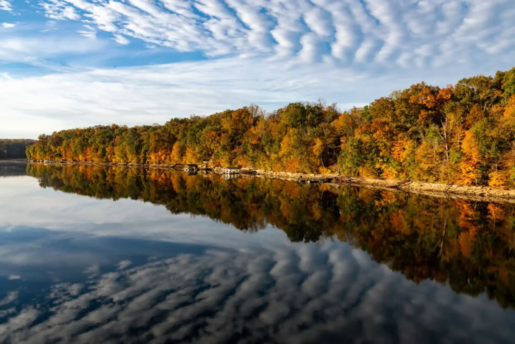
    ATV riding in Miami, Florida does not look like what most people picture. There are no canyon walls or mountain ridgelines. Instead, you get open agricultural flatlands, saw palmetto scrub, cypress-lined trails, and a South Florida sky that earns its own attention. The terrain is subtle. It rewards riders who are paying the right kind of attention.

    In the dry season, the ground runs firm and fast. Open sections on South Dade’s riding parks let you build real speed before the next turn. The loose surface rewards throttle control. In the wet season the character changes entirely. Water fills the low sections, ruts deepen, and the landscape turns dense and close. Riding through it feels genuinely remote, even when the interstate is only thirty minutes behind you.

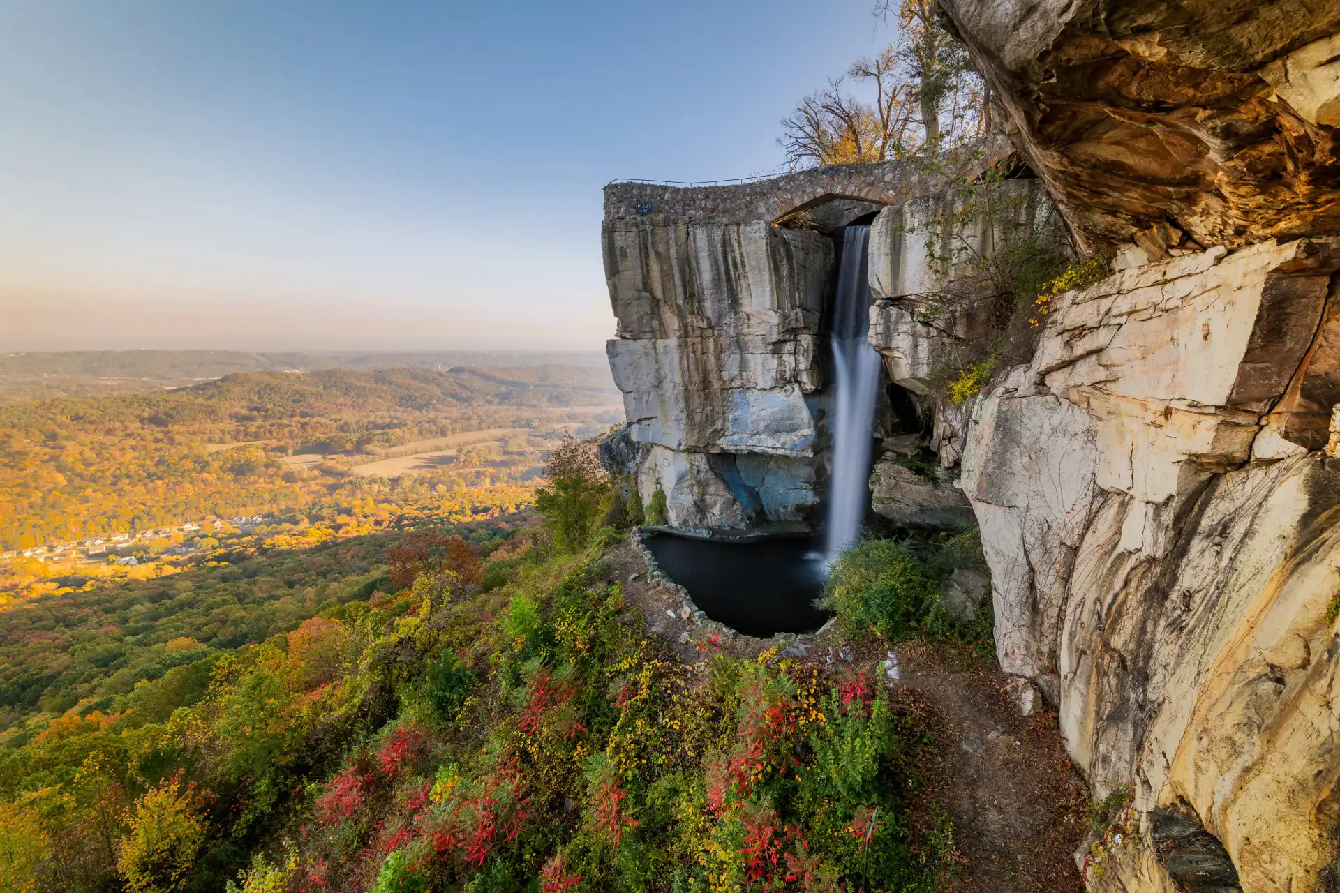
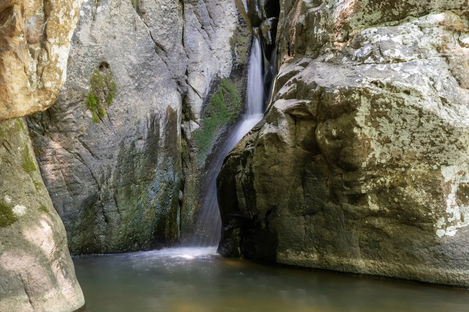
    The Everglades fringe adds something that no ATV destination in the Southeast can replicate. You might cross a water feature with a gator sunning on the near bank. You will almost certainly ride under a sky that is doing several things at once. The wildlife density in this corridor, sandhill cranes, roseate spoonbills, osprey overhead, makes a straightforward trail session feel like considerably more than what you paid for.

    That is exactly what makes ATV rental in Miami, Florida worth building a full trip around. The riding anchors the day. The next sections cover how to fill the rest of it.

    Match Your Trip Type to the Right ATV Experience and Activities

    The right ATV rental in Miami, Florida depends on who is coming and what the rest of the day looks like. This table cuts through the options and pairs each trip type with the operator that fits it best.

    Trip TypeBest OperatorWhy It FitsBuild the Rest of Your Day Around It
    First-time riders or couplesXtreme Action Sports, West KendallEnclosed circuit, full instruction, no surprisesPair with a sunset kayak tour on Biscayne Bay. Both activities fit a single day without a long drive.
    Weekend warriors wanting real ridingSouth Dade ATV Park, HomesteadOpen riding format, multiple tracks, genuine terrainCombine with a late afternoon drive into Everglades National Park. Eco Pond is 20 minutes south.
    Families with kids 8 and olderXtreme Action Sports Jr. TrackDedicated youth circuit, staff-supervised, 50cc machinesFinish at Homestead Bayfront Park. Kids can swim and parents can decompress after a full activity day.
    Experienced riders, wilderness focusBig Cypress OHV Trail Network720,000-acre preserve, remote terrain, real backcountryBase yourself in Florida City the night before. Start riding at dawn before the heat builds.
    Groups or mixed skill levelsEverglades Adventure Tours, Florida CityGuided UTV format seats 2 to 4; one driver handles itFollow up with a airboat tour. Multiple operators run out of Everglades City just 30 miles west.
    Dog owners who want to rideBig Cypress OHV (leashed dogs permitted)Only major option in the region that allows dogs on trailStop at Greynolds Park on the way back. It has off-leash areas and shaded walking paths.

    Tip: Pick your riding operator first. Then build your accommodation and other activities around its location. This saves drive time and makes the day flow naturally.

    Where to Stay: Choosing Your Base for an ATV Trip Near Miami

    Where you stay determines how much of the day you actually spend outdoors. The best active weekend here does not start in South Beach. Most ATV rides in Miami depart from the South Dade corridor, which puts Florida City and Homestead at the center of everything: the riding, both national parks, and the water access that makes a second day worth staying for.

    AreaBest ForDistance to RidingStay TypeWhat Makes It Work for This Trip
    Florida City / HomesteadRiders focused on South Dade or Big Cypress5-20 min to most operatorsVacation rentals, motels, campgroundsThis is the closest base to the best riding. It also puts you at the Everglades NP entrance and Biscayne NP. Plan your riding here first and build everything else around it.
    Everglades City AreaBackcountry riders and paddlers30-45 min to Big Cypress OHV zonesCabins, eco-lodges, fishing campsA strong choice for riders who want to combine ATV riding with kayaking, airboating, or fishing. The area feels genuinely remote without being hard to reach.
    Kendall / Southwest MiamiFirst-timers staying closer to the city10-15 min to Xtreme Action SportsHotels, short-term rentalsIf you are riding at Xtreme Action Sports and combining with other Miami activities, staying in Kendall or Doral keeps everything within a short drive.
    Key Largo (Upper Keys)Couples combining riding and water access45-60 min to South Dade operatorsWaterfront rentals, dive lodgesA longer drive to the riding, but a strong option for a two-day trip. Ride on day one, get on the water in Biscayne Bay or the Atlantic on day two.

    Why Florida City and Homestead Work Best as a Base

    Florida City and Homestead sit at the convergence of three significant outdoor destinations. Everglades National Park begins at the edge of town. Biscayne National Park launches from Convoy Point, nine miles east. The best ATV riding operations in the Miami region sit five to twenty minutes away in every direction.

    The accommodation options here have improved considerably in recent years. Vacation rentals, well-positioned cabins, and a growing number of glamping properties now serve the active traveler market this area quietly attracts. You no longer have to commute south from a generic Miami hotel every morning and spend half your day in the car.

    The Local Trip Builder’s Insight: Book your riding slot first, then find accommodation that puts you within 15 minutes of it. Most visitors do this in reverse. They book a hotel near the beach, then realize they face a 90-minute round trip drive every time they want to do something active in South Dade. Start with the activity and let everything else fall into place around it.

    The Full Active Weekend: A Two-Day Trip Built Around ATV Riding Near Miami

    This itinerary runs Saturday to Sunday, based out of Florida City or Homestead, with South Dade ATV Park as the riding anchor. Swap in any of the operators below depending on your skill level and group.

    DayTimeActivityLocationBooking / Access Notes
    Day 1MorningATV riding sessionSouth Dade ATV Park, HomesteadBook 2+ weeks ahead for weekends Oct-Apr. Morning slots avoid afternoon storms May-Sep.
    Day 1AfternoonEverglades National Park driveMain Park Road, Homestead entranceFree with America the Beautiful pass. Eco Pond at mile 38 is best for wildlife.
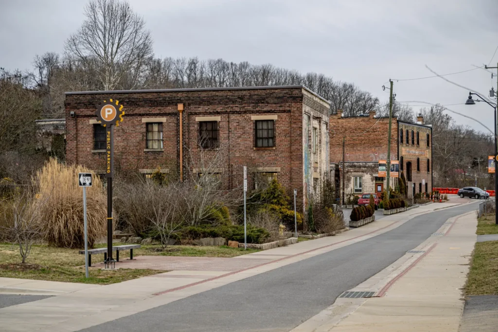
    Day 1EveningDinner in HomesteadHomestead downtown districtRobert Is Here fruit stand closes at 7 PM. Plan a stop before dinner. It is worth it.
    Day 2Early morningKayak or canoe launchBiscayne National Park, Convoy PointRanger-led tours depart at 9 AM on weekends. Bring your own kayak for the free launch.
    Day 2MiddayCoral Castle or Fruit and Spice ParkHomestead areaBoth are within 10 minutes of Florida City. Coral Castle takes about 90 minutes.
    Day 2AfternoonDrive or departReturn north or continue to KeysCard Sound Road (SR-905A) to the Keys adds 15 minutes but is far more scenic than US-1.

    Extending to Three Days

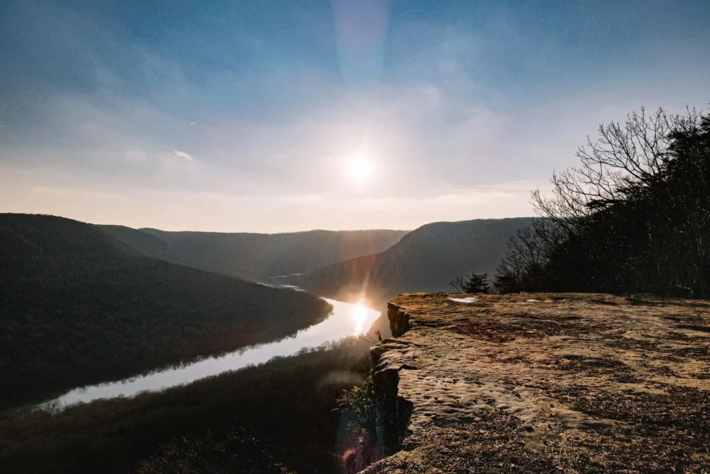
    A third day belongs on the water. Biscayne National Park offers snorkeling, glass-bottom boat tours, and kayak rentals at Convoy Point. The Upper Florida Keys begin forty-five minutes south via Card Sound Road, a stretch of two-lane highway that is considerably more rewarding than US-1. Key Largo adds reef diving, paddleboarding, and fishing to what is already a full active itinerary.

    The other option is to drive west on the Tamiami Trail toward Everglades City. That corridor delivers airboat tours, canoe trails through the Ten Thousand Islands, and small fishing villages that feel genuinely earned rather than packaged. A three-day trip from this base rarely runs out of things worth doing.

    ATV Riding Rentals Near Miami: The Operators Worth Knowing

    The ATV riding rentals in Miami span a wider range than most people expect, from indoor beginner circuits to wilderness permit trails an hour from the city. Finding the right ATV rental in Miami, Florida means knowing which of these fits your group before you show up.

    South Dade ATV Park, Homestead: Best for Weekend Warriors

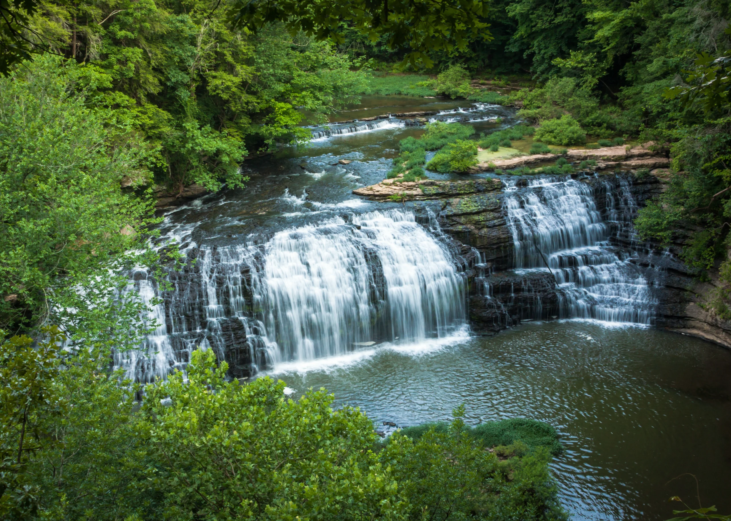
    South Dade ATV Park is the strongest open riding facility available for ATV rental in Miami, Florida. The format gives you genuine freedom: sign in, pick your machine, and ride the available circuits at your own pace. The terrain changes between dry and wet season, which means return visits feel different.

    There is a separate advanced loop that staff do not automatically mention to new arrivals. Ask for it specifically. The beginner circuit handles orientation well. The advanced loop is the reason experienced riders keep coming back to this particular park.

    The location also sits neatly between Everglades National Park to the south and Biscayne National Park to the east. A morning here followed by an afternoon in either park makes a complete and satisfying day without a long drive.

    Xtreme Action Sports, West Kendall: Best for First-Timers and Families

    The indoor facility at Xtreme Action Sports makes ATV rental in Miami, Florida genuinely accessible year-round. The circuits run regardless of storms, heat indexes, or hurricane watches. For visitors traveling between May and October with a fixed schedule, that is a meaningful advantage over any outdoor operation.

    The junior ATV track for riders aged eight and older is the most structured youth circuit in the Miami market. Staff size each child to the right machine before the session starts. Do not skip this step. The facility also runs go-karts and other activities alongside the ATV circuits, which matters when not everyone in the group wants to ride.

    This location pairs naturally with other Miami-area activities. Biscayne Bay water sports, the Deering Estate, and the Fruit and Spice Park in Homestead all work well around an indoor morning ride.

    Everglades Adventure Tours, Florida City: Best for Groups and Eco-Minded Travelers

    Groups looking for guided ATV tours in Miami that also put them inside the Everglades ecosystem will find this operator hard to beat. The UTV format carries two to four riders with a knowledgeable guide. The route adjusts based on current conditions, active wildlife, and water crossing availability. Ask at booking whether the current route includes a water crossing. It is consistently the part people talk about afterward.

    This operator sits at the center of a Florida City or Homestead base. Ride in the morning, then move directly into an Everglades National Park afternoon without changing your accommodation.

    Big Cypress National Preserve OHV Trails: Best for Experienced Independent Riders

    Big Cypress is the most demanding option in this market and, for the right rider, the most rewarding. The OHV trail network covers pine flatwoods, open prairie, and shallow wetlands inside a 720,000-acre preserve. A free permit through recreation.gov is required and takes ten minutes online. Get it before you drive out. Trailhead kiosks sell out on busy weekends.

    The Turner River Road corridor in the northeastern permit zone sees far less traffic than the Condor Prairie area near US-41, yet it delivers the highest concentration of wildlife encounters per mile. The extra ten minutes to reach it is worth it. The two areas are not remotely similar experiences.

    Base yourself in Florida City the night before a Big Cypress ride. Start at dawn before the heat builds. Use the afternoon for an Everglades City airboat tour or the Gulf Coast Visitor Center at the western end of the Tamiami Trail.

    What Locals Know Before They Book ATV Rides in Miami, FL

    None of what follows appears in the standard operator briefings. These are the details specific to ATV rental in Miami, Florida and the South Dade corridor that make the difference between a smooth trip and a frustrating one.

    Book Your Ride First, Then Book Your Stay

    Most travelers book accommodation first and then realize the riding is far from where they are staying. ATV riding in Miami, FL clusters in South Dade, not near the beach. That mistake costs ninety minutes of driving on the day you want to be outdoors. Pick your operator, note the address, and find accommodation within twenty minutes of it. The Florida City and Homestead rental market can handle this without sacrificing quality or comfort.

    The Afternoon Storm Rule

    South Florida’s wet season runs May through October. Afternoon storms arrive almost daily between 2 PM and 4 PM, and they develop fast. A clear sky can produce active lightning in under fifteen minutes. Locals book the first slot of the day from June through September. They ride, eat, and move to a covered or water-based activity before noon. This is not overcaution. South Florida leads the country in lightning activity.

    The Big Cypress Permit Trap

    The Big Cypress OHV trail network requires a free permit through recreation.gov. This takes ten minutes online. The trailhead self-service kiosks run out of permits on busy weekends, and a missing permit is an enforceable violation regardless of intent. Get it from home before you make the drive. Sections of Big Cypress also close on short notice for prescribed burns and wildlife management. Check the NPS status page the morning of your ride, not the night before.

    The Canal Bank Enforcement Problem

    Western Miami-Dade County is threaded with drainage canals managed by the South Florida Water Management District. The maintenance roads alongside them look like open riding areas. Enforcement has increased substantially in recent years, and machines have been impounded at spots used informally for years without incident. Only ride on licensed operator property or within a permitted NPS trail zone.

    The Gator-at-Water Principle

    American alligators live throughout the waterways and canal edges in this region. They do not threaten moving machines. The risk is real, however, for anyone who steps off the machine near water without looking first. Follow this practice: stop and give any water edge three full seconds of deliberate attention before stepping off. Guides at reputable operators know exactly where gators sun regularly. Ask them to include this in the pre-ride briefing. Current wildlife conditions for the region are available at the Florida Fish and Wildlife Conservation Commission.

    When to Plan Your ATV Trip Near Miami: Month-by-Month Guide

    Timing matters more than most visitors realize when booking ATV rental in Miami, Florida. Use this table to match your travel window to the right riding conditions and the best activity pairings.

    MonthsSeasonATV ConditionsBest Pairing ActivityTrip Planning Note
    Nov – JanPeak DryFirm, fast, ideal across all operatorsEverglades NP wildlife viewing (peak season)Busiest travel window. Book riding AND accommodation 2+ weeks out for weekends.
    Feb – AprLate DryFirm ground, low humidity, comfortable tempsKayaking in Biscayne NP, snorkeling the reefsSpring break (mid-March) surges hard. Go the week before or after for better availability.
    May – JunEarly WetMud activating; water crossings beginAirboat tours out of Everglades CityBook morning riding only. Storms arrive by 3 PM. Schedule water activities for afternoons.
    Jul – AugCore WetDeep ruts, standing water, lush sceneryIndoor options: Coral Castle, Fruit & Spice ParkHeat index above 105F. Ride before 10 AM. Use afternoons for shaded or indoor activities.
    Sep – OctHurricane SeasonUnpredictable; short-notice closures possibleFlexible indoor or coastal activitiesBuild in a backup plan. Confirm riding 48 hrs out. Have an Xtreme Action Sports booking as a fallback.

    The Best Overall Window: Late November through January delivers the most consistent conditions for an ATV-anchored trip near Miami. Ground is firm, humidity is low, Big Cypress trail access is most reliable, and Everglades National Park wildlife viewing hits its annual peak. The trade-off is demand. Weekend accommodation and riding slots fill fast. Book both at least two weeks out.

    Bringing Your Dog: The Best ATV and Outdoor Combo Near Miami

    Miami travels with its dogs. Not every ATV tour in Miami permits animals on trail, and the options that do require specific planning. Done right, though, the overall outdoor day can be excellent.

    Big Cypress: The Only Major Riding Option That Permits Dogs

    Big Cypress permits leashed dogs on the OHV trail network. Dogs must ride secured inside a UTV cab or in a purpose-built carrier. They cannot run alongside the machine. Heat management from May through October is not optional. Carry more water than you think the animal needs, plan shade stops, and avoid the midday hours entirely in summer. Alligator awareness at water features is more urgent for dogs than for riders. Keep leashes short near drainage crossings and standing water edges.

    Building the Rest of the Day Around Your Dog

    After the ride, Greynolds Park in North Miami-Dade has off-leash areas and shaded walking paths. Amelia Earhart Park in Hialeah has a dedicated dog park with separate areas for large and small breeds. Both work well as afternoon stops before heading back. For a longer outing, the Shark Valley trail in Everglades National Park allows leashed dogs on the paved loop road and delivers some of the best accessible wildlife viewing in the region.

    Safety on ATV Rides in Miami, FL: What Every Rider Needs to Know

    Gear

    Closed-toe shoes are required at every legitimate operation. Long pants protect against brush contact and abrasion. Operators supply helmets and they are not optional regardless of experience level or session length. Gloves reduce the wear that builds over an hour of throttle work in the heat. Light moisture-wicking fabric is more practical than denim in South Florida’s climate. Sunscreen is relevant in every month of the year.

    Heat and Hydration

    The heat index from June through September regularly exceeds 100 degrees Fahrenheit. Riding generates extra heat through exertion and engine proximity. One liter of water per hour is a reasonable minimum for active summer riding, and electrolyte replenishment matters as much as volume. A headache during a summer ride is the beginning of heat exhaustion. Stop, find shade, and hydrate before continuing. It moves faster in this climate than most visitors expect.

    Surface Reading

    Ground conditions can shift from firm soil to water-saturated sections within the same trail, particularly after rain. Riders who enter unfamiliar sections at full throttle are the ones who dig in and need assistance. The fix is not complicated: approach unknown ground at moderate throttle, feel how the front wheels respond, then commit once you have read the surface. First-time riders benefit from hearing this before the session starts, not after.

    Waiver and Briefing Standard: Every legitimate ATV operator in the Miami area conducts a pre-ride safety briefing and requires a signed liability waiver. If an operation skips either step, find a different operator. The briefing covers terrain-specific risks that matter and are worth understanding before you ride.

    People Also Ask

    Is there ATV riding near Miami?

    Yes. The main riding options sit in the Homestead and Florida City corridor, roughly 35 to 40 miles southwest of downtown. Additional options run along the Krome Avenue corridor in western Miami-Dade County. Furthermore, Xtreme Action Sports in West Kendall operates an indoor facility reachable within 30 minutes from most Miami locations. Big Cypress National Preserve, accessible via the Tamiami Trail (US-41), offers a permitted self-guided OHV trail network for experienced riders.

    How much does ATV rental in Miami cost?

    ATV rental in Miami, Florida typically starts around $75 to $100 per hour for a single-rider quad at an open riding facility. UTV rentals for two to four passengers range from approximately $120 to $200 per hour. Additionally, guided ATV tours in Miami run between $80 and $150 per person. Indoor circuit sessions at Xtreme Action Sports fall in the $30 to $60 range. Always confirm current rates directly with the operator before booking.

    What is the best ATV park near Miami?

    South Dade ATV Park in Homestead is the most capable open riding facility in the region. It offers multiple track configurations and terrain that changes with the seasons. However, for a guided experience on the Everglades fringe, the Florida City operators deliver the most interesting setting. For year-round indoor availability closest to downtown, Xtreme Action Sports in West Kendall is the most practical option.

    Can you ride ATVs in the Everglades?

    Yes, but only in designated areas. Big Cypress National Preserve sits adjacent to Everglades National Park but operates under separate rules. It maintains a permitted OHV trail network managed by the National Park Service. A free permit through recreation.gov is required. However, Everglades National Park proper does not allow off-road vehicle use. Several guided operators also run UTV and ATV tours through private land on the Everglades fringe.

    What else can you do near the ATV parks south of Miami?

    The South Dade corridor offers some of the best outdoor activity density in Florida. Within twenty to forty minutes of most riding operators, you can access Everglades National Park, Biscayne National Park, Homestead Bayfront Park, the Fruit and Spice Park, Coral Castle, and multiple kayak and snorkel launch points. Additionally, the Tamiami Trail west of Miami leads to Everglades City, airboat tours, and the Ten Thousand Islands canoe trail. As a result, an ATV session is a natural anchor activity for a full two or three day outdoor trip.

    Where should I stay for an ATV trip near Miami?

    Florida City and Homestead are the strongest base options. Both put you within five to twenty minutes of the best riding operators, Everglades National Park, and Biscayne National Park. Vacation rentals, small motels, and cabins all serve this corridor. Book accommodation after you confirm your riding operator and slot. Start with the activity and let the stay follow from it.

    Are ATV tours in Miami available year-round?

    Most ATV rental in Miami, Florida operators run year-round. However, they adjust scheduling during the wet season to avoid the afternoon storm window. Indoor facilities at Xtreme Action Sports operate regardless of weather. Big Cypress carries seasonal closures for prescribed burns and flood conditions. October carries the most uncertainty due to tropical storm activity. Therefore, confirm availability within 48 hours of your planned ride during August through October.

    Plan the Trip Around the Experience

    The mistake most people make with a Miami trip is treating the activities as afterthoughts. They book a hotel, then look for things to fill the days. This guide does the opposite. It starts with ATV rental in Miami, Florida, builds the base location around it, and lets everything else follow from there.

    The South Dade corridor rewards that approach more than almost anywhere in the Southeast. Ride in the morning, spend the afternoon inside a national park, eat well in a real working town, and get on the water the next day. The combination of access to Big Cypress, the Everglades, and Biscayne makes this one of the more quietly exceptional active trip destinations in the country.

    Start with the riding. The rest of the trip has a way of taking care of itself.

  • Top 20 Things to Do in Asheville, North Carolina

    Top 20 Things to Do in Asheville, North Carolina

    If you are searching for things to do in Asheville, you are likely trying to figure out how to spend your time in a way that actually feels worth the trip. Asheville is known for three things that consistently show up in visitor experiences: Blue Ridge Mountain access, a strong arts culture, and a food and brewery scene that punches well above its size. The challenge is not finding things to do. The challenge is choosing what is actually worth your time based on how you like to travel.

    This guide is built for travellers who want a clear mix of nature, culture, and local experiences without feeling like they are jumping randomly between attractions. It is especially helpful if you are planning your first Asheville trip, visiting for a long weekend, or trying to balance outdoor time with city exploration.

    Inside this article, you will find major anchor experiences like the Biltmore Estate and Great Smoky Mountains National Park, local culture hubs like the River Arts District and Grove Arcade, and experience-based activities like guided tours, wellness experiences, and scenic drives. Each section focuses on what the experience is actually like, who it is best for, and how it fits into a real Asheville itinerary.

    By the end, you should be able to quickly decide what belongs on your list, what you can skip, and how to build a trip that feels balanced, realistic, and genuinely enjoyable.

    1. Asheville Hop-On Hop-Off Sightseeing

    If you are new to Asheville, the hop-on hop-off sightseeing tour is one of the easiest ways to understand how the city is laid out while still feeling like you are exploring at your own pace. Asheville is very neighbourhood-driven. Downtown, the River Arts District, historic areas, and mountain viewpoints all sit in different pockets. This style of tour helps you connect those areas without worrying about parking, navigation, or missing something important.

    The experience usually includes guided narration from local drivers who mix history, architecture, and local stories. You will learn how Asheville grew from a mountain health retreat into an arts and food destination, why the architecture downtown feels so distinct, and how places like Pack Square and Grove Arcade fit into the city’s identity. Even if you normally avoid tours, this one tends to feel more like local storytelling than a scripted lecture.

    Practically, this is a strong choice for your first day in Asheville. You can ride the full loop to get oriented, then decide where you want to get off and explore deeper. Many travellers use it to scout restaurants, art galleries, or neighbourhoods they want to return to later in the trip.

    If you like low-stress travel, flexible schedules, or you are visiting without a car, this is one of the most efficient ways to experience multiple parts of Asheville without feeling rushed or overwhelmed. It sets a strong foundation for everything else you plan to do in the city.

    2. Pisgah Forest, NC: Off-Road Back Roads Jeep Tour

    Things to Do in Asheville, North Carolina

    If you want to experience the wild side of the Blue Ridge Mountains without needing advanced hiking skills, an off-road Jeep tour through Pisgah National Forest is a memorable way to do it. Pisgah is known for dense hardwood forests, hidden waterfalls, and mountain roads that wind through terrain most visitors would never find on their own. Riding in an open-air Jeep lets you feel connected to the landscape in a way that feels adventurous but still comfortable.

    Most tours are led by guides who know the backroads, seasonal changes, and lesser-known scenic pull-offs. Along the way, you may stop at overlooks, short waterfall walks, or historic forest roads originally used for logging. Guides often share insight into Appalachian ecology, wildlife patterns, and how the forest changes across seasons. In spring and summer, you will see a deep green canopy and rushing water. In fall, the same roads turn into canopies of red, gold, and orange leaves

    This experience works especially well if you want mountain access without committing to long hikes. It is also a strong choice if you are travelling with mixed ability levels, since everyone can enjoy the same views together. The ride itself becomes part of the experience, not just transportation.

    Many visitors leave this tour feeling like they saw a version of Western North Carolina that most tourists miss. It gives you a deeper sense of how big and layered this landscape really is, and often sparks ideas for future hikes or return trips deeper into Pisgah.

    3. Haunted History and Murder Mystery Tour

    Asheville has its spooky side, and a haunted history and murder mystery tour brings it to life in a way that is entertaining without feeling gimmicky. These tours weave together real stories of Asheville’s past, including ghost sightings, historic crimes, and unusual local legends, while letting you wander the streets of downtown or historic districts at night. It is not just about scares; it is about understanding the layers of the city’s history that you might miss during daytime sightseeing.

    The guides are storytellers first, blending humour, suspense, and local knowledge. You will hear about old hotels, mansions, and alleyways, and how events from decades or even centuries ago shaped the Asheville we see today. Many tours include interactive elements, asking questions or leading small group investigations that make the experience feel lively and personal.

    This kind of tour is ideal for visitors who enjoy history with a theatrical twist, or anyone who wants a different perspective on Asheville beyond the mountains and arts scene. It is particularly memorable after a long day of hiking or museum visits, as it slows the pace while still engaging curiosity. Walking through dimly lit streets with tales of Asheville’s past gives a layered sense of place, making the city feel both intimate and mysterious.

    If you enjoy storytelling, history, and a touch of suspense, this tour can easily become one of your favourite memories in Asheville, giving you stories to share long after you have returned home.

    4. Forest Bathing Experience

    If you are looking for a way to slow down and truly connect with nature, Asheville offers forest bathing experiences that go beyond a simple hike. Forest bathing, inspired by the Japanese tradition of Shinrin-yoku, encourages you to move slowly through the woods, pay attention to your surroundings, and fully experience the sights, sounds, and scents of nature.

    Guided sessions often take place in the surrounding Blue Ridge Mountains or local wooded parks. Guides encourage mindful breathing, gentle stretching, and attention to natural details, from the texture of bark to the whisper of leaves overhead. It is less about reaching a destination and more about being present in the moment, noticing patterns, colours, and movements you might otherwise overlook. Participants often leave feeling refreshed, more centered, and attuned to their surroundings.

    This is a particularly great activity for travellers who want a balance between adventure and relaxation. It pairs beautifully with more active experiences, like hiking or biking, and is suitable for almost any age or fitness level. Unlike structured tours or busy attractions, forest bathing gives you space to pause, reflect, and enjoy the quiet beauty of Western North Carolina.

    If you are looking for a meaningful way to recharge during your trip, a forest bathing session can offer a new perspective on Asheville’s mountains. It turns a walk in the woods into a gentle practice that lingers with you, long after you leave the trail.

    5. Scenic and Off-Road Jeep Tours

    For those who want to feel the thrill of the mountains without hiking steep trails, scenic and off-road Jeep tours around Asheville provide an exciting way to explore the region. These tours take you along winding backroads, forest paths, and mountain ridges, offering stunning views that are often missed by casual drivers. You get the best of both worlds: the comfort of a guided ride and the adventure of being off the beaten path.

    Most tours highlight scenic overlooks, waterfalls, and hidden spots tucked away in the Blue Ridge Mountains. Guides share local knowledge about the area’s history, geology, and wildlife, making each stop feel meaningful rather than just a photo opportunity. Depending on the tour, you may navigate rugged trails, cross shallow streams, and even ride through tunnels of colourful trees, especially during the fall foliage season. The combination of movement, fresh air, and scenery makes this a sensory experience that is both fun and memorable.

    These tours are ideal if you are visiting Asheville with mixed-age groups, want to see a lot in a short time, or simply want to enjoy the mountains in comfort. Unlike hiking, there is minimal physical exertion, but you still get the sense of being deep in nature. Many travellers find that a Jeep tour gives them inspiration for future hikes or outdoor activities once they’ve seen where the hidden gems lie.

    If you love adventure, photography, or just want a unique way to experience the Blue Ridge Mountains, a scenic and off-road Jeep tour will leave you feeling exhilarated and connected to the landscape. It’s one of those experiences that reminds you why Asheville is such a special mountain destination.

    6. Guided Safari and Waterfall Tours

    For a more immersive experience in Asheville’s natural beauty, guided safari and waterfall Jeep tours combine adventure with discovery. These tours take you deeper into the Blue Ridge Mountains, offering the chance to see waterfalls, wildlife, and landscapes that are often inaccessible to regular vehicles. Each stop is designed to be both scenic and informative, giving you a richer understanding of the region’s ecosystem and history.

    On these tours, guides often share stories about the local flora and fauna, geology, and the cultural history of Western North Carolina. You might encounter deer, turkeys, or even black bears from a safe distance while learning how the forest changes through the seasons. The waterfalls are usually hidden gems that require knowledge of backroads and trails to reach, so having an experienced guide enhances the experience and ensures you see the best spots safely.

    This type of tour works well for families, small groups, or travellers who want adventure without strenuous hiking. The vehicles are typically open or semi-open, allowing everyone to feel connected to the environment, hear the rushing water, and breathe in the mountain air. Many guests describe it as a combination of thrill and tranquillity, where you can be active and engaged while still taking in the peacefulness of the forest.

    If you are looking to explore Asheville’s mountains in a way that feels curated, exciting, and nature-focused, a guided safari and waterfall Jeep tour is a perfect choice. It lets you experience the raw beauty of the area while creating memories that stay with you long after the trip.

    7. Blue Ridge Hiking Tour

    If you love being on your own two feet and immersing yourself in the mountains, a Blue Ridge hiking tour is one of the most rewarding ways to experience Asheville’s natural beauty. These guided hikes take you through lush forests, along streams, and up ridges that offer sweeping mountain views. Unlike solo hiking, a guided tour ensures you see the most scenic spots while learning about local flora, fauna, and Appalachian history.

    The trails vary in difficulty, so there are options for beginners who want a leisurely stroll as well as more experienced hikers looking for a moderate challenge. Guides often point out hidden waterfalls, rare plants, and wildlife tracks, which adds layers to the experience you might otherwise miss. Along the way, you can stop for photos, enjoy picnic spots, or just take a moment to soak in the tranquillity of the Blue Ridge Mountains.

    These tours are particularly great if you want to combine exercise with education and storytelling. They work well for solo travellers, couples, or small groups who enjoy learning while being active. Many visitors say that after one of these hikes, they feel a stronger connection to the mountains and a better understanding of Asheville’s surrounding landscapes.

    Whether you are chasing panoramic views, waterfall discoveries, or the simple pleasure of walking among centuries-old trees, a Blue Ridge hiking tour offers a balanced mix of adventure, insight, and the kind of fresh-air therapy only the mountains can provide.

    8. Pinball Museum

    For a completely different kind of adventure in Asheville, the Pinball Museum is a playful and nostalgic stop that appeals to both kids and adults. Unlike traditional museums, here you are encouraged to interact with nearly every exhibit. Over a hundred pinball machines, spanning decades, line the space, giving you a chance to play, compete, and relive the charm of classic arcade culture.

    The museum isn’t just about fun and games; it also provides a glimpse into the evolution of pinball, including the technology, design, and artistry behind each machine. Guides and staff often share stories about rare machines, regional arcade history, and quirky anecdotes that make each game more than just a pastime. You might even pick up a few tips on improving your score from someone who has mastered the classics.

    A visit here works well if you want a break from the outdoors, need a rainy-day option, or are travelling with a mixed-age group. It’s casual, engaging, and surprisingly educational. Many visitors find themselves lingering longer than expected, enjoying the tactile, hands-on experience while sharing laughs and friendly competition.

    If you love games, nostalgia, or just want a lighter, fun-filled stop during your Asheville adventure, the Pinball Museum delivers exactly that. It’s the kind of place where the atmosphere is as lively as the machines, leaving you with a smile and maybe even a high score to brag about.

    9. River Arts District

    The River Arts District in Asheville is a vibrant hub where creativity meets community, making it a must-visit for anyone wanting to experience the city’s artistic soul. Once a collection of industrial warehouses along the French Broad River, the area has been transformed into working studios, galleries, and small shops where local artists create and display everything from painting and sculpture to glassblowing and ceramics.

    Walking through the district feels like stepping into a living gallery. You can watch artists at work, chat about their techniques, and sometimes even join a workshop or class. The mix of mural-covered walls, riverside views, and unique studios creates an atmosphere that’s both inspiring and approachable. There are also cafés, breweries, and small eateries interspersed among the studios, so you can pause, sip a coffee, and absorb the creative energy around you.

    This stop works especially well for those who enjoy arts and culture, photography, or want a more relaxed way to connect with Asheville’s local vibe. It’s accessible for casual visitors as well as dedicated art enthusiasts, offering both spontaneous discoveries and intentional shopping opportunities.

    Visiting the River Arts District leaves you with more than souvenirs: it gives a sense of Asheville’s character, its emphasis on creativity, and the way the community nurtures artistic expression. Spending a few hours here allows you to feel like part of the city’s ongoing story, making it a highlight of any Asheville itinerary.

    10. Asheville Botanical Garden

    The Asheville Botanical Garden is a serene oasis tucked near the edge of the city, offering a peaceful escape into the region’s native plants and natural landscapes. Unlike large, formal gardens, this spot focuses on preserving Western North Carolina’s unique ecology, featuring local flora, woodland trails, and thoughtfully designed garden spaces that showcase the diversity of the area’s plant life.

    Walking the trails, you’ll notice native wildflowers, ferns, and shrubs carefully arranged to reflect their natural habitats. Benches and shaded areas invite quiet contemplation, reading, or simply enjoying the fresh mountain air. It’s a place where nature feels curated but still authentic, connecting visitors to the rhythms of the local environment.

    This stop is especially rewarding for plant lovers, photographers, or anyone looking to slow down and take a mindful stroll. Because the garden is intimate, it encourages a relaxed pace, allowing you to notice details you might miss in more crowded attractions. Seasonal blooms and changing foliage add a dynamic element, making each visit slightly different from the last.

    Visiting the Asheville Botanical Garden gives you a sense of calm and connection. It’s a space that balances the city’s energy with natural beauty, perfect for a reflective morning walk or a quiet afternoon in between more active adventures. It also highlights Asheville’s commitment to environmental awareness and appreciation for the local ecosystem.

    11. Basilica of Saint Lawrence

    The Basilica of Saint Lawrence is one of Asheville’s most striking landmarks, combining history, architecture, and a sense of reverence that few buildings in the city can match. Known for its massive Romanesque dome and intricate interior details, the basilica is both a functioning church and a destination for architecture enthusiasts and history buffs alike.

    Inside, you’ll find beautiful stained glass windows, hand-carved woodwork, and a grand organ that fills the space with music during services and special performances. The building’s design, completed in the early 20th century, reflects a blend of European influences while maintaining a distinct presence in the Asheville skyline. Guided tours often highlight architectural innovations, the role of the church in the community, and its connections to local history.

    Visiting the basilica is ideal for anyone interested in art, architecture, or spiritual spaces. Even if you’re not attending a service, the calm and grandeur of the interior provide a moment of reflection amid a busy trip. Photography enthusiasts will also appreciate the play of natural light through the stained glass and the symmetry of the building’s design.

    The Basilica of Saint Lawrence is more than a historical site: it’s a symbol of Asheville’s cultural depth and artistic sensibility. Taking time here adds a layer of meaning to your trip, offering both aesthetic enjoyment and a connection to the city’s past that complements Asheville’s natural and cultural attractions.

    12. Grove Arcade

    Grove Arcade is a gem in downtown Asheville where history, shopping, and local craftsmanship converge. Built in 1929, this historic building features elegant architecture with high ceilings, arched windows, and intricate stonework. Inside, you’ll find a curated mix of local shops, artisanal goods, boutiques, and cafés, making it easy to spend an hour or two wandering and discovering unique treasures.

    Visiting Grove Arcade feels like stepping into a space where Asheville’s past and present meet. You can admire the Art Deco details while chatting with local artisans or sampling small-batch foods. Seasonal events, live music, and occasional art exhibits add layers of experience, turning a simple shopping stroll into a cultural outing. It’s also an ideal stop if you’re planning a day exploring the city on foot, as it sits within easy walking distance of Pack Square and other downtown attractions.

    For those seeking a mix of history, architecture, and local flavour, Grove Arcade captures Asheville’s charm without feeling like a tourist trap. Whether you’re picking up a gift, enjoying a coffee, or simply admiring the building, this stop highlights the city’s dedication to preserving history while fostering a creative community. It’s one of the most enjoyable ways to experience Asheville’s urban heart and adds variety to your list of things to do in Asheville.

    13. Great Smoky Mountains National Park

    For a nature-filled escape, a visit to Great Smoky Mountains National Park is hard to beat. Just a short drive from Asheville, the park offers endless trails, scenic overlooks, and abundant wildlife, making it a must for anyone who wants to experience the Blue Ridge region at its most pristine. Whether you enjoy short hikes to waterfalls, longer treks along ridgelines, or simply soaking in the views from a roadside pull-off, there is something for every pace and interest.

    The park is famous for its misty valleys, diverse plant life, and rich history. Walking the trails, you may encounter old homesteads, cascading streams, and perhaps even a black bear or deer. Each season offers a distinct experience: spring brings blooming wildflowers, summer delivers lush greenery, fall bursts with vibrant foliage, and winter creates a quiet, snow-dusted wonderland. Interpretive signs and visitor centers provide context about the park’s ecology and cultural history, enriching your adventure with stories of the region’s past.

    This destination works well for both first-time visitors and repeat travellers seeking a peaceful retreat from city life. You can spend a few hours on a scenic drive or commit to a full-day hike, tailoring your experience to your energy and interests. Including Great Smoky Mountains National Park on your list of things to do in Asheville allows you to connect with the area’s natural beauty on a larger scale, creating memories that go far beyond a typical sightseeing stop.

    14. Biltmore Estate

    Visiting the Biltmore Estate is like stepping into another era, where grandeur, history, and landscape design all come together in one unforgettable experience. As the largest privately-owned home in the United States, the estate showcases the vision of George Vanderbilt, who built it in the late 19th century with a blend of European architectural styles, lush gardens, and sweeping mountain views. Exploring the mansion, gardens, and grounds gives a sense of Asheville’s historical significance and its connection to the surrounding Blue Ridge Mountains.

    Inside the Biltmore House, each room tells a story. From the ornate library and grand banquet hall to the intricately designed bedrooms and art collections, every detail reflects craftsmanship and attention to detail. The estate also includes beautifully maintained gardens designed by Frederick Law Olmsted, walking paths, and outdoor sculptures. Seasonal events, like candlelight evenings or garden tours, offer fresh ways to experience the property throughout the year.

    A visit to Biltmore Estate fits well for anyone who enjoys history, architecture, or simply wants to immerse themselves in a setting that feels both luxurious and serene. Families, couples, and solo travellers can find enjoyment whether exploring the house, strolling the gardens, or sampling wines at the estate’s winery. Including Biltmore Estate on your list of things to do in Asheville offers a mix of history, elegance, and scenic beauty, giving you a deeper appreciation for why the city draws visitors from around the world.

    15. The North Carolina Arboretum

    The North Carolina Arboretum offers a refreshing blend of cultivated gardens, forested trails, and outdoor exhibitions, making it a perfect stop for nature lovers and anyone looking to connect with the outdoors without leaving Asheville. Spread across 434 acres, the arboretum features everything from formal gardens and bonsai collections to hiking and biking trails that weave through native Appalachian forests. It’s a place where both active exploration and quiet reflection are possible, depending on your mood and interests.

    Visitors can wander through themed gardens, like the Quilt Garden, which showcases intricate plant designs inspired by traditional Appalachian quilting patterns. Educational exhibits highlight the region’s plant diversity, conservation efforts, and sustainable landscaping techniques, offering insight into local ecology. For those who enjoy more physical activity, the arboretum’s trails vary from easy, stroller-friendly paths to longer, moderately challenging loops through pine and hardwood forests. Guided programs, seasonal workshops, and special events also provide opportunities to learn, try new skills, and engage with the local community.

    Including the North Carolina Arboretum on your Asheville itinerary provides a chance to experience the area’s natural beauty in a structured yet open-ended way. It is particularly rewarding for photographers, families, and anyone who appreciates both the science and aesthetics of plants. This stop balances the city’s cultural and historical attractions, giving you a sense of Western North Carolina’s biodiversity and the care taken to preserve it for future visitors.

    16. Nature and Wildlife Tours

    If you love getting close to wildlife and experiencing Asheville’s natural landscapes up close, nature and wildlife tours are an excellent way to explore. These tours range from guided hikes and river excursions to vehicle-based trips that let you see the region’s animals and plants without straying off-trail. They are designed to give you a deeper understanding of the Blue Ridge Mountains’ ecosystems while highlighting the species that call this area home, from white-tailed deer and wild turkeys to native birds and even black bears.

    Guides typically share stories about the natural history of Western North Carolina, pointing out plants with medicinal or culinary uses, explaining animal behaviours, and discussing conservation efforts in the region. Many tours also incorporate photography tips, making them perfect for capturing wildlife or scenic landscapes in their natural state. Seasonal variations are a big part of the experience: spring brings wildflowers and baby animals, summer offers lush greenery and flowing streams, fall is all about vibrant foliage, and winter gives a quiet, almost magical perspective of the forest.

    These tours work well for solo travellers, couples, or families seeking educational yet engaging outdoor experiences. Unlike a casual hike, a guided wildlife tour ensures you spot and learn about species you might otherwise overlook, turning the outing into a memorable adventure. Including a nature or wildlife tour in your Asheville itinerary adds depth to your visit by connecting you with the living landscape, highlighting the region’s biodiversity, and reminding you why Asheville is celebrated for its scenic outdoors.

    17. City Tours

    City tours in Asheville are a wonderful way to connect with the heartbeat of the city while gaining insights that you might miss on your own. These tours often focus on history, architecture, and local culture, highlighting landmarks, hidden gems, and neighbourhoods that reflect Asheville’s eclectic personality. From guided walking tours to small-group van excursions, each tour is designed to give you a sense of place, showing how the mountains, art, and history all intersect in the city.

    Most tours cover downtown Asheville, the River Arts District, and historic neighbourhoods, pointing out architectural styles ranging from Art Deco to Victorian. Guides often share stories about the city’s founding, its boom as a mountain health retreat, and the artists and visionaries who shaped its modern identity. Along the way, you might stop at local shops, cafés, or viewpoints, making the experience both informative and immersive. Some tours also include culinary tastings, offering a taste of Asheville’s famous craft food and drink scene while you explore.

    City tours are perfect for first-time visitors or anyone who wants to get oriented before venturing out independently. They also work well for those who appreciate storytelling, photography opportunities, or learning little-known facts about a city’s character. Taking a city tour allows you to see Asheville as both a historic place and a lively, modern community, giving your visit context and depth while making it easier to plan the rest of your itinerary.

    18. Walking Tours

    Walking tours in Asheville offer a slower, more intimate way to experience the city, letting you immerse yourself in its neighbourhoods, architecture, and stories. Unlike bus or van tours, walking allows you to notice the small details, such as murals tucked into alleys, the texture of brick buildings, or the craftsmanship of local shops, all of which give Asheville its unique character. These tours are often guided by locals who share anecdotes, history, and personal insights that make the city feel alive and approachable.

    There are many styles of walking tours to choose from, depending on your interests. Historical walking tours focus on Asheville’s evolution from a 19th-century health retreat to a modern cultural hub. Art-focused tours take you through the River Arts District and downtown galleries, highlighting artists’ studios and public art installations. Food and brewery walking tours are popular for those who want to sample the local cuisine, tasting artisanal chocolates, craft beer, or farm-to-table offerings while learning about the people behind them.

    Walking tours are ideal for travellers who enjoy a slower pace, want to explore on foot, or love learning through storytelling. They work well for solo travellers, couples, or small groups and often reveal hidden gems you would not discover on your own. By the end of the tour, you will feel a stronger connection to Asheville, equipped with tips and local knowledge to explore further, whether it is returning to a café, wandering a gallery, or simply enjoying the charm of the streets at your own pace.

    19. Breweries and Taprooms

    Asheville is famous for its craft beer scene, and visiting breweries and taprooms is as much about soaking in the local vibe as it is about tasting beer. With more breweries per capita than almost any other U.S. city, the choices range from small, experimental brewers to larger, well-established names. Each taproom has its own personality, reflecting the creativity and community focus that define Asheville’s culture.

    Many breweries offer tasting flights, letting you sample a variety of styles in one visit, from crisp IPAs to rich stouts. The atmosphere is often casual and welcoming, with live music, board games, and outdoor seating where you can linger for hours. Some taprooms also feature local food pairings or host community events, making them social hubs as well as places to enjoy craft beverages. Visiting a brewery is a chance to meet the brewers, learn about their processes, and understand the story behind each beer, which adds depth to the experience beyond the drink itself.

    Exploring Asheville’s breweries and taprooms is perfect for anyone who enjoys relaxed social experiences, culinary creativity, or discovering local flavours. You can plan a casual afternoon sampling a few spots downtown or make it part of a full day exploring nearby neighborhoods. Each stop tells a small story about the city, its people, and its dedication to craftsmanship. By the end of your brewery tour, you will not only have tasted great beer but also gained insight into why Asheville’s craft scene is celebrated nationwide.

    20. Food Trucks, Live Music, and Local Social Culture

    One of the most memorable things to do in Asheville is soaking up the city’s vibrant food and music scene. Asheville has a rotating lineup of food trucks serving up everything from Mediterranean wraps to gourmet burgers, and these mobile kitchens often pair perfectly with live music events and brewery outdoor stages.

    Start by tracking down some standout local trucks. Gypsy Queen Cuisine offers flavorful Mediterranean and Lebanese street food that locals love, while Root Down Food Truck – Creole Southern Soul Food serves rich Southern classics with a Creole twist. For plant-based options, The Smokin’ Onion brings highly rated vegan comfort food and sides, and Mean Mandy’s Food Truck delivers plant-based tacos and burgers that even non-vegans enjoy. If you want a truly local favourite with hearty portions and fun flavour, Decrepit Old Geezer’s Sausages is known for gourmet sausages and classic hot dogs. Outside the city, Sweet Southern Funk Food Truck in Candler is a beloved stop for Southern-style comfort eats.

    Many food trucks pop up at breweries and weekly events. For example, Highland Brewing regularly hosts food trucks alongside live bands on its lawn and outdoor stage, creating a festival-like atmosphere with local beer and music flowing together. Other venues around town, like outdoor stages at Pisgah Brewing or city parks during seasonal events (such as weekly Food Truck Friday downtown), bring together local chefs, food carts, and musicians for an easygoing evening out with friends or family.

    Whether you’re grabbing a gyro from a food truck, sipping a craft beer to the sound of a local band, or joining a community street party, this mix of food and music is one of the most authentic ways to feel Asheville’s personality.

    People Also Ask

    What do people usually go to Asheville for?

    People visit Asheville for the Blue Ridge Mountains, the arts and craft scene, craft breweries, and historic sites like the Biltmore Estate. Outdoor adventures and local food are also major draws.

    How to spend a day in Asheville, NC?

    Start with a morning hike or scenic drive in the Blue Ridge Mountains, explore downtown and the River Arts District, enjoy lunch from a food truck or local café, and finish with live music or a brewery visit in the evening.

    What do people do for fun in Asheville?

    Visitors enjoy hiking, guided tours, exploring art galleries, visiting botanical gardens, trying local cuisine, sampling craft beers, and attending live music or outdoor events.

    What to do in Asheville for 3 days?

    Day 1: Downtown exploration, River Arts District, and food trucks.
    Day 2: Biltmore Estate, gardens, and breweries.
    And Day 3: Blue Ridge Parkway, hiking, or a guided Jeep or waterfall tour.

    In Conclusion

    Asheville offers a rare mix of mountain adventure, vibrant arts, and local flavour that makes every visit feel both refreshing and memorable. Whether you are wandering the Blue Ridge trails, exploring the River Arts District, tasting local brews, or discovering hidden waterfalls, there is always something to capture your curiosity. The city’s charm lies not just in its attractions but in the way its history, nature, and culture intertwine to create experiences that feel personal and immersive.

    By following this guide to the top things to do in Asheville, you can craft a trip that balances exploration and relaxation, city life and mountain escapes, planned activities and spontaneous discoveries. From iconic landmarks like the Biltmore Estate to local favourites like food trucks and live music, Asheville rewards curiosity, encourages adventure, and invites you to slow down and savour the moment.

    No matter how long your visit, you are likely to leave with memories of breathtaking views, flavorful bites, and a deeper connection to a city that celebrates both its natural surroundings and its creative spirit. Asheville is a place where every corner offers a story, and every experience is a chance to make your trip uniquely your own.

  • Top 15 Things to Do in Ashfield Massachusetts

    Top 15 Things to Do in Ashfield Massachusetts

    If you are looking for a mix of history, nature, and small-town charm, Ashfield, Massachusetts, has more to offer than you might expect. Nestled in the rolling hills of Franklin County, this town gives visitors a chance to slow down, enjoy scenic landscapes, and connect with both its past and present. From tranquil lakes and forest trails to historic bridges and unique local attractions, Ashfield is a place where each stop feels like a story waiting to be discovered.

    This guide covers the top 15 things to do in Ashfield, Massachusetts, whether you are visiting for the day, the weekend, or longer. We’ll explore outdoor adventures like Chapel Brook and DAR State Forest, historic sites like the Ashfield Plain Cemetery and Bardwell’s Ferry Bridge, cultural experiences at Double Edge Theatre, and even seasonal delights like Bear Swamp Orchard. Each destination offers something different, making it easy to craft a day or a full itinerary that fits your interests.

    Along the way, you’ll find practical tips, local insights, and hidden gems that only someone familiar with the area would know. This is more than a list of attractions. It’s a roadmap to experiencing Ashfield like a friend would show you around, with stories, scenery, and experiences that make the town memorable. Whether you are a history buff, a nature enthusiast, or someone who just wants to explore small-town Massachusetts, these stops will give you a full and authentic taste of what Ashfield has to offer.

    1. Bullitt Reservation

    Bullitt Reservation is a true haven for anyone who enjoys being surrounded by nature. The reservation covers a substantial area of woodlands and open spaces, making it ideal for hiking, birdwatching, and quiet reflection.

    Walking through the trails, you can feel the calm of the forest, hear the occasional rustle of wildlife, and enjoy the rich scents of pine and wildflowers. It is not just a stop for exercise but a place to slow down and reconnect with the outdoors.

    What makes Bullitt Reservation special is the variety of trails available. Some paths are short and easy, perfect for a morning walk, while others are longer and more challenging for serious hikers.

    Several small ponds along the trails reflect the surrounding trees and create beautiful spots for photographs or simply sitting and enjoying the view. The terrain changes gently, offering both shaded forest paths and open clearings where sunlight filters in.

    Many visitors appreciate that Bullitt Reservation feels like a hidden gem. It is not as crowded as some of the other local hiking areas, which allows for a peaceful experience even on weekends. You might come across families, solo hikers, or small groups exploring together, but the space never feels overwhelming.

    For those interested in wildlife, keep an eye out for deer, foxes, and a wide variety of birds. Spending time at Bullitt Reservation is both calming and invigorating, making it a top recommendation for your list of things to do in Ashfield, Massachusetts.

    Additionally, Bullitt Reservation hosts seasonal events and volunteer activities, which are a great way to connect with the community while enjoying the outdoors.

    Whether it is a guided nature walk, a birding workshop, or a trail maintenance day, these activities give visitors a deeper appreciation for the environment. Participating in such events can also introduce you to locals who are passionate about conservation, offering a sense of connection that goes beyond the trails themselves.

    2. Bug Hill Farm

    Bug Hill Farm is a charming working farm that showcases the best of Ashfield’s agricultural scene. The farm offers visitors a chance to see a variety of crops, livestock, and sustainable farming practices in action.

    Strolling through the fields, you can enjoy the smell of fresh hay, see chickens roaming freely, and even pick seasonal produce if you visit during harvest time. It is a hands-on experience that gives you insight into rural life in Massachusetts.

    The farm is also a wonderful place for photography. Rolling hills, barns painted in classic red, and grazing animals provide a quintessential New England backdrop.

    Families, couples, and solo travelers alike can find something engaging at Bug Hill Farm. It is also a peaceful spot for children to learn about animals and farming without feeling like they are on a formal field trip.

    Many visitors note the warm, welcoming atmosphere created by the farm’s owners. They are happy to answer questions about the crops, the animals, and their approach to sustainable farming. This personal interaction adds a lot of value to a visit, making it feel less like sightseeing and more like connecting with a working landscape.

    If you plan your visit during the fall, the farm becomes a seasonal wonder. Apples, pumpkins, and other harvest crops transform the property into a vibrant display of colours and textures. There are often tasting opportunities, from fresh cider to baked goods made from farm produce.

    Spending a few hours here is not just a visit but an immersive experience that connects you to the land and the people who care for it. Bug Hill Farm is a must-visit for anyone wanting to experience the charm and authenticity of Ashfield, Massachusetts.

    3. Double Edge Theatre

    Double Edge Theatre is a unique cultural gem in Ashfield. The theater company is known for its immersive performances that take place in unconventional spaces, often blending live performance with visual art, puppetry, and experimental storytelling. Attending a show here is unlike any traditional theater experience. You become part of the environment, moving through different sets and interacting with performers in ways that make the story feel alive and tangible.

    Even if you are not attending a performance, the grounds themselves are fascinating. Double Edge Theatre is situated on a sprawling campus with gardens, performance spaces, and workshops. Walking through the property, you can feel the creativity that permeates every corner. The buildings, both historical and modern, are designed to enhance the artistic vision of the company while preserving the sense of place in the rural landscape.

    For those who love behind-the-scenes experiences, Double Edge offers educational programs, workshops, and residencies. These are perfect for aspiring performers, artists, or anyone simply interested in understanding the craft of immersive theater. You can gain insights into set design, physical theater, or ensemble-based performance, making it more than just a visit but an opportunity to learn.

    A visit to Double Edge Theatre is not only about entertainment but also about inspiration. The performances challenge traditional notions of theater while encouraging reflection and creativity. Whether you are attending a show, exploring the grounds, or participating in a workshop, the experience leaves a lasting impression. It is one of those stops in Ashfield that makes you feel part of something larger, connecting art, nature, and community in a meaningful way.

    4. Ashfield Historical Society

    The Ashfield Historical Society is a treasure trove for anyone interested in the town’s rich history. It provides a detailed look into the lives of early settlers, the evolution of the town, and how Ashfield developed over the centuries. The society maintains artefacts, photographs, and documents that illustrate everyday life, commerce, and culture in the area. Walking through the exhibits, you gain a strong sense of the people and events that shaped Ashfield.

    Visiting the Historical Society is a very personal experience. The curators are often locals who are deeply passionate about preserving the town’s heritage, and they are happy to share stories that you will not find in guidebooks. Whether it is the history of local schools, historic homes, or notable families, the insights you gain make your visit feel like a conversation with someone who truly knows the place.

    The building itself is charming, often reflecting the architectural style of the era it was constructed in. You can spend time exploring the exhibits, looking at antique tools, furniture, and photographs. For history enthusiasts, it is easy to spend a full afternoon uncovering layers of Ashfield’s past.

    The Historical Society also hosts seasonal events and walking tours that bring history to life. Participating in a guided tour or attending a local talk can deepen your understanding of the area while connecting you with other visitors who share your interest in history. For anyone looking to immerse themselves in Ashfield’s story, this is an essential stop that enriches your visit beyond the natural beauty and outdoor experiences.

    5. Ashfield Lake

    Ashfield Lake is a serene destination perfect for swimming, picnicking, or just relaxing by the water. Its calm surface reflects the surrounding hills and forests, creating a peaceful atmosphere that is ideal for a quiet afternoon. Families and solo visitors alike find it easy to spend hours here, whether they are reading a book, kayaking, or simply enjoying the gentle lapping of the water.

    The lake is well-maintained and has areas for swimming as well as places to launch small boats or canoes. It is especially popular in the summer months when the water is warm and inviting. The shores are lined with trees, offering shade and a feeling of being tucked away in nature, even though amenities are nearby.

    Ashfield Lake is more than just a recreational spot. It also provides opportunities to observe local wildlife, from ducks and geese to dragonflies and frogs. Birdwatchers often bring binoculars to see herons and kingfishers. The lake’s natural setting encourages a slower pace, making it easy to forget the hours pass by as you enjoy the scenery.

    In addition to its natural charm, Ashfield Lake often hosts community events like summer concerts, small festivals, and charity swims. Joining in on a local event can give you a sense of the town’s spirit and bring you into contact with residents who are eager to share their love of the lake. Whether you are there for a quiet day or a lively gathering, Ashfield Lake remains one of the most enjoyable and accessible places in town.

    6. Chapel Brook

    Chapel Brook is a beautiful natural area just outside of Ashfield, offering visitors a mix of hiking, swimming, and picnicking opportunities. The brook itself is peaceful, with gentle rapids and small waterfalls that provide a soothing soundtrack for your walk. Trails vary in difficulty, from easy loops along the water to more challenging climbs through the surrounding hills. It is a great spot for families, solo hikers, or anyone looking for a serene nature escape.

    In addition to the water and trails, Chapel Brook is home to diverse flora and fauna. Walking here in spring or summer, you may spot wildflowers in bloom or hear birds singing from the canopy above. The brook’s pools provide natural swimming spots where you can cool off on a warm day, and shaded areas make for ideal picnic locations. The mix of open water and forested trails ensures there is something for everyone.

    Many visitors appreciate the quiet and contemplative atmosphere of Chapel Brook. It is not overrun with tourists, making it feel like a secret retreat where you can truly connect with nature. Even a short visit can feel restorative, as the gentle sounds of flowing water and rustling leaves encourage mindfulness and reflection.

    Chapel Brook also has historical significance. The area has long been used by local communities for recreation and gathering, and you can still find remnants of old stone walls and foundations along the trails. Learning about the history while exploring the natural beauty adds depth to your visit, creating a richer sense of place. It is a destination that blends recreation, nature, and history seamlessly.

    7. Ashfield Plain Cemetery

    Ashfield Plain Cemetery offers a quiet, contemplative experience for visitors interested in history and landscape. The cemetery dates back to the eighteenth century and provides insight into the town’s early settlers through its gravestones and inscriptions. Walking here is less about sightseeing and more about reflection. The layout, the aging stones, and the surrounding views create a sense of continuity between past and present. It is a subtle but meaningful stop that deepens your understanding of Ashfield as a living community shaped over generations.

    Beyond its historical value, Ashfield Plain Cemetery is also a peaceful place for reflection and photography. The landscape is gently rolling, with trees providing shade and a natural frame for the gravestones. Seasonal changes dramatically alter the ambiance, from fresh blooms in spring to fiery foliage in the fall, making each visit unique. The cemetery encourages visitors to slow down, pay attention to details, and absorb the quiet beauty of the surroundings.

    Many locals visit regularly to maintain the grounds or pay respects, which contributes to a sense of community stewardship. Observing these small acts of care reinforces the connection between past and present, reminding visitors that history is not just about buildings or events but the ongoing story of people and place.

    In addition to exploring the old gravestones, consider taking time to notice the inscriptions, carvings, and symbolic motifs. These small details often reveal personal stories, cultural influences, and the values of Ashfield’s early residents. Spending an hour wandering the paths can be surprisingly meditative, offering both insight into history and a peaceful retreat from daily life.

    8. DAR State Forest

    DAR State Forest sits just outside Ashfield and offers a wide range of outdoor activities. The forest includes hiking trails, picnic areas, a swimming beach, and camping facilities. Trails range from easy walks to longer loops that take you deeper into the woods. Because of its size and variety, DAR State Forest works well for travelers who want flexibility. You can spend a full day here or just an hour. It also pairs well with other nearby stops, making it a practical addition to your list of things to do in Ashfield, Massachusetts.

    The forest is particularly well-suited for wildlife observation. Deer, turkeys, and a variety of birds are commonly seen along the trails. Seasonal changes bring new experiences, from wildflowers in spring to vibrant foliage in autumn. This diversity makes every visit feel fresh and rewarding. Families often take advantage of the open spaces for games or picnics, while hikers appreciate the solitude offered by the more remote trails.

    DAR State Forest also has educational opportunities. Interpretive signs along certain trails explain local ecology, forest management practices, and the land’s historical uses. These insights enhance your visit, giving you a sense of how humans have interacted with the environment over time.

    In addition to day visits, camping at DAR State Forest is highly recommended. The campgrounds are nestled in scenic areas that make evenings especially memorable, with quiet nights, starry skies, and the sounds of the forest. Staying overnight allows you to experience the forest in a more immersive way. It gives you the chance to explore early-morning trails, watch wildlife, and enjoy a slower pace than on a typical day trip.

    9. Shelburne Falls Trolley Museum

    A short drive from Ashfield, the Shelburne Falls Trolley Museum preserves the history of electric rail travel in the region. Visitors can ride restored trolleys and learn how transportation shaped small towns and industries in western Massachusetts. This stop adds a different layer to your trip, especially if you enjoy hands-on history. It is informative without being overwhelming and works well for visitors of all ages.

    Beyond the rides, the museum offers exhibits detailing the engineering, design, and social impact of trolleys. The displays include artifacts, photographs, and historical documents that bring the story to life. Volunteers and staff are usually very welcoming and enjoy sharing anecdotes about trolley travel, regional development, and how these vehicles changed local life in the early 20th century.

    The experience is both educational and engaging. Kids love the chance to ride the restored cars, while adults can appreciate the craftsmanship and historical context. The museum also occasionally hosts special events, such as themed trolley rides or maintenance demonstrations, which make each visit unique.

    Visiting the Shelburne Falls Trolley Museum is also a great opportunity to explore the nearby town. Shelburne Falls itself is picturesque, with charming streets, local shops, and the famous Bridge of Flowers. Pairing your museum visit with a stroll through the village makes for a full and satisfying day that combines history, art, and the scenic charm of western Massachusetts.

    10. Historic Deerfield

    Historic Deerfield is one of the most well-known historic sites in Massachusetts and makes an excellent day trip from Ashfield. The village features preserved homes, museums, and exhibitions that explore colonial life, early American history, and regional craftsmanship. Visiting Historic Deerfield adds depth to your understanding of the broader area and complements Ashfield’s quieter historical sites.

    Walking through the village is like stepping back in time. Each house and building is carefully restored, and the interiors display authentic furniture, textiles, and household items from the 17th and 18th centuries. Knowledgeable guides offer tours that provide context for the architecture, artifacts, and the stories of the families who lived there.

    The site also hosts seasonal events, including craft demonstrations, workshops, and historical reenactments. These activities allow visitors to engage with the past in an interactive way, making history tangible and memorable. Whether you attend a cooking demonstration, a woodworking session, or a lecture on colonial farming techniques, the experience is informative and engaging.

    Historic Deerfield also offers beautiful landscapes to explore. Gardens, stone walls, and the surrounding hills enhance the sense of place and provide excellent photography opportunities. Spending a day here allows you to connect with the region’s history while enjoying a carefully preserved slice of New England life. It is a must-visit destination for anyone exploring Ashfield and the surrounding towns.

    11. Bardwell’s Ferry Bridge

    Bardwell’s Ferry Bridge spans the Deerfield River and offers scenic views and a strong sense of place. The bridge connects Ashfield to surrounding towns and has long been an important crossing point. Stopping here, even briefly, gives you a chance to appreciate the river landscape and the role infrastructure played in shaping local travel and trade.

    Walking across the bridge allows you to take in the gentle flow of the river below and the surrounding forests. It is especially beautiful in autumn, when the leaves reflect in the water. Photographers and nature lovers often pause here to capture the combination of historical engineering and natural beauty.

    The bridge is also a popular spot for locals who enjoy walking, jogging, or simply spending time outdoors. Its history is woven into the community, and it provides a tangible connection to the past while still serving a practical purpose today.

    Nearby trails and river access points make Bardwell’s Ferry Bridge a convenient stop during a broader exploration of Ashfield. Whether you are travelling for photography, history, or a quiet moment of reflection, the bridge offers a simple but memorable experience. It is a small but meaningful landmark that enhances any itinerary of things to do in Ashfield, Massachusetts.

    12. Eunice Williams Covered Bridge

    This historic covered bridge is another worthwhile nearby stop. It offers a classic New England scene and ties into the broader history of settlement and movement in the region. Covered bridges like this one are increasingly rare, and seeing one in person adds texture to your exploration of western Massachusetts.

    Walking or driving across the bridge gives you a sense of its original function as a vital link for local travel. The craftsmanship of the wooden structure is impressive, and the design has stood the test of time. The surrounding landscape, with its gently flowing river and forested banks, enhances the experience and provides excellent photographic opportunities.

    Visiting the Eunice Williams Covered Bridge also allows you to reflect on the engineering ingenuity of earlier generations. Covered bridges were designed to protect wooden structures from the elements, extending their lifespan, and this one remains a testament to that practical yet elegant solution.

    The bridge is especially charming during seasonal changes. Spring and summer bring vibrant greenery, while fall turns the surrounding hills into a riot of colour. Winter offers a quiet, almost meditative scene with snow blanketing the structure and its surroundings. No matter the season, it is a timeless landmark that complements the historical and natural beauty of Ashfield.

    13. Springfield Museums

    For a more urban cultural experience, Springfield Museums provide art, science, and history collections in one walkable complex. It is an easy day trip from Ashfield and offers a change of pace while still staying connected to regional history. The complex features multiple museums, including a science museum, art galleries, and history exhibits, making it a full-day destination.

    Beyond the exhibits, the Springfield Museums offer interactive experiences for visitors of all ages. Science demonstrations, hands-on art activities, and temporary exhibitions ensure there is always something new to explore. The museums are well-curated, blending educational content with engaging displays that keep visitors interested and informed.

    The architecture and layout of the complex add to the experience. Walking between buildings, you encounter gardens, outdoor sculptures, and historical landmarks that enhance your understanding of the city’s cultural richness. The museums often host lectures, performances, and community events that make each visit unique.

    Visiting the Springfield Museums allows you to combine your exploration of Ashfield with a deeper appreciation for the arts and sciences in Massachusetts. It is a perfect complement to the rural and historic stops, offering both intellectual stimulation and entertainment. A full day here leaves you inspired and enriched, making it a must-add to your itinerary.

    14. Zoo in Forest Park

    Forest Park’s zoo and green space provide a relaxed, family-friendly outing. The park itself is worth exploring, with walking paths and open areas that make it feel more like a community space than a traditional attraction. The zoo features a variety of animals, including small mammals, birds, and reptiles, making it a perfect stop for children and adults alike.

    The surrounding park enhances the visit with scenic trails, picnic areas, and recreational facilities. Visitors can spend hours wandering, observing animals, and enjoying the open green space. Seasonal events, such as animal talks or feeding demonstrations, provide interactive experiences that engage visitors and add educational value.

    Families particularly appreciate the combination of learning and leisure. Kids can run and play in the park, explore the zoo, and take part in structured activities, while parents enjoy the calm atmosphere and beautiful scenery. It is an easy destination to integrate into a day trip from Ashfield.

    In addition to the zoo, Forest Park features local gardens and public art installations, offering moments of quiet reflection or inspiration. Walking the trails, you can enjoy a mix of natural beauty, wildlife observation, and cultural enrichment. The zoo and park together provide a balanced experience that combines recreation, education, and relaxation.

    15. Bear Swamp Orchard

    Bear Swamp Orchard is a seasonal favourite, especially in fall. Known for its apples, cider, and hilltop views, it captures the agricultural beauty of the region. A visit here often becomes a highlight, especially on a crisp autumn afternoon. You can pick apples, sample fresh cider, and enjoy the sweeping views that surround the orchard.

    The orchard also provides a sense of place and connection to the local farming community. Owners and staff are often happy to share stories about the history of the orchard, the varieties of apples they grow, and tips for baking or preserving fruit. It is a personal, engaging experience that goes beyond simply purchasing produce.

    In addition to apples, the orchard often has other seasonal activities, from pumpkin picking to small craft markets. Families and solo travellers alike find the hilltop trails and picnic areas perfect for relaxing, enjoying the scenery, and taking photos. The mix of activity and leisure makes it a versatile destination.

    Visiting Bear Swamp Orchard offers a chance to slow down and enjoy the flavours and traditions of western Massachusetts. Whether you are tasting cider, wandering the grounds, or admiring the view, it provides a sensory experience that captures the region’s agricultural charm.

    People Also Ask

    What is the prettiest place in Massachusetts?

    Western Massachusetts, near Ashfield, is full of scenic spots like Chapel Brook and Ashfield Lake. Rolling hills, forests, and rivers make it a peaceful and beautiful escape.

    What do people do for fun in Massachusetts?

    In Ashfield and nearby towns, people hike trails, visit historic bridges, explore local farms, or enjoy theaters and museums. Outdoor activities and small-town charm make it easy to find something fun.

    What is the history of Ashfield Massachusetts?

    Ashfield was settled in the 1700s as an agricultural and small industrial town. Historic sites like Ashfield Plain Cemetery and the Ashfield Historical Society showcase its rich past.

    What is the number one tourist attraction in Massachusetts?

    Historic Deerfield is a top draw near Ashfield, offering colonial homes, museums, and exhibitions. It’s a must-visit for anyone exploring western Massachusetts.

    In Conclusion

    Ashfield, Massachusetts, is a small town with a big personality. It offers visitors a blend of nature, history, and local flavour that is hard to find elsewhere. From quiet forest walks to historic landmarks, scenic bridges, and seasonal treats, each stop on this list of things to do in Ashfield, Massachusetts, provides a unique experience that combines beauty, culture, and community.

    What makes Ashfield truly special is the sense of discovery. Many attractions are hidden gems, from tranquil cemeteries and forest trails to charming orchards and historic bridges. Even well-known spots like Historic Deerfield or DAR State Forest feel personal and immersive because the town has maintained its character and authenticity.

    Exploring Ashfield gives you a chance to slow down, pay attention to details, and appreciate the stories that make the town what it is today.

    Whether you are planning a family outing, a solo adventure, or a day trip with friends, Ashfield rewards curiosity and exploration. Take your time wandering its trails, crossing its historic bridges, and visiting its cultural sites.

    Stop for a moment to enjoy the view from a hilltop orchard or the quiet of a shaded brook. With this guide, you now have everything you need to experience the top things to do in Ashfield, Massachusetts, in a meaningful and enjoyable way.

  • Hiking Around Chattanooga: Local Secrets, Hidden Gorges & More

    Hiking Around Chattanooga: Local Secrets, Hidden Gorges & More

    Chattanooga is not just a city with trails. It is a city carved into the ancient sandstone of the Cumberland Plateau where the Appalachian foothills meet the Tennessee River Gorge. When you search for hiking around Chattanooga, you are not just looking for a weekend walk. You are stepping into a landscape where urban life and wilderness sit side by side. Within minutes, you can go from a bustling downtown to trails that feel completely removed from civilization.

    This guide is for serious hikers, weekend adventurers, dog owners, and families who want an authentic experience. It covers the rules locals follow, the best urban trails, mountain hikes, gorges, dog-friendly options, and photo-perfect spots. You will learn what to expect from each trail, how to navigate logistics, and how to stay safe while enjoying your time on Chattanooga’s trails. If you want to discover the hidden gems beyond the tourist attractions, this is the definitive resource for hiking around Chattanooga and the surrounding area.

    Hiking Near Chattanooga TN: Quick-Reference Guide

    Trail NameDistance (RT)DifficultyBest FeatureDog Friendly?Parking Status
    Stringer’s Ridge1.5 – 3.0 milesEasyCity Skyline ViewYesEasy (Paved)
    Glen Falls1.1 milesEasyRock Tunnel/FallsYesRoadside (Tight)
    Sunset Rock3.0 miles*ModerateSunset OverlookYesRoadside (Very Tight)
    Rainbow Lake2.3 milesModerateSuspension BridgeYesMedium (Gravel)
    North Chick Gorge2.5 – 8.0 milesStrenuousBlue Holes/CanyonsYesLarge (Paved)
    Snoopers Rock0.5 – 6.0 milesModerateRiver HorseshoeYesRemote (Gravel)
    Cloudland Canyon2.0 – 5.0 milesStrenuousWaterfalls/CavesYes**Large (State Park)

    *Distance based on starting from Cravens House.

    **Note: Grated metal stairs at Cloudland Canyon can be difficult for some dogs.

    Hiking Near Chattanooga Tennessee: Find Your Trail Vibe

    Choosing from the many hikes near chattanooga tn can be overwhelming because the terrain changes so quickly. One moment, you are on a flat river basin at Moccasin Bend, and the next, you are navigating a vertical rock puzzle on Signal Mountain.

    This table helps you match your physical energy to the landscape. If you are seeking total quiet, the Ritchie Hollow trail is your best bet because its remote location filters out the casual weekend crowds that flock to more accessible spots.

    The VibeBest Trail PickWhy It Fits
    Complete SolitudeRitchie HollowNo road access; long climb filters out the crowds.
    Geological MysteryMushroom RockA literal massive rock balancing on a tiny stem.
    History BuffCravens House LoopPass through Civil War rifle pits and stone ruins.
    Pure AdventureThe Mousetrap (Signal)Jagged rock stairs that feel like a puzzle.
    Post-Work SunsetStringer’s Ridge5 mins from Northshore; back at the car by dark.
    “Grand Canyon” ViewsSnoopers RockThe most iconic horseshoe bend in the South.
    Prehistoric VibesLittle Rock CityBouldering fields that feel like a stone labyrinth.

    Local Rules You Need to Know Before You Go

    Before you lace up your boots to explore hikes near Chattanooga TN, there are specific local laws that separate the tourists from the residents.

    The Spider Web Rule

    If you are the first person on a trail like Stringer’s Ridge or the Guild Trail at 7:00 AM, you are the designated web clearer. In the humid Tennessee summer, spiders spin massive high-tensile webs across the trails overnight.

    • The Pro Move: Never be the first one out. Wait for the 8:00 AM mountain biker to do the dirty work, or carry a spider stick. This is a small branch held vertically in front of your face to intercept the silk before it hits your eyes.

    The Blue Hole Hierarchy

    Locals do not just say they are going swimming. They specify which Blue Hole they mean.

    • The Social Hole: The North Chick Blue Hole lower pools is the spot for college kids and music.
    • The Hiker’s Hole: Stevenson’s Branch which is about four miles in. If you want to swim in a place that does not smell like sunscreen and speaker static, you have to earn it.

    The Hunter’s Calendar Warning

    This is the most critical tip for hiking near Chattanooga Tennessee. Massive tracts of land like Prentice Cooper State Forest are closed entirely for managed hunts multiple times a year. Nothing ruins a forty-five-minute drive like a closed gate and a “Closed for Big Game Hunt” sign. Always check the Tennessee Wildlife Resources Agency schedule before you head out.

    Urban Escapes: Places to Hike Near Chattanooga TN

    You do not need a day of prep to get into the woods. Some of the best places to hike near Chattanooga TN are literally in the backyard of the city’s Northshore neighborhood.

    Stringer’s Ridge: The Skyline Specialist

    Located in the heart of Northshore, Stringer’s Ridge is the crown jewel of urban hiking in Chattanooga.

    • The Hike: A 92-acre wilderness with a skyline overlook that provides the definitive photo of the Walnut Street Bridge and the riverfront.
    • The Hidden Gem: The Spears Secret. Most people take the paved main loop. If you peel off onto the Hilltop Trail, you will find a quieter and steeper climb that feels much more like a mountain trail and less like a city park.
    • Post-Hike Pairing: Niedlov’s Bakery. It is a five-minute drive. Grab a cruffin to refuel.

    Moccasin Bend: The Old Man of the Woods

    Moccasin Bend is one of the most unique National Archaeological Districts in the country, yet it is often ignored for the more dramatic mountains.

    • The Hike: The Blue Blazes Trail. It is a three-mile, nearly flat loop through a dense hardwood canopy.
    • The Hidden Gem: Look for the Old Man of the Woods. It is a massive twisted ancient tree that looks like something out of a fantasy novel. It is a local legend and the perfect spot for a mid-hike meditation.
    • The Vibe: Because of its proximity to the Moccasin Bend Mental Health Institute and the firing range, the trail has a unique, slightly eerie but peaceful energy. It is the best place for a flat but fast trail run when you want to clear your head.

    Hiking Near Chattanooga with Children

    Hiking Near Chattanooga with Children

    When you are hiking near Chattanooga with children, the goal is usually high reward with low meltdowns. The following spots are local favorites for families with toddlers and elementary-aged kids.

    Audubon Acres: The Swinging Bridge Quest

    This is the headquarters of the Chattanooga Audubon Society, and it is a paradise for young explorers.

    • The Feature: A massive swinging bridge over South Chickamauga Creek.
    • The Fun: Across the bridge, you can find the Little Owl Village. While the structures are gone, the wide open fields are perfect for kids to run. There is also a restored 1700s cabin called Spring Frog Cabin that provides a great history lesson without the boredom of a museum.
    • Pro Tip: Bring some water shoes. The creek is shallow and perfect for splashing during the summer months.

    McCoy Farm and Gardens: The Secret Garden Vibe

    Located on Signal Mountain, McCoy Farm feels like stepping into a storybook.

    • The Hike: A very easy one-mile loop around the outskirts of the historic property.
    • The Magic: In the center of the loop, there is a Children’s Garden and an old apple orchard. It is completely flat and provides plenty of space for kids to play in the grass while parents enjoy the towering hemlocks and magnolias.

    Hikes Near Chattanooga TN that are Accessibility Friendly

    Accessibility Friendly Hikes Near Chattanooga TN

    Finding hikes near Chattanooga TN, that are accessibility friendly can be a challenge in a city built on cliffs. However, these specific spots offer beautiful views without the rugged stairs or boulders.

    Enterprise South Nature Park: The Paved Forest

    Located next to the Volkswagen plant, this 2,800-acre park is a masterclass in accessibility.

    • The Accessible Route: The park features a one-mile ADA accessible woodland trail that is completely paved and winds through deep forest.
    • The Bunkers: This was once a TNT storage facility for WWII. Kids and history buffs love seeing the sealed ammunition bunkers scattered along the paved paths.
    • Stroller Pro Tip: If you have a jogging stroller with large wheels, you can handle the Poe Run Path. It is a wide and well-maintained gravel road that stays relatively flat.

    The Tennessee Riverwalk: 16 Miles of Paved Views

    While locals often view this as a bike path, it is one of the best accessible “hikes” in the region.

    • The Terrain: Completely paved with concrete, asphalt, and wooden boardwalk sections.
    • The Views: It hugs the Tennessee River for over 16 miles. It is perfect for those with limited mobility who want to experience the riverfront, see local birdlife, and access various parks and playgrounds along the way.

    The Giants: Lookout Mountain and Signal Mountain

    Photograper hiking with camera

    When people talk about hiking near Chattanooga, they are usually referring to the two main mountains.

    Lookout Mountain: The Cravens House Strategy

    Avoid the tourist trap of the upper Sunset Rock parking lot. It has space for about three cars and a high chance of a ticket if you park on the grass.

    • The Route: Park at Cravens House. It is free, has plenty of space, and offers a much more rewarding climb.
    • The Bluff Trail: This trail hugs the side of the mountain’s sandstone cliffs. It is rocky, technical, and offers constant views of the valley.
    • The Hidden Gem: Skyuka Springs. Instead of turning up toward Point Park, follow the lower trails to Skyuka Springs. It is a deep-mountain spring where the water is ice-cold year-round. Because there is no road access within five miles, you will likely have it to yourself.

    Signal Mountain: Rainbow Lake and The Mousetrap

    Signal Mountain offers the most dramatic views of the Tennessee River Gorge and is a staple for hiking around Chattanooga TN.

    • The Hike: Rainbow Lake to Edward’s Point.
    • The Iconic Bridge: You will cross a massive, swaying suspension bridge over the dam. It is the ultimate Chattanooga hiking photo op.
    • The Technical Challenge: The Mousetrap. If you continue toward Julia Falls, you will encounter a set of steep, jagged rock stairs that require near-total focus. Locals call it the Mousetrap because once you go down, you realize the only way back is a grueling vertical climb.

    Best Dog-Friendly Hiking Trails Near Chattanooga

    Chattanooga is famously a dog-centric city, but not all trails are paw-friendly. The sharp sandstone and metal grate stairs found on many local routes can be hazardous for your four-legged partner.

    Enterprise South Nature Park: The Barks and Tails Haven

    If you want an easy day where your dog can socialize and hike, this is the premier choice.

    • The Feature: The Barks and Tails Dog Park is a 1.2-acre shaded oasis located within the larger nature park.
    • The Hike: After your pup burns off energy at the splash pad or agility course, you can hit the Poe Run Path. It is wide, well-maintained, and heavily shaded, which is essential for Tennessee summers.

    Greenway Farms: The Water Access King

    Located in Hixson, Greenway Farms offers 180 acres of fields and forest.

    • Why Dogs Love It: There is a large fenced off-leash area, but the real draw is the North Chickamauga Creek.
    • The Route: Take the loop trail to the quarry. Note that swimming is prohibited in the quarry itself, but there are numerous shallow “put-ins” along the creek where dogs can safely splash.

    Safety Tip for Dog Owners

    Avoid taking your dog down the stairs at Signal Point or the Waterfall Trail at Cloudland Canyon. These routes feature grated metal stairs that can catch claws and tear paw pads. Stick to the West Rim Trail at Cloudland or the Rainbow Lake Trail on Signal Mountain for a safer experience.

    The Gorges: Where Hiking Around Chattanooga Gets Rugged

    If you want to experience the raw power of the Cumberland Plateau, you have to leave the city limits and head toward the three gorges section of the Cumberland Trail.

    North Chickamauga Creek: The Boulder Hopping Masterclass

    • The Vibe: Pure wilderness and clear blue water.
    • The Secret: Most people stop at the first Blue Hole. To experience the real hikes near Chattanooga TN, continue past the swimmers.
    • The Destination: Stevenson’s Branch. It is an eight-mile round trip that takes you deep into the gorge. You will cross massive boulder fields and see rock walls that climbers travel from all over the world to scale.
    • Pro Tip: Wear shoes with serious grip. The sandstone rocks near the water are greasy with moss and will send you sliding if you are not careful.

    Big Soddy Creek Gulf: The Flat and Fast Secret

    • The Hike: A wide gravel-path trail that follows an old mining road.
    • Why it is a Gem: It is the best place for hiking near Chattanooga with children or dogs. It is almost entirely flat for the first two miles, but the scenery, including towering cliffs and emerald-green water, is world-class.
    • The Hidden Pool: About two miles in, look for a side path that leads down to a massive, quiet pool under a railroad bridge. It is the perfect spot for a picnic.

    The Photography Holy Grail: Snoopers Rock

    You have seen the photo: a perfect horseshoe bend in the Tennessee River, framed by jagged rocks. That is Snoopers Rock in Prentice Cooper State Forest.

    The Snoopers Rock Photo Hack

    Most guides tell you to hike the six-mile Mullen’s Cove Loop to get here. If you want the workout, go for it. But if you just want the sunset view?

    • The Drive-In: You can drive a high-clearance vehicle almost the entire way down Tower Drive. There is a small parking area just zero point two miles from the overlook.
    • The Timing: Go exactly thirty minutes before sunset. The sun sets behind the far side of the gorge, lighting up the river in a brilliant orange-gold.
    • The Safety Note: Prentice Cooper is a Wildlife Management Area. If it is a Quota Hunt weekend, the gates will be locked. Check the sign at the entrance or you will be doing a U-turn ten miles into the woods.

    People Also Ask

    What is Chattanooga’s best kept secret?

    For hikers, it is the Ritchie Hollow Trail. It was built recently and connects the Tennessee River to the top of the Cumberland Plateau. It features a stunning thirty-foot waterfall called Blowing Wind Falls and almost zero foot traffic compared to Lookout Mountain.

    What areas to stay away from in Chattanooga?

    While the tourist areas are safe, hikers should be cautious at isolated trailheads like Lightfoot Mill or certain sections of the Riverwalk after dark. For general safety, many locals suggest exercising extra awareness in parts of East Lake or Alton Park. Always hide your valuables at trailheads, as car break-ins can happen at even the most popular spots.

    What is the nicest part of Chattanooga?

    The Northshore and Bluff View Art District are widely considered the nicest for walkability and aesthetics. If you want mountain living, the brow of Signal Mountain or Lookout Mountain offers multi-million dollar views and direct trail access.

    Is Chattanooga an outdoorsy city?

    Yes, it has been named Best Town Ever by Outside magazine twice. The culture is built on climbing, mountain biking, and trail running. You will see more Subarus with bike racks than almost any other city in the South.

    How close is Chattanooga to the mountains?

    You are literally in them. Chattanooga sits in a valley surrounded by the Cumberland Plateau and the Appalachian foothills. You can be on top of a mountain within ten to fifteen minutes of leaving downtown.

    Where is the blue hole in Chattanooga?

    The most famous Blue Hole is in Soddy-Daisy at the North Chickamauga Creek Gorge State Natural Area. The address for the parking lot is four-eighteen Montlake Road. There is another flatter swimming hole at Big Soddy Creek Gulf.

    Can you see Lookout Mountain for free?

    Yes! While attractions like Rock City cost money, the mountain itself is a National Military Park. You can park for free at Cravens House. The Guild Trail and Bluff Trail offer the same views as the paid attractions for zero dollars.

    Final Thoughts

    The true allure of hiking around Chattanooga lies in its incredible diversity and accessibility. While other cities may offer a handful of trails on the outskirts of town, Chattanooga is fundamentally woven into the ridges and gorges that surround it. You can spend your morning navigating the urban forest of Stringer’s Ridge, grab lunch in the Northshore, and be standing on a two-thousand-foot bluff at Snoopers Rock by sunset. This seamless transition between city life and rugged wilderness is what defines the local culture. It is a place where your professional life and your outdoor life do not have to be separate.

    To make the most of your time here, remember to look beyond the famous landmarks. While Sunset Rock and Point Park are iconic for a reason, you’ll find the real soul of the region in quiet moments at Skyuka Springs or during the technical climb up the Mousetrap. By following local advice like the spider web rule and respecting the hunting seasons at Prentice Cooper, you ensure a safe and authentic experience. This city rewards the curious and the prepared. 

    Whether you are a local resident looking to rediscover your backyard or a visitor seeking a world-class outdoor escape, the trails of the Scenic City are waiting. Chattanooga invites you to slow down, lace up your boots, and see the world from the top of the plateau!

  • Best Hikes in Chattanooga TN: Trails, Waterfalls & Scenic Views

    Best Hikes in Chattanooga TN: Trails, Waterfalls & Scenic Views

    In this comprehensive guide, you’ll find detailed information on the best hikes in Chattanooga, including iconic downtown trails, Signal Mountain adventures, hidden urban gems, Georgia neighbors, and longer day trips. Each trail is described with difficulty level, distance, seasonal tips, parking guidance, and key landmarks, ensuring you can plan your hike confidently.

    For anyone who loves exploring nature on foot, this area offers an exceptional variety of trails. Whether you’re a beginner looking for a short, family-friendly hike, a local wanting a quick escape after work, or an experienced hiker seeking strenuous climbs and waterfalls, Chattanooga has something for you. This guide is designed for locals, weekend adventurers, visiting families, and even photographers or history enthusiasts who want to make the most of the area’s outdoor opportunities.

    You’ll also discover specialized hikes, like waterfall trails near the city, historic Civil War paths, and scenic overlooks with incredible sunset views. The guide covers Glen Falls Trail, the “Big Daddy” Loop, Sunset Rock, Rainbow Lake, and even less-known gems like Audubon Acres and Ritchie Hollow, with tips on what to expect during each season.

    Additionally, we’ve answered the most frequently asked questions to address the most common questions about hiking in Chattanooga, such as whether trails are family-friendly, the easiest hikes, and which mountains are iconic. By the end of this guide, you’ll know where to park, what gear to bring, and which hikes fit your schedule and skill level.

    Whether you are looking for a short nature escape, a strenuous endurance hike, or a scenic photography trip, this article is your ultimate roadmap to exploring Chattanooga’s trails safely and enjoyably.

    Quick Guide: Top Chattanooga Hikes by Category

    CategoryTop PickDistanceDifficultyWhy It’s The Best
    Best Overall ViewSunset Rock3.0 milesModerateIconic sunset overlook of the Tennessee River & downtown.
    Best WaterfallCloudland Canyon2.0 milesStrenuousTwo massive waterfalls (Cherokee & Hemlock) in one hike.
    Best for FamiliesGlen Falls2.0 milesEasyShort, flat, features a rock tunnel and cascading pools.
    Best Urban HikeStringer’s Ridge1.5 milesEasyBest skyline view of the city; located in North Shore.
    Best WorkoutBig Daddy Loop10.0 milesHardThe ultimate trail-running loop on Lookout Mountain.
    Best Photo OpRainbow Lake2.3 milesModerateFamous suspension bridge and creek views.

    The Chattanooga Classics: Best Lookout Mountain Hikes

    Best Sunset Hike: Sunset Rock via Kravitz Trail

    Difficulty: Moderate
    Distance: ~3 miles round trip (from Cravens House)
    Best For: Sunset views, Civil War history

    The Sunset Rock hike begins at the Cravens House and winds through shaded forested paths before opening onto the dramatic overlook known as Sunset Rock. The trail climbs steadily with moderate elevation gain, featuring exposed roots and occasional rocky sections. Along the way, hikers will pass through hardwoods and pine, with intermittent glimpses of downtown Chattanooga and the Tennessee River below. Sunset Rock itself offers a panoramic view ideal for photography or a relaxing rest before heading back.

    The trail is particularly beautiful in late afternoon light when the sun casts long shadows across the cityscape. Its proximity to downtown makes it accessible yet feels removed from urban noise. Trail conditions vary seasonally, with muddy sections in spring and dry, firm footing in summer and fall.

    Local’s Tip: Arrive early on weekends for parking near Cravens House. Avoid the tiny upper parking lot on West Brow Road, as it is strictly enforced, and towing is common.

    Best Historic Trail: Point Park to Cravens House Loop

    Difficulty: Moderate (Steep stairs)
    Distance: 1.5-2 miles
    Best For: History buffs, Civil War sites

    This loop connects the historic Point Park area with the Cravens House, descending the famous “Steps” past Civil War rifle pits. The trail includes paved sections, stone steps, and occasional wooden bridges, offering hikers a mix of easy walking and steep climbs. Views from various overlooks reveal Chattanooga’s river valley and surrounding ridges, blending natural beauty with historical significance. Along the route, informational plaques detail the park’s Civil War history, making it an engaging hike for both adults and school-age children.

    While the trail is short, it is strenuous in sections, particularly the staircases. The mixture of sun-exposed overlooks and shaded paths keeps the hike comfortable across seasons.

    Local’s Tip: Wear sturdy shoes for the steep stairs and bring water, especially on sunny days.

    Best Family Waterfall Hike: Glen Falls Trail

    Difficulty: Easy
    Distance: 2 miles round trip
    Best For: Families, wet-weather hiking, waterfalls

    Glen Falls Trail offers a short, accessible hike just minutes from downtown Chattanooga. The trail begins with a gradual ascent through red clay and forest undergrowth, quickly immersing hikers in the sounds of rushing water. Midway, you encounter the iconic rock tunnel, cut into a sandstone fin, followed by stone steps that lead to a cascading waterfall. The waterfall drops roughly 30 feet into a shallow basin, creating a scenic and photogenic destination. The terrain is mostly dirt and sandstone, with moss-covered rocks and roots along the path. While easy, the trail can be slippery in wet conditions, so careful footing is necessary. The forest canopy provides shade, making it a pleasant hike in warm weather, and the short length makes it ideal for families or visitors looking for a quick outdoor escape.

    Local’s Tip: Visit after rainfall for the best waterfall flow and be cautious on wet rocks.

    Best Endurance Hike: The “Big Daddy” Loop

    Difficulty: Strenuous
    Distance: 10+ miles
    Best For: Endurance hikers, trail runners

    The Big Daddy Loop combines multiple trails to create an extended exploration of Lookout Mountain. Hikers traverse rugged terrain, including ridges, valleys, and creek crossings, while enjoying a variety of ecosystems: from dense hardwoods to open bluffs.

    The trail is well-marked but physically demanding, requiring stamina for long climbs and descents. Scenic highlights include panoramic city views, rock outcroppings, and isolated hollows that feel far removed from urban life.

    Due to its length and difficulty, this hike is best suited for experienced hikers or trail runners who are prepared with adequate water, food, and navigation tools. Seasonal variations significantly affect the trail, with slippery rocks in winter and thick undergrowth in late summer.

    Local’s Tip: Start early and plan for at least half a day. Carry navigation maps or GPS, as some forks can be confusing.

    Best Signal Mountain & Gorge Hiking Trails

    Best Suspension Bridge: Rainbow Lake to Edwards Point 

    Difficulty: Moderate to Strenuous
    Distance: 2.3-6 miles round trip
    Best For: Suspension bridge photography, Tennessee River Gorge views

    The Rainbow Lake to Edwards Point trail system offers a combination of lakefront hiking and cliff-edge viewpoints. The Rainbow Lake section is relatively flat and suitable for a moderate walk, while Edwards Point involves steeper climbs and rocky ledges. Along the way, hikers encounter mixed hardwood forests, small creeks, and open meadows.

    The Edwards Point overlook provides sweeping views of the Tennessee River Gorge, making it one of the area’s most scenic spots. The trail passes several smaller streams and wetlands, which support diverse wildlife, including songbirds and turtles. Hikers should watch footing on narrow sections and near cliff edges.

    Local’s Tip: Photography enthusiasts should schedule hikes for early morning or late afternoon to capture the best light.

    Best River Gorge View: Signal Point to Julia Falls 

    Difficulty: Moderate/Hard
    Distance: 2.5 miles round trip
    Best For: Dramatic gorge views

    This trail features a steep descent famously known as “The Mousetrap,” leading hikers to Julia Falls across the gorge. The path is rocky, uneven, and sometimes muddy, requiring sturdy footwear. Hikers are rewarded with views of cascading water and the river gorge below.

    The trail’s short length makes it manageable, but the intensity of the elevation changes provides a challenging workout. Seasonal considerations are important, as wet conditions can make rocks extremely slippery. Despite the effort, the dramatic natural features and secluded atmosphere make this trail highly rewarding for adventurous hikers.

    Local’s Tip: Hike early to avoid slippery rock conditions and to enjoy quieter trails.

    Best Geological Feature: Mushroom Rock via Suck Creek

    Difficulty: Moderate
    Distance: 4 miles
    Best For: Geological curiosity, suspension bridge crossing

    Mushroom Rock is an unusual geological formation. It’s a massive rock balanced on a narrow stem that makes this hike unique. The trail includes a swinging footbridge over Suck Creek and wooded terrain with mixed elevations. Hikers navigate uneven dirt paths, exposed roots, and occasional rocky ledges.

    The highlight is the rock formation itself, perfect for photography or a brief rest. Wildlife is common along this route, including deer and small birds. The trail is moderately challenging but manageable for most hikers in good health. Conditions vary depending on rainfall; wet weather can make creek crossings slippery.

    Local’s Tip: Park in the designated hiker lot on the left side of Suck Creek Road. Do not park on the roadside, as it is dangerous and ticketing can occur.

    Best Hikes Near Chattanooga (Georgia Side)

    Best Canyon Views: Cloudland Canyon West Rim Loop 

    Cloudland Canyon State Park | Looking out over the deep gorge at one of the best hikes in Chattanooga for scenic photography
    Looking out over the deep gorge at one of the best hikes in Chattanooga for scenic photography

    Difficulty: Moderate
    Distance: 5 miles
    Best For: Canyon views, panoramic landscapes

    The West Rim Loop at Cloudland Canyon offers expansive overlooks into one of Georgia’s most dramatic canyons. Trails traverse mixed forests and rock outcrops, with several steep sections and switchbacks. Hikers encounter deep ravines and cliffs, with minor creek crossings adding interest. The trail is well-marked and maintained, making it accessible to moderate-level hikers.

    Seasonal variations bring colorful foliage in fall and vibrant greenery in spring. The loop is popular for photography and birdwatching, with hawks and small mammals frequently observed along the path. The elevation gain is noticeable but manageable with breaks.

    Local’s Tip: Start the loop clockwise for smoother climbs and prime sunset viewpoints.

    Best Waterfall Workout: Cloudland Canyon Waterfalls Trail 

    Cloudland Canyon Waterfalls Trail
    Crystal clear waters at the base of the falls, a highlight of the best hikes in Chattanooga

    Difficulty: Strenuous (600 stairs)
    Distance: 2 miles round trip
    Best For: Cherokee and Hemlock Falls

    This trail features a rapid elevation drop via carved stairs leading to two impressive waterfalls. The path is rocky and often wet near cascades, demanding careful footing. Both Cherokee and Hemlock Falls offer excellent photo opportunities, with accessible rock ledges and shallow pools.

    Hikers will experience the canyon’s microclimate, with cooler temperatures and damp air near the water. The short distance belies the physical effort required due to steep steps and occasional loose rock. It’s ideal for hikers seeking waterfall experiences without committing to a long trek.

    Local’s Tip: Bring water and use hiking poles if you need extra stability on the stairs.

    Best Exclusive Hike: Lula Lake Land Trust

    Difficulty: Easy/Moderate
    Distance: 4.5 miles
    Best For: Turquoise waters, reservation-only access

    The Lula Lake Land Trust preserves pristine landscapes with waterfalls, creeks, and natural pools. The Core Preserve Loop winds through hardwood forests, across boardwalks, and past small waterfalls that feed turquoise pools. The trail is relatively flat, suitable for families and casual hikers. Access is limited to weekends, and reservations are required, ensuring a quiet experience with minimal crowding.

    Seasonal highlights include wildflowers in spring and colorful foliage in fall. Wildlife sightings are frequent, including songbirds, turtles, and deer.

    Local’s Tip: Reservations are mandatory and often sell out 2–3 weeks in advance. Plan ahead: walk-ins are strictly turned away.

    Best Historic Walk: Chickamauga Battlefield

    Difficulty: Easy (Flat)
    Distance: 1-7 miles (varied loops)
    Best For: History, casual walking, biking

    Chickamauga Battlefield combines history with light outdoor activity. Trails meander through open fields, forests, and past historical monuments. Terrain is flat, making it accessible for all skill levels.

    Hikers can explore short loops or connect multiple trails for longer walks. Interpretive signs highlight battle events and cannon placements. The expansive fields and wooded areas provide quiet escapes, wildlife viewing, and casual biking. The open landscape also makes this a good spot for photography and family outings.

    Local’s Tip: Wear sun protection for open fields; bring binoculars for birdwatching.

    Best Urban & Hidden Gem Hikes in Chattanooga

    Best City Skyline Views: Stringer’s Ridge

    Stringer’s Ridge | A stunning sunset over the skyline, a must-see on any list of the best hikes in Chattanooga
    A stunning sunset over the skyline, a must-see on any list of the best hikes in Chattanooga

    Difficulty: Easy
    Distance: 1-3 miles
    Best For: Skyline views, city access

    Stringer’s Ridge offers a quick escape within Chattanooga city limits. The trail ascends gently through forested paths and overlooks the downtown skyline. Hikers will enjoy a mix of gravel and dirt paths, moderate inclines, and shaded forest. The trail is ideal for short hikes, morning runs, or sunset views. Wildlife is limited but includes squirrels, songbirds, and occasional deer.

    Local’s Tip: Visit during golden hour for the best skyline photography.

    Best Family Nature Park: Enterprise South

    Difficulty: Easy/Moderate
    Distance: Varies (network of trails)
    Best For: Families, WWII history

    This park features wide, maintained trails suitable for hiking, walking, and biking. The landscape includes former TNT bunkers from WWII, creeks, and wooded areas. Trails are generally flat with some moderate hills, making it accessible for children and beginners. Seasonal wildflowers and birdwatching opportunities add to the appeal.

    Local’s Tip: Bring bikes for longer exploration; trails connect to several picnic areas.

    Best Swimming Hole Hike: Big Soddy Creek Gulf 

    Difficulty: Easy
    Distance: 2-4 miles
    Best For: Swimming, summer hikes

    Big Soddy Creek Gulf is a gentle hike along a gravel path next to a creek. Flat terrain makes it accessible to all levels, and summer swimming holes and blue pools are highlights. Large boulders provide climbing fun for kids. The trail is shaded by a mature forest canopy, keeping temperatures cooler in hot months.

    Local’s Tip: Bring water shoes for swimming and hiking near the creek.

    Best Birdwatching Hike: Audubon Acres 

    Difficulty: Easy
    Distance: 3-5 miles
    Best For: Birdwatching, creek-side walks

    Audubon Acres features wooded trails along a small creek with a swinging footbridge and quiet forest paths. Hikers can spot a variety of birds, squirrels, and other wildlife.

    The terrain is flat with a few gentle inclines, making it suitable for casual hikers and families. Note that, as a private sanctuary, a small admission fee is required for non-members.

    Local’s Tip: Early morning hikes increase chances of bird sightings.

    Adventure & Day Trips

    Best Rugged Wilderness: Laurel-Snow State Natural Area

    Difficulty: Strenuous
    Distance: 6-10 miles
    Best For: Rugged terrain, Laurel Falls

    Laurel-Snow features rugged trails with steep ascents and descents through dense forest. Hikers encounter historic mining areas and large waterfalls, including the 80-foot Laurel Falls. Terrain is rocky, and roots are prevalent, requiring careful footing. It is a full-day hike for most, rewarding visitors with remote wilderness and panoramic views.

    Local’s Tip: Bring plenty of water and snacks; the trail is remote with limited cell service.

    Best Solitude Hike: Ritchie Hollow Trail 

    Difficulty: Strenuous
    Distance: 8 miles
    Best For: Solitude, Blowing Wind Falls

    Ritchie Hollow offers a challenging hike through a relatively untouched portion of the River Gorge. The trail includes creek crossings, steep ridges, and rugged rock formations. Highlights include the 30-foot Blowing Wind Falls and quiet forest solitude. Hikers should be prepared for strenuous terrain and limited signage.

    Local’s Tip: Plan for an early morning departure to maximize daylight. The trail is not well-marked in some sections.

    People Also Ask

    Does Chattanooga have good hiking?

    Yes, Chattanooga offers a wide variety of hiking options, from urban trails to challenging mountain loops, suitable for all skill levels.

    What is the famous mountain in Chattanooga, Tennessee?

    Lookout Mountain is the most famous, offering historic sites, scenic overlooks, and numerous hiking trails.

    Is Sunset Rock in Chattanooga easy to hike?

    Moderate. The trail includes a steady climb and some rocky sections, but it is accessible to most hikers with average fitness.

    What is the best trail to hike in Tennessee?

    For Chattanooga area hikers, Sunset Rock, Glen Falls, and Cloudland Canyon trails are among the top-rated due to scenery, accessibility, and variety.

    In Conclusion

    Chattanooga offers a hiking experience unlike most mid-sized cities in the U.S. From urban trails minutes from downtown to secluded waterfalls hidden in the forests, every type of hiker can find a trail that fits their skill level and schedule.

    The “Chattanooga Classics” like Sunset Rock and Glen Falls offer quick escapes with iconic views, while Signal Mountain and nearby Georgia trails provide more strenuous adventures and dramatic landscapes.

    This guide also highlights hidden gems within city limits, such as Stringer’s Ridge and Enterprise South Nature Park, perfect for families, photographers, and casual walkers.

    For those seeking adventure, longer day trips like Laurel-Snow State Natural Area or Ritchie Hollow Trail allow hikers to explore rugged terrain and secluded waterfalls just a short drive from the city.

    Seasonality plays a significant role. Winter hikes bring quieter trails and icy beauty, spring showcases wildflowers and rushing waterfalls, summer trails provide shade and creek access, and fall reveals brilliant foliage. Hikers are encouraged to plan according to weather, check trail conditions, and respect private property.

    Accessibility and safety are key. While some trails are easy and family-friendly, others require sturdy shoes, water, and awareness of slippery rocks or steep descents. Chattanooga’s trails reward preparation with panoramic views, serene waterfalls, historical markers, and wildlife encounters, making each outing memorable.

    Ultimately, these trails reflect Chattanooga’s unique blend of urban convenience and natural beauty. Whether you’re a local wanting a weekend escape, a visitor looking for iconic photography spots, or a seasoned hiker seeking endurance challenges, Chattanooga provides an incredible variety of options. Lace up your shoes, pack your water bottle, and explore! The trails are ready to welcome you.

  • Glen Falls Chattanooga: A Local’s Guide to the Trail

    Glen Falls Chattanooga: A Local’s Guide to the Trail

    Pull your car onto the gravel shoulder of Ochs Highway. Turn off the engine. Roll down the window and listen. Before you even open your door, you can often hear the faint sound of water moving over rock. This is Glen Falls Chattanooga. It sits on the western flank of Lookout Mountain, suspended just a few minutes above the historic St. Elmo neighborhood of Chattanooga.

    Unlike the heavily advertised attractions nearby, this trail does not have a paved parking lot or a visitor center. There is no ticket booth to pass through. There is no gift shop waiting at the end. Instead, it offers a simple, functional entry point directly into the forest. It is a roadside access that feels more like a local secret than a regional destination. The lack of signage is a defining feature here. It suggests that this place belongs to those who take the time to find it.

    Because it lacks the infrastructure of a state park, the experience here is raw and unfiltered. You step immediately from the asphalt of a busy mountain road onto a dirt path that winds through ancient hardwoods. The noise of the commuter traffic fades quickly, replaced by the sound of the wind in the hemlocks and the rush of the creek. 

    This guide covers the practical details you need to find the trailhead, park safely, and explore the upper and lower sections of the falls.

    Trail Data and Vital Statistics

    This table organizes the essential logistics for quick planning.

    MetricDetails
    Trail NameGlen Falls Trail
    LocationLookout Mountain, TN (Ochs Highway)
    Trail Length/TypeVaries (Approx 1.1 miles), Out & Back
    Elevation Gain~220 Feet
    Difficulty RatingModerate
    Cell ReceptionSpotty (Carrier dependent)
    ADA AccessibleNo
    Stroller FriendlyNo
    Terrain TypeDirt, Sandstone, Roots
    Water FountainNo
    BathroomsNo
    Pet FriendlyYes (Leash required)
    Fee$0.00
    Parking DetailsRoadside shoulder only (Limited capacity)
    Nearby convenience storeYes (Bottom of the mountain in St. Elmo)
    Camping NearbyNo
    Emergency support within 5 milesYes (Chattanooga metro area)

    Glen Falls Trail Chattanooga Address

    One of the most common points of confusion for first-time visitors is the lack of a physical street address. The trailhead doesn’t have a mailbox, a building number, or a reception desk. It is just a pull-off in the woods, which can make plugging it into a GPS a little tricky if you don’t know what to look for.

    • GPS Strategy: Avoid searching for a specific street number. Instead, type “Glen Falls Trailhead” or simply “Ochs Highway” into your navigation app. Most modern maps have the trailhead pinned accurately.
    • Coordinates: If your map app is struggling or sending you to the wrong spot, you can use these approximate coordinates: 35.006, -85.344.
    • Visual Landmark: You are looking for a widened gravel shoulder on Ochs Highway, roughly 1.5 miles up the mountain from St. Elmo Avenue. There is a stone wall on the left side of the road and a gap in the trees on the right.

    Glen Falls Chattanooga Directions

    Navigating to the trail is pretty straightforward once you know the route, but the winding mountain road requires your full attention. The road is narrow, the curves are tight, and locals tend to drive it quickly.

    From St. Elmo (Bottom of the Mountain)

    Most visitors approach from St. Elmo Avenue at the bottom of Lookout Mountain. Follow these steps to reach the start point:

    • Turn onto Ochs Highway: From St. Elmo, take TN-58/Ochs Highway. The road climbs immediately.
    • Navigate the Ascent: The road is steep and winds tightly against the mountain. You will pass the Guild Trail crossing, which is marked by overhead lights. Keep going up.
    • Watch Your Speed: The limit is 30 mph. Stick to it. The lanes are narrow, and local traffic often moves quickly. Cyclists also use the climbing lane, so stay alert.
    • Identify the Destination: The parking area appears on your right about 1.5 miles from the bottom. You will see a rock wall on your left and a patch of gravel shoulder on your right.
    • Overshot Markers: If you see signs for Covenant College or the Sanders Crossing intersection, you have gone too far. You will need to turn around safely and come back down.

    From Lookout Mountain (Top of the Mountain)

    If you are coming from Rock City or Covenant College, you will be driving downhill.

    • Descent: Head down Ochs Highway.
    • Pass Landmarks: You will pass the Sanders Crossing trail intersection.
    • Arrive: The parking area will be on your left. It is safer to drive past it, find a turnaround spot lower down, and approach it from the uphill lane to avoid crossing traffic blindly.

    Glen Falls Chattanooga Parking

    Parking is the main limitation for this hike. Since there is no paved lot, you have to parallel park on the gravel shoulder.

    • Capacity: The shoulder has room for about 10 to 12 cars. It fills up fast on weekends.
    • Positioning: Pull your car as far off the road as you can. Ochs Highway is a busy road with commercial trucks and residents. Your mirror should not hang over the white line. Fold it in if you are unsure.
    • Overflow Rules: If the shoulder is full, do not squeeze in. Do not park in front of the private gates or driveways nearby. Do not park on the blind curves across the street. Police patrol this road and will ticket cars that block traffic.
    • Security: This is an isolated spot. Leave nothing valuable in sight. Put your bags and electronics in the trunk before you arrive at the trailhead.

    Glen Falls Trailhead

    The start of the hike is subtle. Look for the simple wooden bollards (posts) that prevent cars from driving into the woods.

    • Identification: Look for the gap in the trees at the center of the gravel pull-off.
    • Immediate Terrain: You will step directly from gravel onto red clay dirt. The trail rises immediately, so there isn’t much of a warm-up.
    • The Approach: The noise of the highway fades quickly as the mountain blocks the sound. The ground here is packed red clay and dirt. It is hard and fast when dry, but it gets slick and sticks to your shoes when wet.
    • Water Bars: You will see logs buried across the trail immediately. These are meant to stop erosion. Step over them rather than on them. Wet wood is slippery and can cause a fall.

    Glen Falls Chattanooga Map

    Glen Falls Chattanooga Map

    While you won’t find a stack of printed maps at the trailhead, understanding the basic layout of the area helps you stay oriented.

    The Trail Layout

    Imagine the trail as a simple “Y” shape that has been bent slightly.

    • The Stem: The main trail leads up from the road, keeping the creek on your left side.
    • The Junction: Near the falls, the trail splits. The lower path goes to the base of the falls. The upper path (which looks like rock stairs) goes to the top.
    • The Connection: At the very top of the falls, the trail connects to the Guild Trail, which runs horizontally across the mountain.

    Key Landmarks

    • The Road: This is your baseline. If you ever get turned around, heading downhill will eventually lead you back to Ochs Highway.
    • The Creek: Think of this as a handrail. Keep the creek on your left as you hike up, and on your right as you hike down.
    • The Power Lines: You might spot power lines cutting through the forest above the falls. These parallel the Guild Trail and can help you orient yourself if you decide to extend your hike.

    Glen Falls Chattanooga Hike

    The hike itself is short, but it is packed with interesting geological features. It breaks down into two distinct main sections: the Rock Door and the Cascades.

    The Rock Door and Tunnel

    About 0.4 miles in, the trail changes. The dirt turns into the sandstone rock of the Cumberland Plateau. You will reach a set of stone steps built into the cliff.

    • The Stairs: Watch your step here. The stairs are uneven. Some are cut into the rock, and others are placed stones. Moss grows on the shaded walls.
    • The Tunnel: You will soon reach the Rock Door. This is a tunnel cut through a fin of sandstone. It is about six feet high and four feet wide. Walking through it is a highlight of the hike.
    • Microclimate: You will notice the temperature drop inside. The rock keeps this spot cooler than the rest of the woods.
    • The Ledge: You come out onto a narrow ledge. The trail hugs the wall here. There is a drop-off into the ravine on your left. Keep your eyes on the ground.

    The Falls and Basin

    The trail dips down after the tunnel. You arrive at the bottom of the main waterfall. The water spills over a wide rock ledge and drops about 30 feet into a pool.

    • The Pool: The basin is usually shallow and full of leaves. It is not really deep enough for swimming.
    • The Ground: The area is made of big flat boulders. These rocks are smooth from water and years of hikers walking on them. They are slippery even when dry and dangerous when wet.

    The Upper Route

    Most people stop at the bottom, but you should keep going. Look for the trail to the right of the falls. A steep set of rock stairs takes you to the top.

    • The Climb: Use the stairs to reach the upper level.
    • The Creek: Here, the creek flows flat across the rock before it drops over the edge.
    • Crossing: You can cross the creek easily when the water is low. Just make sure you step on dry rocks.

    Geology and Hydrology Analysis

    It helps to know what you are walking on. Glen Falls exists because of the rock layers of Lookout Mountain.

    The Rock Layers

    • Warren Point Sandstone: The waterfall flows over this hard rock. It does not wash away easily, which forms the cliffs and ledges you see. It is strong enough to support the Rock Door without collapsing.
    • The Undercut: Under the sandstone is softer shale and limestone. Water wears away this softer rock faster than the hard sandstone on top. This creates the overhangs and small caves near the falls.

    The Soil and Water Flow

    The flow of Glen Falls depends entirely on rain. The area that drains into the creek is small. It does not pull from a big river. It only drains a small part of the mountain.

    • Flashy Nature: The stream rises fast and drops fast.
    • Rain Event: Water hits the ground above.
    • Runoff: The rock does not let water soak in deep, so it runs across the surface.
    • Peak Flow: The falls will be heavy for a day or two after a storm.
    • Dry Spells: If it has not rained in two weeks, the falls might just be a trickle.

    Seasonal Conditions Guide

    The hike changes a lot depending on the season. Here is what to expect throughout the year.

    Winter (December through February)

    • Overview: The water is highest in winter. The trees have no leaves, so you can see through the woods clearly.
    • Hazards: Ice is a real issue. The spray from the falls freezes on the rocks. The stone steps can turn into ice sheets.
    • Gear: You might need traction devices like microspikes if it is freezing.
    • Crowds: This is the quietest time to visit.

    Spring (March through May)

    • Overview: The rain keeps the waterfall flowing. The forest floor turns green with wildflowers like Trillium.
    • Hazards: Mud is the main problem. The lower trail can be very slippery.
    • Gear: Wear waterproof boots.
    • Crowds: Expect to see more people on weekends.

    Summer (June through August)

    • Overview: The water often slows down or stops. Locals call it “Glen Drips” when it gets dry. The trees provide full shade, which helps with the heat.
    • Hazards: The air in the ravine can feel heavy and humid. Mosquitoes breed in the still pools.
    • Gear: Bring bug spray.
    • Crowds: The shade attracts people looking to escape the city heat.

    Fall (October through November)

    • Overview: The forest turns red and orange. It is a beautiful time for photography.
    • Hazards: Fallen leaves hide the roots and rocks on the trail. Dry leaves on smooth rock can be as slippery as ice.
    • Crowds: This is peak season for Ochs Highway. Expect the parking to be full.

    What Lives in These Woods

    Spot a Pileated Woodpecker on the Glen Falls Chattanooga trail.
    Spot a Pileated Woodpecker on the Glen Falls Chattanooga trail

    You are walking through a specific type of forest called the Cumberland Plateau escarpment. It is a living ecosystem, so here is what to keep an eye out for.

    • Eastern Hemlock: These are the large evergreen trees with short needles and rough bark. They grow along the creek banks because they love the cool, damp air in the ravine.
    • Tulip Poplar: Look for tall, straight trunks and unique leaves shaped a bit like a cat’s face. These giants grow fast in spots where old trees have fallen and opened up sunlight.
    • Salamanders: The wet rocks are a haven for salamanders. You might spot them under leaves or near the water’s edge. Just look, don’t touch. The oils on our hands can hurt their sensitive skin.
    • Birds: Pileated Woodpeckers are common here; you’ll likely hear their loud, laughing calls before you see them. Barred Owls also hunt in this ravine, and you might hear their distinct “Who-cooks-for-you?” call, especially late in the afternoon.

    Safety Protocols

    This is not a dangerous mountain climb, but you still need to be careful. Most injuries here happen when people slip on wet rocks.

    • Test Footing: Always test a rock before you put your full weight on it.
    • Knees Bent: Keep your knees bent when you go down the stone stairs.
    • No Jumping: Do not try to jump between boulders. A twisted ankle here is a problem because there is no easy way out.
    • Water Safety: Do not drink from the creek without a filter. Do not swim in the pools.
    • Private Property: The trail is on public land, but the woods around it are private. Do not walk off the trail. Respect the property lines.

    Equipment Checklist

    Pack smart for your Glen Falls Chattanooga adventure.
    Pack smart for your Glen Falls Chattanooga adventure

    You do not need much gear, but you should bring the right things.

    • Footwear: Wear trail runners or light hiking boots. Smooth sneakers will slide on the wet rock. Sandals are a bad idea because of roots and poison ivy.
    • Water: Bring a bottle of water for each person.
    • Light: If you hike late in the day, bring a headlamp. The woods get dark before the sun actually sets.
    • Traction (Winter): Micro-spikes help on icy stairs.
    • Trekking Poles (Optional): These help with balance on the stone steps.

    Post-Hike Logistics and St. Elmo

    When you are done hiking, you are close to St. Elmo. It is a good spot to grab food.

    • Getting There: Turn left out of the parking spot to go downhill. Drive 1.5 miles. The road flattens out at the bottom. You are now in the historic district.
    • Plus Coffee: This is on St. Elmo Ave. They serve good espresso.
    • The Tap House: A good spot for burgers and local beer.
    • Clumpies Ice Cream: This is a famous local spot near the Incline Railway station.
    • Grocery: There is a Publix grocery store further down Broad Street.
    • Supplies: Ace Hardware in St. Elmo has basic outdoor supplies if you need something.

    People Also Ask

    How long is the Glen Falls hike? 

    The hike is approximately 1.1 miles round-trip. It is an out-and-back trail, meaning you’ll hike to the falls (and potentially up to the Guild Trail) and return the same way you came.

    Can you swim in Glen Falls, Chattanooga?

    No, Glen Falls is not a swimming hole. The basin at the bottom of the falls is usually shallow, filled with leaves and sediment. While you can wade or splash your feet in the creek, it isn’t deep enough for swimming.

    Is Glen Falls an easy hike? 

    The trail is rated as Moderate. While it is short, it features uneven stone stairs, roots, and a narrow “rock door” tunnel. It is not ADA accessible or stroller-friendly, and the terrain can be very slippery when wet.

    Where to park for Glen Falls? 

    There is no paved parking lot. You must park on the gravel shoulder of Ochs Highway (TN-58). Look for the rock wall on the uphill side and pull completely off the asphalt to avoid obstructing mountain traffic.

    How long is the loop at Waterfall Glen? 

    It’s important to distinguish the two: Waterfall Glen (located in Illinois) features a 9.5-mile loop. Glen Falls in Chattanooga is an out-and-back trail roughly 1 mile long.

    Is there an entrance fee to Great Falls Park?

    While Great Falls Park (in Virginia) charges an entrance fee, Glen Falls in Chattanooga is completely free. There are no permits, tickets, or parking fees required to enjoy this trail.

    In Conclusion

    Glen Falls serves as a powerful reminder of why Chattanooga is such a unique place to live and visit. You can drive fifteen minutes from the center of a mid-sized city and find yourself standing in a sandstone tunnel surrounded by ancient hemlocks. It bridges the gap between the urban and the wild in a way that feels seamless.

    The trail rewards consistency. If you visit once in July, you might see a dry creek and a shady walk. If you return in February, you might find a roaring cascade and ice clinging to the cliffs. It teaches you to pay attention to the weather and the seasons. It encourages you to return to the same spot multiple times to see how the land changes.

    This hike also represents the democratic nature of the outdoors in this region. There is no gatekeeper here, and there is no entrance fee. There is no reservation system. You simply need to find a parking spot and start walking. That accessibility is rare in an era where many natural spaces are becoming increasingly regulated and monetized.

    However, that freedom comes with responsibility. Because there is no staff to clean up the trail, the condition of Glen Falls depends entirely on the people who use it. It relies on hikers to pack out their trash and stay on the marked path. It relies on visitors to respect the neighbors who live just through the trees.

    Glen Falls is not the biggest waterfall in Tennessee. It is not the highest overlook on Lookout Mountain. But it is perhaps the most charming. It is a quiet, reliable escape that asks for nothing but your attention. When you need to reset, check your gas, lace up your shoes, and go!

  • Hiking in Nashville TN: Trails, Waterfalls, and Scenic Adventures

    Hiking in Nashville TN: Trails, Waterfalls, and Scenic Adventures

    Hiking near Nashville TN, offers an unexpected escape into Tennessee’s natural beauty. Within just a couple of hours from the city, hikers can find rolling ridges, hardwood forests, tranquil lakes, waterfalls, and creek valleys. From beginner-friendly trails to more challenging loops, this guide provides a variety of trails for all skill levels. Whether you are planning a quick morning hike, a family-friendly afternoon adventure, or a weekend immersion in the backcountry, the region has something for every outdoor enthusiast.

    The Nashville metro area blends urban convenience with natural retreats. Parks like Radnor Lake, Percy Warner Park, and Beaman Park offer well-maintained trails and scenic overlooks, while smaller reserves such as the Burch Reserve give hikers a quieter, more intimate experience. Waterfalls near Nashville are accessible on trails such as Hidden Lake and Shorts Springs, offering refreshing endpoints after moderate hikes. Longer excursions like Montgomery Bell Loop or Big East Fork Reserve provide multi-hour adventures for those seeking to stretch their legs and enjoy forested solitude.

    Many trails also intersect with historical or cultural landmarks, giving hikers a glimpse of Tennessee’s heritage alongside the natural scenery. The Natchez Trace National Scenic Trail and Cumberland River Greenway offer unique connections between history, river landscapes, and hiking experiences. These trails are ideal for those who want a mix of sightseeing and outdoor activity without venturing far from Nashville.

    Hiking in Nashville TN is also family-friendly, with several easy loops perfect for children or casual walkers. Trails are generally well-marked, with varying terrain that introduces hikers to local flora and fauna. Seasonal variations enhance the experience, with spring wildflowers, summer shaded paths, autumn colors, and crisp winter forest walks. Whether you are new to hiking or a seasoned trail-goer, the hiking trails near Nashville TN deliver a balanced, accessible, and memorable outdoor adventure.

    Nashville Hiking Guide: Trail Distance, Difficulty, and Pet Policies

    Trail NameParkDifficultyDistance (Round Trip)Best ForPet Policy
    Lake TrailRadnor LakeEasy2.5 milesWildlife spottingNo Pets
    Mossy RidgePercy WarnerModerate4.5 milesWorkout / HillsLeashed Only
    Hidden LakeHarpeth RiverEasy/Mod2.0 milesHistory / ViewsLeashed Only
    Volunteer TrailLong HunterModerate4.0 milesLake viewsLeashed Only
    Couchville LakeLong HunterEasy (Paved)2.0 milesAccessible / PavedNo Pets
    Cummins FallsState ParkStrenuous2.5 milesSwimming / WaterfallLeashed Only
    Walls of JerichoAL/TN BorderStrenuous7.0 milesEpic WaterfallLeashed Only
    Virgin FallsState Natural AreaStrenuous9.0 milesExperienced HikersLeashed Only

    Radnor Lake State Park: Lake Trail

    Radnor Lake State Park Tennessee Hiking Trail

    Difficulty: Easy

    Distance: 2.5 miles (Loop)

    Pet Policy: Strictly Prohibited (Lake Trail)

    Radnor Lake State Park is one of the most visited hiking spots in the Nashville area. The Lake Trail is a favorite, offering roughly 2.5 miles (round trip) of easy-to-moderate walking along the shoreline. The trail is mostly flat with gentle inclines, making it accessible for families, beginner hikers, and those seeking a scenic loop near the city. Hikers will encounter calm waters, occasional wildlife, and shaded stretches lined with hardwood trees.

    The park is known for its abundant wildlife, including deer, otters, beavers, and a variety of bird species. Observing these animals in their natural habitat adds an immersive component to the hike. Interpretive signage along the trail offers information about the local ecosystem and conservation efforts, giving visitors a deeper understanding of the natural environment. The Lake Trail can be completed in approximately 1-1.5 hours, though stopping for wildlife viewing or photography may extend the visit. Note that to protect the wildlife, pets and jogging are not allowed on this trail.

    Trailheads are well-marked and include parking areas, restrooms, and informational kiosks. Hikers are encouraged to stay on the designated paths to protect the fragile ecosystem and follow Leave No Trace principles. The trail’s accessibility, combined with the opportunity to see both water and forest landscapes, makes it one of the best hiking experiences in Nashville TN for a quick yet fulfilling nature escape.

    Local’s Tip: Parking here is competitive. The main lot on Otter Creek Road often fills by 8:00 AM on weekends. Try the West Parking Lot (Granny White Pike entrance) for slightly better availability.

    Percy Warner Park: Mossy Ridge and Warner Woods Trails

    Percy Warner Park Tennessee

    “The Mossy Ridge Trail offered the perfect mix of exercise and scenic views. Each overlook felt like a reward for the climb.” – Jason, Hiker

    Percy Warner Park features several interconnected trails that span over 3,000 acres, including the Mossy Ridge and Warner Woods trails. These routes are moderate, offering elevation changes, scenic overlooks, and panoramic views of Nashville and the surrounding countryside. The trails are popular with local hikers, runners, and mountain bikers seeking a challenging workout within a short drive from the city.

    The Mossy Ridge Trail

    Difficulty: Moderate

    Distance: 4.5 miles (Loop)

    Pet Policy: Leashed Dogs Allowed

    The trail follows the top of a series of forested ridges, providing both aerobic challenge and rewarding vistas. The Warner Woods Trail (2.5-mile loop) winds down to secluded valleys, small creeks, and areas dense with oak and hickory trees. Seasonal variations dramatically alter the scenery; fall colors highlight the deciduous canopy, while spring offers blooming wildflowers along the trail edges. Hikers can expect to spend 2-3 hours completing loops, depending on pace and detours to overlooks.

    The park is well-maintained, with marked trailheads, gravel access roads, and maps provided at entrances. Safety is important as trails include steep drops near bluffs; hikers should wear proper footwear and exercise caution near exposed areas. The network of trails allows for flexible itineraries, from short loops to extended day hikes.

    Harpeth River State Park: Hidden Lake and Narrows Trails

    Harpeth River State Park Tennessee

    Difficulty: Easy to Moderate

    Distance: 2.0 miles (Loop)

    Pet Policy: Leashed Dogs Allowed

    Harpeth River State Park features multiple hiking options, including the Hidden Lake Trail, the Narrows of the Harpeth, and the Gossett Tract. These trails provide varied experiences, from forested pathways to gentle lakeside strolls and river gorge exploration. Total trail lengths range from 1 mile for the Narrows bluff to over 2 miles for the Hidden Lake loop.

    The Hidden Lake Trail is an easy, looped trail perfect for families or beginners. It passes through wooded areas and opens to a scenic lake with opportunities for birdwatching and wildlife observation. The Gossett Tract is moderate, with rolling terrain and shaded pathways. The Narrows Trail introduces hikers to limestone bluffs, a historic man-made tunnel, and dramatic river views. It is ideal for those seeking a shorter, immersive hike closer to water features.

    Hikers should bring water, sturdy shoes, and a camera. Creek crossings may be slippery after rain, and wildlife is abundant, so respectful observation is recommended. The park has informational signage on history, flora, and fauna to enhance the experience.

    Local’s Tip: Ticks are common here in the summer (June-August). Stick to the center of the path and use DEET-based repellent.

    Montgomery Bell State Park: Wildcat to Ore Pit Loop and Trails

    Montgomery Bell State Park Tennessee

    Difficulty: Moderate

    Distance: 3.0 miles (Combined)

    Pet Policy: Leashed Dogs Allowed

    Montgomery Bell State Park offers trails like the Wildcat to Ore Pit Loop, the Creech Hollow Lake Trail, and the Montgomery Bell Overnight Trail. These trails provide moderate to strenuous hiking, with rolling hills, ridgelines, and forested valleys. Total trail distances vary from 3 miles to over 10 miles, allowing hikers to customize their adventure.

    Wildcat to Ore Pit Loop features a mixture of shaded forest, old iron ore mining remnants, and creek valleys. Hikers may encounter wildlife, including deer, foxes, and a variety of songbirds. The Montgomery Bell Overnight Trail is more remote, offering solitude and extended forest immersion.

    “The Ore Pit Loop was incredible; I felt immersed in history and nature simultaneously. It was challenging yet highly rewarding.” – Alex, Hiker

    The park provides marked trailheads, parking, restrooms, and picnic areas. Hikers should check weather and trail conditions before venturing out, especially after rainfall, which can make trails slippery.

    Additional Nashville Metro Area Trails

    Exploring hiking trails within and near Nashville offers a variety of accessible forest paths, creek-side walks, and scenic overlooks. These trails provide both short excursions and moderate hikes suitable for families, beginners, and seasoned hikers looking for a nearby escape into nature. Many are part of larger park systems or greenways, making them easy to combine into half-day or full-day outdoor adventures. Seasonal changes further enhance the experience, from spring wildflowers to colorful fall foliage, while wildlife sightings, quiet creeks, and shaded hardwood forests add to the immersive quality of hiking near Nashville TN.

    Little Acorn, Burch Reserve, Henry Hollow, and Laurel Woods Loop Trails

    These compact trails provide excellent options for hikers seeking a quick forest escape without venturing far from the city. Little Acorn Trail (Warner Park Nature Center) is a gentle loop under a mile, ideal for beginners or families, featuring shaded hardwoods and small creek crossings. Burch Reserve Trail spans roughly 3 miles, winding through mature forest, offering wildlife observation opportunities, and gentle elevation for a short but immersive hike. Henry Hollow Loop Trail (Beaman Park) is approximately 1.5 miles with modest elevation changes, featuring quiet hollows, creek crossings, and open meadows that attract songbirds, deer, and other local wildlife. Laurel Woods Loop Trail is slightly longer at 2 miles, with ridges and creek-side sections providing scenic diversity.

    All four trails share a focus on accessibility and safety. Terrain consists mainly of packed dirt with occasional rocky sections or tree roots. Trails are clearly marked, minimizing the risk of getting lost, and the loop formats ensure continuous walking paths. Seasonal variations make each hike unique: spring brings wildflowers, summer provides dense shade, fall transforms the canopy with vivid colors, and winter offers quiet solitude.

    Visitors should wear sturdy shoes, bring water, and be cautious on damp areas. Lightweight trekking poles can help on uneven sections. Parking is limited at trailheads, so early arrival is advised during weekends or peak foliage. These trails are excellent introductions to Nashville hiking, offering immersive forest experiences without extensive travel.

    Bowie Park Trails

    Bowie Park Trails provide easy-to-moderate loops ranging from 1.5 to 4 miles, weaving through shaded forest paths, creek-side stretches, and gentle ridges. Hikers encounter small creek crossings and rocky sections that add mild challenge without difficulty, making the network suitable for beginners, families, and casual walkers. Wildlife is abundant, including deer, squirrels, and a variety of birds, especially during early morning or late afternoon hikes.

    Benches and rest areas provide space to pause, enjoy the scenery, and observe wildlife. These trails combine scenic viewpoints, forest immersion, and ease of access, making them ideal for locals or visitors looking for a short outdoor escape.

    Both trail systems are well-marked and maintained, with easy-to-follow paths and accessible parking. Seasonal changes create unique experiences: spring wildflowers bloom along creek banks, summer provides shade and cooling canopy cover, fall brings striking leaf color, and winter offers quiet, solitary hikes. Hikers should wear appropriate footwear, carry water, and plan for limited parking during weekends.

    “Bowie Park Trails felt like a hidden refuge. The ridge views were unexpected, and the forest paths were perfectly peaceful.” – Jessica, Hiker

    These trails highlight the variety and convenience of hiking near Nashville TN, blending accessible terrain, scenic overlooks, and immersive forest experiences in a compact metro-area setting.

    Cheeks Bend Bluff Trail

    Cheeks Bend Bluff Trail, part of the Duck River Complex, offers a scenic, moderately challenging hike for outdoor enthusiasts near Nashville. The trail spans roughly 2 miles round trip, with an elevation gain of about 200 feet. Hikers follow a mixture of packed dirt paths and rocky sections, winding through shaded hardwood forests and along creek valleys. The highlight of the trail is the bluff overlook, providing panoramic views of the Duck River below. Early morning or late afternoon visits increase the chance of observing wildlife, including deer, songbirds, and occasionally river otters.

    The trail is relatively compact, making it suitable for families, beginners, and hikers seeking a quick nature escape. Seasonal changes enhance the experience: spring brings flowering understory plants, summer offers a dense canopy for shade, fall provides vibrant foliage for photography, and winter presents quiet solitude with crisp air. Benches along the trail offer rest spots, perfect for pausing and taking in the scenery.

    Parking at the trailhead is limited, so arriving early on weekends is recommended. Hikers should wear sturdy shoes, bring water, and exercise caution on rocky sections or near the bluff edge. Lightweight trekking poles can aid in balance on uneven terrain.

    Cheeks Bend Bluff Trail exemplifies accessible hiking trails near Nashville TN, combining forest immersion, creek-side walking, and rewarding overlooks. Its compact layout and natural beauty make it ideal for a half-day hike or as part of a longer exploration of nearby trails in the region.

    Creek Greenways

    Local Greenways, located near the Cumberland River and its tributaries, are gentle, scenic pathways ideal for beginners and families. These trails often run approximately 2 miles one way, with minimal elevation gain, making them accessible for walkers of all skill levels. The path follows a combination of dirt and gravel (or pavement), hugging the creek banks and providing intermittent views of the water. Small footbridges cross minor tributaries, adding charm and easy creek access for wildlife observation.

    The trail is especially popular for birdwatching, with frequent sightings of herons, kingfishers, and migratory species during spring and fall. Mammals such as squirrels and deer are common, and the shaded canopy keeps hikers cool during warmer months. Seasonal wildflowers in spring and early summer add pops of color along the path, while fall foliage enhances scenic vistas. Winter offers quiet solitude and reflective waters, making for peaceful hikes and photography.

    Trails are well-marked, and their linear format allows hikers to turn around at any point for shorter walks. Parking is available at trail access points, though spaces can fill quickly on weekends. Hikers should wear sturdy footwear, carry water, and be mindful of wet or muddy sections, particularly after rain. The trail is dog-friendly on leashes and provides an easy escape into nature for locals.

    These greenways’ combination of creek-side views, easy terrain, and accessible location make them a favorite among hiking trails near Nashville TN, especially for those seeking a short, immersive outdoor experience without leaving the metro area.

    Cumberland River Greenway

    The Cumberland River Greenway is a multi-use trail network running along the Cumberland River, offering both recreational and commuter-friendly hiking options. The Greenway stretches over 10 miles in total, with numerous access points connecting urban neighborhoods to scenic riverfront sections. Elevation changes are minimal, making it suitable for beginners, families, runners, and casual cyclists.

    Hikers enjoy long stretches along the river, with views of waterfowl, turtles, and occasional deer. The Greenway connects several parks, picnic areas, and small forested sections, providing both natural scenery and convenient amenities. Trail surfaces vary from paved segments to packed gravel, accommodating diverse activities while maintaining a pleasant hiking experience. Seasonal changes add variety: spring flowers bloom along the edges, summer offers shade along tree-lined paths, fall colors provide visual interest, and winter presents crisp, quiet walks along the river.

    The trail is ideal for those seeking long, uninterrupted walks or for connecting multiple local parks. Rest areas, benches, and interpretive signs make it suitable for educational or casual strolls. Hikers should wear comfortable shoes, bring water, and plan for parking near trail access points, especially on weekends.

    The Cumberland River Greenway demonstrates how hiking trails near Nashville TN can combine accessibility, riverfront views, and urban convenience. Its extensive reach allows hikers to tailor distances to their time and ability, offering both short walks and longer excursions while staying close to the city.

    Percy Priest Lake and Long Hunter State Park Trails

    Percy Prient Lake

    Percy Priest Lake and Long Hunter State Park together offer a diverse range of hiking opportunities within an hour of Nashville. Trails here vary from easy lakeside walks to moderate forested ridges, making them ideal for beginners, families, and seasoned hikers alike. One of the park’s highlights is the Couchville Lake Trail at Long Hunter State Park, a 2-mile paved loop that winds through wetlands, mixed hardwoods, and occasional limestone bluffs. The trail offers frequent views of the lake, with opportunities to spot herons, turtles, and waterfowl along the shore.

    For moderate hikers, the Volunteer Trail (Day Loop) provides 4 miles of lakeshore paths and rocky ridges with minimal elevation gain. Seasonal variations make each visit unique: spring brings wildflowers and migratory birds, summer offers shaded relief along the forested segments, fall colors brighten the canopy, and winter presents quiet solitude. Wildlife sightings, including deer and foxes, are common along these trails.

    Couchville Lake Trail is family-friendly, with minimal technical terrain, while the Volunteer Trail and connecting paths provide longer excursions for more experienced hikers. Parking is available at designated trailheads, though spaces fill quickly on weekends and holidays. Hikers should wear sturdy shoes, bring water, and follow Leave No Trace practices, particularly near the lake shore and creek crossings.

    The trails at Percy Priest Lake and Long Hunter State Park showcase hiking near Nashville TN that blends forested ridges, wetland habitats, and serene water views. Visitors can combine short loops for a quick hike or extend their trip with multiple trail connections, making it possible to spend a half or full day exploring the diverse natural scenery.

    Cedars of Lebanon State Park

    Cedars of Lebanon State Park offers a unique hiking experience characterized by limestone glades, rolling forested ridges, and wildflower meadows. The park contains multiple trails ranging from short half-mile walks to longer 5-mile loops suitable for more advanced hikers. One of the most popular routes, the Cedar Forest Trail, is about 2 miles and winds through cedar glades and mixed hardwood forests.

    Elevation changes are moderate, averaging 100–300 feet depending on the route, and the park’s open glades provide expansive views of the surrounding plateau. Wildlife is abundant, including deer, turkeys, and small songbirds, while seasonal wildflowers like shooting stars and columbine add color to spring hikes. Summer trails are shaded in forested sections, providing relief from the heat, while fall foliage enhances vistas along ridge-top paths. Winter offers quiet solitude and crisp air.

    Trails are well-marked with clear signage, and the terrain consists mostly of packed dirt, gravel, and occasional rocky sections. Hikers should wear proper footwear and carry water, especially on longer loops. Picnic areas, parking, and restrooms are available near major trailheads.

    Cedars of Lebanon demonstrates the best hiking near Nashville TN, by combining natural beauty, varied terrain, and accessible amenities. Overall, the park’s mix of open glades, forested ridges, and wildflower meadows ensures a visually engaging experience for short afternoon hikes or extended explorations.

    Natchez Trace National Scenic Trail

    Natchez Trace National Scenic Trail Tennessee

    The Natchez Trace National Scenic Trail, part of the historic Natchez Trace Parkway, stretches across Tennessee and offers hikers a mix of long-distance trekking and shorter day hikes near Nashville. Sections within the metro area are primarily flat to moderate, with well-maintained dirt and gravel paths suitable for all skill levels. Trail distances vary, from short 2–3 mile segments to multi-day excursions exceeding 20 miles.

    Hikers traverse hardwood forests, rolling hills, and river valleys, experiencing a combination of natural beauty and historic landmarks along the route. Wildlife, including white-tailed deer, foxes, and migratory birds, is commonly observed. Seasonal variations offer changing scenery: spring and early summer highlight wildflowers and lush greenery, fall displays vibrant foliage, and winter provides peaceful solitude with bare forested hills.

    The trail is ideal for educational walks, history enthusiasts, and hikers seeking longer excursions within a natural setting. Parking is available at major access points along the Parkway, and trailheads include interpretive signage detailing the region’s natural and cultural history.

    Hikers should wear sturdy footwear, bring water, and be prepared for sun exposure on open sections. Dogs on leashes are permitted, and Leave No Trace principles are strongly recommended.

    The Natchez Trace National Scenic Trail offers a unique combination of best hiking in Nashville TN, natural beauty, and cultural history. Its variety of trail lengths and difficulty levels makes it accessible to casual walkers and serious hikers alike, providing both short escapes and extended backcountry experiences near the city.

    South Cumberland Plateau Hikes and Waterfalls

    Fall Creek Falls State Park

    Fall Creek Falls State Park is one of Tennessee’s premier hiking destinations, located about two hours from Nashville. The park spans over 26,000 acres, featuring waterfalls, gorges, and diverse ecosystems. The trail network offers options for all skill levels, from easy walks to strenuous backcountry treks. One of the most popular routes is the trail to the base of Fall Creek Falls, a strenuous loop descending into the gorge, where hikers are rewarded with views of one of the tallest waterfalls east of the Mississippi River at 256 feet.

    The trail features well-maintained steps, switchbacks, and bridges, allowing hikers to safely navigate steep terrain. For those seeking longer adventures, the Paw Paw and Upper Loop trails provide multi-mile loops through dense hardwood forests, rocky outcrops, and shaded creek valleys. Spring brings vibrant wildflowers and high water flow over the falls, summer offers lush greenery and shaded trails, fall showcases brilliant foliage, and winter presents crisp air and quiet solitude.

    Parking is available near major trailheads, but weekends and holidays can be busy, so early arrival is recommended. Hikers should wear sturdy shoes, carry water, and prepare for elevation changes. Photography is popular along the trails, and multiple overlooks offer unique perspectives of cascading waters.

    Fall Creek Falls exemplifies the best waterfall hikes near Nashville and nearby cities. Its combination of accessibility, natural beauty, and multiple trail options makes it suitable for families, beginner hikers, and seasoned adventurers seeking both short excursions and full-day hikes in the scenic South Cumberland Plateau region.

    Grundy Forest State Natural Area at South Cumberland State Park

    Grundy Forest offers a mix of forested trails, ridge lines, and small creek crossings, making it an ideal spot for mountain hikes near Nashville. Trails range from 2–6 miles, with moderate elevation gains of 150-400 feet, depending on the route. The park’s dense hardwood forests provide shade in summer and vibrant color in fall, while seasonal wildflowers enhance spring hikes.

    The Grundy Day Loop is a popular 2-mile trail featuring hardwood canopy, rock outcrops, and small waterfalls along the route. Hikers may spot wildlife such as white-tailed deer, wild turkeys, and migratory songbirds. The terrain is a mix of packed dirt, leaf-covered paths, and occasional rocky patches, requiring sturdy shoes and attention to footing, especially after rain.

    Grundy Forest trails are well-marked and connected to the broader South Cumberland State Park network. Hikers can extend their visit by combining loops or exploring nearby overlooks for expansive valley and ridge views. Educational signage along some paths provides information about local flora, fauna, and geology.

    Parking and amenities are available at the main trailhead, but hikers should carry water and snacks, especially for longer loops. Dogs on leashes are permitted, and visitors are encouraged to follow Leave No Trace principles.

    Grundy Forest is an excellent example of the best hikes within an hour of Nashville, providing forest immersion, creek-side walking, and manageable elevation for both beginner and intermediate hikers seeking quiet, scenic trails away from crowded parks.

    Mr. & Mrs. Harry Lee Carter State Natural Area

    The Harry Lee Carter State Natural Area is a lesser-known gem featuring rugged trails, forested ridges, and small waterfall encounters. Trail lengths vary, with loops ranging from 2 to 5 miles and moderate elevation gains averaging 200-350 feet. Trails traverse dense hardwood forests, limestone glades, and rocky stream crossings, offering both variety and natural beauty.

    The area is popular for its combination of shaded forest, small cascades, and exposed rock outcrops providing views across the plateau. Spring and early summer bring wildflowers and flowing streams, fall offers colorful foliage, and winter provides crisp air and a quieter hiking experience. Wildlife such as deer, raccoons, and songbirds are common along the paths.

    Trailheads are accessible via paved roads with modest parking areas. Hikers should wear sturdy shoes, bring water, and be cautious on slippery rocks or creek crossings. Lightweight trekking poles can assist with balance on uneven terrain. Dogs on leashes are welcome.

    Harry Lee Carter Natural Area illustrates long hikes near Nashville that combine a sense of adventure with manageable distances. The park’s mix of forested ridges, rock formations, and water features make it suitable for hikers seeking moderate trails that deliver both exercise and scenic rewards.

    Remote Plateau Trails and Backcountry Hikes

    Franklin State Forest

    Franklin State Forest offers a quieter alternative to Tennessee’s more heavily trafficked parks, making it a strong option for hikers looking to explore less crowded terrain within two hours of Nashville. The forest spans over 10,000 acres and features a network of loop and connector trails that range from short exploratory hikes to longer backcountry routes. Elevation changes are moderate, with rolling ridges, shallow hollows, and intermittent creek crossings shaping the landscape.

    Trails here are primarily dirt and leaf-covered, with occasional rocky sections that require steady footing. The terrain feels wild without being overwhelming, making it well-suited for intermediate hikers who want distance without extreme climbs. Wildlife sightings are common, including deer, turkey, and a wide range of bird species, especially during early morning hours.

    Navigation skills are important, as signage is more limited than in state parks. A downloaded map or GPS app is strongly recommended. The forest roads leading to trailheads are generally passable for standard vehicles, though rain can create muddy conditions. There are no developed facilities, so hikers should carry all necessary water, food, and safety gear.

    Franklin State Forest works well for those seeking longer hikes near Nashville without crowds. It rewards preparation with solitude, quiet forest immersion, and a sense of exploration that feels increasingly rare near major cities.

    Walls of Jericho

    Difficulty: Strenuous

    Distance: 7.0 miles

    Pet Policy: Leashed Dogs Allowed

    The Walls of Jericho is one of the most physically demanding hikes accessible from Nashville, located near the Tennessee-Alabama border. The main route is approximately 7 miles round trip and includes steep elevation changes that exceed 1,000 feet. The trail descends sharply into a bowl-shaped canyon, meaning the hardest part of the hike comes at the end during the climb back out.

    Hikers pass through dense hardwood forest, rocky switchbacks, and exposed ridgelines before reaching the canyon floor. The reward is a dramatic waterfall pouring from limestone cliffs into a shaded amphitheater. Water flow is strongest in late winter and spring, while summer brings heat and humidity that significantly increase difficulty.

    The trail surface is rugged, with loose rock, roots, and uneven footing throughout. Trekking poles are highly recommended, along with sturdy footwear and ample water. There are no facilities along the route, and cell service is unreliable. This hike is not suitable for beginners or casual hikers.

    Walls of Jericho is best approached as a full-day commitment. Those who prepare properly are rewarded with one of the most memorable waterfall hikes near Nashville, combining physical challenge with striking natural scenery.

    Savage Gulf State Natural Area

    Savage Gulf is a vast wilderness area known for deep gorges, sandstone cliffs, and extensive trail networks that support both day hikes and overnight backpacking trips. Located roughly two hours from Nashville, the park offers dozens of miles of trails ranging from moderate loops to demanding backcountry routes.

    Popular trails like the Savage Day Loop and Stone Door area provide dramatic overlooks with relatively short mileage, while longer routes descend into the gulf itself, following creeks and river corridors. Elevation changes can be significant, especially on routes that drop into the canyon and climb back out. Trail conditions vary from smooth dirt paths to rocky, technical sections.

    Savage Gulf is ideal for hikers seeking long hikes near Nashville that feel remote and immersive. Water sources are plentiful but should be filtered. Trail signage is good near major access points, but becomes sparse deeper in the backcountry. Maps and route planning are essential.

    This area rewards patience and preparation. The scale of the landscape, combined with quiet forest corridors and expansive overlooks, makes Savage Gulf one of the most compelling hiking destinations in Tennessee for experienced hikers.

    Virgin Falls State Natural Area

    Virgin Falls offers one of the most unique hiking experiences in Tennessee, centered around a waterfall that emerges from a cave, plunges over a cliff, and then disappears underground again. The main trail is about 9 miles round trip with strenuous elevation changes and several creek crossings.

    The hike begins with a steady descent through mixed forest before reaching the waterfall basin. Along the way, hikers pass smaller cascades, rock shelters, and shaded creek corridors. The final approach requires careful footing on rocky terrain, especially after rainfall.

    Virgin Falls flows strongest in winter and spring. During dry summer months, water levels may be reduced, but the cave system and surrounding cliffs remain visually striking. This hike requires good preparation, including water, navigation tools, and sturdy footwear.

    Virgin Falls stands out among waterfall hikes near Nashville for its geological uniqueness rather than sheer size. It is best suited for intermediate to advanced hikers who enjoy longer distances and less developed trail systems.

    South Cumberland and Plateau Classics

    Rock Island State Park Tennessee

    Rock Island State Park

    Rock Island State Park sits at the meeting point of the Caney Fork, Collins, and Rocky Rivers and delivers one of the most visually dynamic hiking experiences within two hours of Nashville. Trails here range from short overlooks to longer river-level walks, with constant views of moving water, cascades, and sculpted rock formations. The Downstream Trail is a standout, following the Caney Fork River past waterfalls, swimming holes, and limestone cliffs.

    Terrain varies between flat gravel paths and uneven rocky sections near the riverbanks. Hikers should expect exposed roots, slick rock near water, and occasional elevation changes when moving between overlooks and river access points. During warmer months, this area is popular, so early starts help avoid crowds and improve wildlife sightings.

    Rock Island is especially appealing for hikers who enjoy combining scenery with movement. You can build a route that includes overlooks, river walks, and waterfall viewpoints without committing to a full-day hike. Facilities are well developed, with restrooms, picnic areas, and clearly marked trailheads.

    Seasonal conditions matter here. Spring brings strong water flow and dramatic cascades, while late summer exposes more rock shelves and calmer water. Rock Island works well for intermediate hikers and confident beginners who are comfortable navigating rocky terrain and wet conditions near the river.

    Cummins Falls State Park

    • Difficulty: Strenuous (River Crossing)
    • Distance: 2.5 miles
    • Requirement: Gorge Access Permit (Online)

    Cummins Falls is one of Tennessee’s most well-known waterfall hikes and requires careful planning due to terrain and safety considerations. The Gorge Trail, the primary route to the base of the falls, is approximately 2.5 miles round trip but demands attention due to steep descents, river crossings, and uneven rock surfaces.

    The trail descends quickly from the parking area into a narrow gorge, where hikers must cross the Blackburn Fork River multiple times. Water levels fluctuate dramatically depending on rainfall, and flash flooding is a serious concern. A gorge access permit is required to hike to the base of the falls and must be purchased online in advance.

    The payoff is a powerful waterfall plunging into a wide plunge pool surrounded by rock walls. This is one of the most dramatic waterfall settings near Nashville, especially during spring runoff. Swimming is common during safe conditions, though water remains cold year-round.

    Cummins Falls is best suited for experienced hikers who are comfortable with route finding, water crossings, and changing conditions. Proper footwear, weather awareness, and adherence to park guidelines are essential. When conditions align, it offers one of the most rewarding short hikes in the region.

    Local’s Tip: Flash flooding is real here. If it has rained heavily in the last 24 hours, do not enter the gorge. You must buy your permit online before you arrive, as cell service is spotty.

    Frozen Head State Park

    Frozen Head State Park is known for rugged terrain, steep climbs, and long-distance trail options. Located just over two hours from Nashville, the park is a destination for hikers seeking elevation, solitude, and physical challenge. Trails climb sharply from valley floors to exposed ridges, offering expansive views and remote forest corridors.

    The terrain is rocky and often unforgiving, with sustained climbs that test endurance. Trails like the South Old Mac and Lookout Tower trails gain significant elevation and pass through dense hardwood forest, rhododendron tunnels, and rocky outcrops. Navigation skills are important, especially on longer routes.

    Frozen Head is also famous for hosting the Barkley Marathons, which speaks to the park’s difficulty and wild character. While not all trails are extreme, even moderate routes require preparation, strong footwear, and sufficient water.

    This park is best for experienced hikers who enjoy challenging climbs and quieter backcountry settings. Weather changes quickly at higher elevations, and winter conditions can include snow and ice. Frozen Head rewards effort with solitude and a raw Appalachian landscape rarely experienced near Nashville.

    Prentice Cooper State Forest

    Prentice Cooper State Forest sits just outside Chattanooga but remains accessible as a longer day trip from Nashville for hikers seeking expansive views and open terrain. The forest is characterized by wide gravel trails, cliffside overlooks, and plateau-top hiking with consistent elevation changes.

    Many trails follow old logging roads, making them suitable for longer mileage without technical difficulty. The Mullens Cove Loop and other bluff trails offer repeated overlooks of the Tennessee River Gorge, especially striking during sunrise and fall foliage season. Wind exposure is common along ridgelines, so layered clothing is useful year-round.

    Trail navigation is straightforward, with wide paths and minimal obstacles, though distances can add up quickly. There is little shade in some sections, especially during summer, so water planning is important.

    Prentice Cooper works well for hikers who enjoy big views, steady walking, and less crowded spaces. It is especially popular with trail runners and long-distance hikers, building endurance near Middle Tennessee.

    North Chickamauga Creek Gorge State Natural Area

    North Chickamauga Creek Gorge offers a mix of waterfall hikes, creek-side trails, and rugged backcountry terrain. Located on the edge of the Cumberland Plateau, the area features steep canyon walls, cascading streams, and remote-feeling trails despite relative accessibility.

    Popular routes follow the creek upstream to waterfalls and swimming holes, with rocky footing and frequent water crossings. Trails can be muddy after rain, and route finding becomes more important deeper into the gorge. Elevation changes are moderate but sustained on longer routes.

    This area is best for hikers who enjoy creek hiking and less structured trails. Water levels determine difficulty, especially in spring. Summer hikes offer shaded relief along the creek but still require attention to footing.

    North Chickamauga rewards patience with quiet forest corridors, flowing water, and a sense of exploration that feels far removed from urban life.

    Remote Backcountry Near Nashville

    Cumberland Trail State Park Tennessee Bridge

    Justin P. Wilson Cumberland Trail State Park

    The Justin P. Wilson Cumberland Trail State Park is not a single destination but a growing network of trail segments that stretch across Middle and East Tennessee. For hikers based in or around Nashville, several segments within a two-hour drive offer long-distance hiking, dramatic terrain, and a true backcountry feel. These trails are best known for rugged climbs, river gorges, bluff lines, and quiet forest corridors that feel far removed from city life.

    Trail segments vary widely in difficulty and length. Some sections are suitable for half-day hikes with moderate elevation gain, while others are designed for full-day or multi-day backpacking trips. Expect narrow single-track paths, rocky footing, and sustained climbs in gorge areas. Bluff sections provide expansive views over rivers and valleys, rewarding effort with solitude and scenery rather than crowds.

    Navigation is a key consideration. While trail signage exists, hikers should carry a map or GPS track, especially on longer segments where trailheads may be miles apart. Water sources are often available near creeks and rivers, but filtration is essential. Seasonal conditions greatly impact difficulty, with summer heat, spring runoff, and winter ice all requiring careful planning.

    This trail system appeals most to experienced hikers seeking long miles and minimal development. There are a few amenities, limited parking at some access points, and little cell service. For those willing to prepare, the Cumberland Trail offers one of the most immersive hiking experiences within reach of Nashville, blending physical challenge with remote Appalachian scenery.

    Catoosa Wildlife Management Area

    Catoosa Wildlife Management Area is one of the largest and wildest public land areas in Tennessee, offering an entirely different hiking experience compared to developed state parks. Located roughly two hours east of Nashville, this massive tract of forested plateau and deep gorges is known for isolation, rugged terrain, and minimal trail infrastructure.

    Hiking here feels truly exploratory. Trails are fewer, less maintained, and often unsigned. Old logging roads, footpaths, and backcountry routes crisscross the landscape, allowing hikers to build their own routes based on skill and comfort level. Expect rocky climbs, creek crossings, and long stretches without seeing another person.

    The terrain includes steep ridges, narrow hollows, and remote waterfalls that require effort and navigation skills to reach. Wildlife sightings are common, including deer, wild turkey, and a variety of bird species. Because this is an active wildlife management area, hikers must check the hunting schedule before visiting and wear visible clothing when required.

    Catoosa is best suited for experienced hikers who are comfortable with self-navigation, changing conditions, and limited access to help. There are no restrooms, marked parking areas may be primitive, and cell service is unreliable. Therefore, water, food, and emergency supplies are essential.

    For those seeking true solitude and a raw landscape within reach of Nashville, Catoosa Wildlife Management Area delivers a backcountry experience that feels untouched and deeply rewarding.

    Things to Carry and Keep in Mind

    Preparation plays a major role in having a safe and enjoyable hiking experience near Nashville. While many trails are well-marked and close to the city, terrain, weather, and water conditions can change quickly, especially on longer routes or waterfall hikes.

    • Water and nutrition are essential, even on short trails. Tennessee’s humidity increases dehydration risk year-round. For hikes over two hours, bring more water than you expect to need along with calorie-dense snacks such as trail mix or energy bars.
    • Footwear matters more than distance. Many Nashville-area trails include exposed roots, limestone rock, mud, and creek crossings. Sturdy hiking shoes or trail runners with good traction help prevent slips, especially after rain.
    • Navigation tools are important beyond metro parks. Remote areas like the Cumberland Trail, South Cumberland Plateau, and Catoosa Wildlife Management Area may have limited signage or cell service. A downloaded map, GPS app, or physical trail guide helps prevent wrong turns.
    • Safety and emergency items should always be accessible. A compact first-aid kit, whistle, and headlamp are smart additions, particularly on longer or less-traveled hikes.
    • Clothing should match conditions, not the forecast alone. The weather in Middle Tennessee can shift quickly. Lightweight layers, rain protection, and sun coverage improve comfort and reduce risk, especially on exposed ridges or long climbs.
    • Leave No Trace practices protect fragile ecosystems. Stay on designated trails, pack out all trash, avoid disturbing wildlife, and respect trail closures. Many Nashville-area parks protect sensitive habitats and waterways.
    • Extra awareness is required for families and waterfall hikes. Children should be closely supervised near bluffs, steep drop-offs, and creek crossings. Waterfall trails often involve slick rock, strong currents, and sudden water level changes. Always check recent conditions and avoid entering gorges during or after heavy rain.

    People Also Ask

    Is there good hiking in Nashville?

    Yes, Nashville has extensive hiking options located directly within the city limits. Unlike many cities where you must drive far for nature, the Warner Parks and Radnor Lake offer dense forest hiking less than 20 minutes from downtown. For rugged waterfalls, hikers typically drive 1.5 to 2 hours to the South Cumberland Plateau.

    Is there a waterfall near Nashville?

    Yes, but most require a 1-hour drive. The closest significant waterfalls are Cummins Falls and Burgess Falls (approx. 1 hour east). Narrows of the Harpeth has a small man-made waterfall tunnel closer to town. There are no major natural waterfalls inside the Nashville city limits due to the geography.

    Are dogs allowed on hiking trails in Nashville? 

    It depends on the park. You can bring leashed dogs to Percy Warner Park, Beaman Park, and the Volunteer Trail at Long Hunter. However, avoid the Lake Trail at Radnor Lake and the Couchville Lake Trail at Long Hunter, as they strictly prohibit dogs. Always check specific park rules before arriving.

    What should you miss in Nashville?

    While hiking is a highlight, key attractions include Radnor Lake for wildlife, Percy Warner for panoramic views, Harpeth River for river trails, and Montgomery Bell for historic forest exploration. Nashville also offers urban greenways, scenic overlooks, and cultural experiences along trails such as the Natchez Trace and Cumberland River Greenway. Seasonal foliage, wildflowers, and river valleys enhance outdoor visits. Explore waterfall hikes like Hidden Lake or Shorts Springs for the best nature photography and short-day adventures.

    What are the best hikes in Tennessee?

    The state features varied hiking from easy forest loops to rugged backcountry trails. Notable hikes near Nashville include Montgomery Bell, Percy Warner, Radnor Lake, and Harpeth River trails. Expanding further, South Cumberland Plateau trails, Fall Creek Falls, Savage Gulf, and Virgin Falls provide waterfalls, gorges, and multi-day trekking options. The Great Smoky Mountains offer both accessible trails like Laurel Falls and challenging hikes like Abrams Falls. Selecting a hike depends on desired difficulty, scenery, and trail length. Tennessee offers something for every hiker, combining natural beauty, forested valleys, rivers, and waterfalls.

    What is the #1 tourist attraction in Tennessee?

    While Nashville boasts music and culture, many visitors also seek natural attractions. Great Smoky Mountains National Park is the most visited outdoor destination. Waterfalls, hiking trails, and wildlife viewing draw visitors year-round. Other popular natural sites include Fall Creek Falls, Radnor Lake, and Cumberland River Greenway. Outdoor enthusiasts can combine cultural and hiking experiences, exploring music landmarks in Nashville while also enjoying accessible forest and waterfall trails nearby. Tennessee’s combination of natural beauty and heritage makes it a multifaceted tourist destination.

    What is the best month to go hiking?

    October brings peak fall foliage and drier weather. April offers blooming wildflowers and active waterfalls. Summer (June-August) is often difficult due to high humidity, heat, and tick activity.

    In Conclusion: Experiencing Hiking Around Nashville TN

    Hiking in Nashville TN offers a wide variety of trails within a short drive from the city. From urban loops at Radnor Lake and Percy Warner Park to extended explorations at Montgomery Bell, Harpeth River, and Long Hunter State Park, visitors can select routes suited to their experience and interest. Waterfalls, lakes, creeks, and forested valleys provide a balanced mix of scenery, wildlife, and outdoor recreation opportunities.

    Seasonal changes enhance these experiences, whether it is spring wildflowers, summer shaded hikes, fall foliage, or crisp winter walks. Trails are accessible for beginners and families, while longer loops reward more ambitious hikers. Hiker quotes and personal observations underscore the immersive, memorable nature of these outdoor adventures.

    By combining well-marked paths, natural scenery, and convenient access, hiking near Nashville TN presents a reliable, enjoyable, and diverse experience for locals and visitors alike. In other words, proper preparation, seasonal awareness, and trail etiquette ensure every hike is safe and rewarding, leaving visitors eager to return and explore more of the region’s rich outdoor offerings.

  • Benton Falls TN: Hiking, Biking & Exploring Cherokee National Forest

    Benton Falls TN: Hiking, Biking & Exploring Cherokee National Forest

    Benton Falls, TN, tucked away in the Cherokee National Forest, is a hidden gem for outdoor enthusiasts seeking waterfalls, forested trails, and serene natural beauty. Whether you’re searching for the perfect day hike, a scenic biking route, or a peaceful escape into nature, this area delivers a rewarding experience for travelers of all ages. 

    The trail to the waterfall is short, accessible, and ideal for beginners, while the surrounding forest offers extended opportunities for backcountry hiking, mountain biking, and wildlife viewing. With cascading water, hardwood forest, and a tranquil creek, it represents the best of Tennessee’s accessible wilderness experiences.

    The appeal goes beyond the waterfall itself. The surrounding Cherokee National Forest features rolling ridges, creek valleys, and multi-use trails that make the area perfect for both short excursions and longer outdoor adventures. Unlike crowded state parks, the forest provides a sense of solitude without sacrificing accessibility. Hikers, families, and casual travelers can enjoy the trail in a single morning or afternoon, while more adventurous visitors can explore the extended trail network and nearby natural attractions. From photographing the cascading falls to enjoying a quiet picnic beside the pool, the location creates a memorable connection to Tennessee’s forests.

    “I loved this trail because the forest felt so peaceful and the waterfall was the perfect reward at the end.”

    – Emily, Hiker

    This destination is also part of a larger network of outdoor recreation in the region, making it a hub for hikers, bikers, and nature-focused travelers. Its location in the Cherokee National Forest provides easy access to scenic drives, picnic areas, and other nearby waterfalls, ensuring a full-day or weekend itinerary is possible. Whether you are a local exploring your backyard or a visitor traveling through eastern Tennessee, the area offers an approachable and memorable outdoor experience.

    Benton Falls TN Hike: Length, Elevation, and Difficulty

    The Benton Falls hike is an out-and-back trail measuring approximately 3 miles round trip starting from the Chilhowee Recreation Area. The elevation gain is modest, about 150 feet, making it an approachable hike for beginners, families, and casual hikers. Most hikers complete the trail in 1.5 to 2 hours, depending on how long they linger at the falls and stop to take in the surrounding forest. Despite its short length, the trail offers a satisfying forest immersion, with small creeks, rocky paths, and shaded hardwood trees providing a quiet escape into nature.

    The trail is well-marked from the trailhead, which is accessible via forest service roads connecting from TN highways. While most of the path is easy to navigate, the final approach to the waterfall requires careful footing over rocks and roots, particularly after rainfall. The waterfall itself is a tiered cascade into a shallow pool, providing a scenic reward at the end of the short trek. Its modest height and gentle flow make it visually appealing without overwhelming visitors, and it’s an ideal spot for photos or quiet reflection.

    Benton Falls is a prime example of a hike that is accessible but still immersive. Hikers can enjoy the forest environment, spot native wildlife, and experience the sound of flowing water without the challenges of steep terrain or long distances. The trail’s accessibility makes it perfect for day trips, especially for travelers who may be exploring other nearby waterfalls or backcountry trails in Cherokee National Forest. For families with children, the manageable trail length and gentle incline provide a safe yet engaging introduction to Tennessee’s outdoor landscapes.

    Hikers should wear sturdy footwear and bring water, as even short hikes benefit from preparation. A lightweight backpack, snacks, and a camera for waterfall shots will enhance the experience.

    Getting There and Trail Access

    Reaching Benton Falls is straightforward for visitors driving through eastern Tennessee. The trailhead is located within Cherokee National Forest, northeast of Benton, TN. Most visitors approach via the Ocoee Scenic Byway (US 64), turning onto Forest Service Road 77 to climb the mountain to the Chilhowee Recreation Area. These roads are well-maintained for passenger vehicles, though larger vehicles or trailers should use caution, especially after rain.

    Parking is available at the trailhead, though spaces are limited, so arriving early is recommended during weekends or peak foliage season. From the parking lot, the Benton Falls trail begins immediately, with signage directing hikers toward the waterfall. The trail is an out-and-back route, which means the same path is followed both to and from the falls. This layout makes navigation simple and eliminates the risk of getting lost, which is particularly helpful for beginners and families.

    Trail accessibility is another key factor that sets Benton Falls apart. Unlike more remote backcountry hikes in the Cherokee National Forest, this trail is clearly marked, well-trodden, and easy to follow. There are no complicated intersections or forks that might confuse hikers. This makes it ideal for those exploring the forest for the first time. Additionally, the trail is suitable for short day trips, allowing hikers to pair Benton Falls with nearby attractions or other waterfalls in the South Cumberland Plateau region.

    Weather conditions can influence accessibility, particularly after heavy rain. The trail becomes slightly slick near creek crossings and rock outcrops, so hikers should wear shoes with good traction. In colder months, ice or frost may appear on shaded sections, requiring extra caution. Despite these considerations, Benton Falls remains a highly accessible and reliable destination year-round, offering a consistent outdoor experience regardless of the season.

    General Hiking Tips and Safety

    • Footwear: Wear hiking shoes or sturdy trail runners for good grip on rocky or uneven terrain.
    • Gear: Bring a small daypack with water, snacks, and a basic first aid kit for comfort and preparedness.
    • Weather Check: Always check forecasts before heading out as rain can make trails slippery and creek levels higher.
    • Timing: Early mornings or weekdays are ideal for avoiding crowds, observing wildlife, and capturing better photos.
    • Photography: A camera or smartphone is recommended to document the waterfall, forest, and creek surroundings.
    • Stability Aids: Lightweight trekking poles can help with creek crossings and uneven or slippery sections.
    • Leave No Trace: Pack out all trash, stay on trails, and respect wildlife and vegetation to preserve the forest.
    • Beginner-Friendly: Gentle inclines and a short distance make this hike approachable for families and new hikers.
    • Advanced Hikers: Can use the trail as a warm-up or combine it with other Cherokee National Forest trails for a longer adventure.
    • Seasonal Considerations:
      • Spring & Early Summer: Waterfalls are at their peak, but creek crossings may be slightly challenging.
      • Fall: Cooler temperatures and colorful foliage make for a scenic hike.
      • Winter: Offers solitude and quiet trails, though ice or frost may appear in shaded areas.

    Benton Falls Biking

    Benton Falls TN, and the surrounding Cherokee National Forest offer excellent opportunities for mountain biking, making the area appealing for riders of all skill levels. The trail to Benton Falls is a popular hike-and-bike route; riders can bike about 95% of the way, locking their bikes at the rack provided just before the final rocky descent to the water. These trails vary from easy, beginner-friendly paths to more technical single-track routes for experienced riders.

    “Biking these trails was amazing. The mix of ridges, creeks, and shaded paths made every part of the ride enjoyable.”

    – Marcus, Cyclist

    Bike rentals are available in nearby towns such as Benton, Cleveland, or Chattanooga. Local outfitters provide mountain bikes, helmets, and trail maps, making it convenient for visitors who don’t bring their own gear. Some shops also offer guided rides, which are ideal for discovering hidden trails, scenic overlooks, and forest areas that might not be clearly marked on standard maps.

    Riders can choose routes based on skill and stamina:

    • Beginner-friendly trails: Wide dirt or gravel roads with gentle inclines, shaded forest stretches, and smooth creek-side paths.
    • Intermediate routes: Single-track loops, moderate climbs, and forested terrain with occasional rocky sections.
    • Advanced trails: Technical descents, steep hill climbs, and rugged backcountry paths that reward skill and endurance.

    Popular nearby riding areas include the Tanasi Trail System at the Ocoee Whitewater Center and the Chilhowee Mountain trail network, both located in the immediate vicinity.

    Before heading out, check trail conditions and weather, as wet surfaces can be slippery, and creek crossings may require caution. Essential gear includes water, gloves, a small repair kit, and snacks for longer rides. Mountain biking here is more than exercise. It’s an immersive way to experience the sights, sounds, and wildlife of Cherokee National Forest, combining adventure with exploration.

    Accessibility and Amenities

    The Benton Falls trail is moderately accessible. It’s suitable for families, beginner hikers, and visitors seeking a low-effort forest experience. The trailhead is reachable by car, with parking available on-site. While not wheelchair accessible, the trail is compact, well-marked, and easy to navigate for most hikers.

    There are no facilities at the waterfall base, but the Chilhowee Recreation Area trailhead offers excellent amenities, including bathhouses with flush toilets and picnic tables. Visitors should pack their own food and water, plan for waste disposal, and dress appropriately for the season.

    Hiking requires attention to leave-no-trace principles. Stay on trails, avoid disturbing wildlife, and do not remove rocks or plants. Cell phone coverage can be spotty in some areas, so letting someone know your plans is advised. First-aid knowledge is helpful, especially for creek-side or remote trail sections.

    About Cherokee National Forest

    Cherokee National Forest spans over 650,000 acres across eastern Tennessee, offering a wealth of outdoor opportunities. It is known for rugged ridges, rolling valleys, waterfalls, and diverse ecosystems. Visitors can enjoy hiking, biking, camping, fishing, and wildlife observation. The forest contains numerous trails ranging from short, accessible hikes like Benton Falls to multi-day backcountry treks.

    The forest’s management focuses on preservation and sustainable recreation, ensuring trails remain scenic, safe, and well-maintained. Many areas also feature historic remnants, including old logging structures, Native American sites, and early settler landmarks. For travelers, Cherokee National Forest is not just a place to hike: it is a place to immerse yourself in Tennessee’s natural and cultural history.

    Frequently Asked Questions About Benton Falls TN

    Can you swim at Benton Falls, TN?

    Swimming at Benton Falls is possible but comes with caution. The waterfall flows into a shallow natural pool, and the depths vary depending on rainfall and season. Rocks can be slippery, and there is no lifeguard or safety infrastructure. Water is cold year-round, and visitors should supervise children closely. Wading or sitting near the water is safer for casual visitors. Swimming is best for prepared adults with proper footwear and caution. Benton Falls is primarily a hiking destination, so water play is optional, not the main attraction. Visitors should follow Leave No Trace guidelines, avoid disturbing the environment, and respect personal safety while enjoying the pool.

    How long is the hike for Benton Falls in Tennessee?

    The Benton Falls hike is an out-and-back trail about 3 miles round trip with mild elevation gain. Most hikers complete it in 1.5 to 2 hours, depending on pace and stops. The trail is well-marked and relatively easy, though rocks and roots near the waterfall require careful footing. The short distance makes it suitable for beginners, families, and casual hikers. The path meanders through the hardwood forest, with small creeks and shaded sections. Benton Falls provides an approachable, immersive forest experience and is ideal for visitors seeking a quick waterfall hike within the Cherokee National Forest.

    What is Benton Falls known for?

    Benton Falls TN, is known for its scenic, accessible waterfall within the Cherokee National Forest. It is a short, family-friendly hike with a tiered cascade and a small pool. The surrounding hardwood forest offers a peaceful, immersive natural experience, free from crowds. Benton Falls serves as a gateway to the larger trail network in the forest, making it popular for hikers, families, and travelers seeking accessible outdoor adventures. The trail’s combination of beauty, accessibility, and forest immersion gives it a reliable and memorable appeal for day trips, photography, and quiet nature experiences.

    What is the most beautiful waterfall in Tennessee?

    Tennessee has numerous waterfalls, each offering unique scenic qualities. Fall Creek Falls is the tallest east of the Mississippi River, while Greeter Falls and Virgin Falls provide multi-tiered, dramatic cascades. The Smoky Mountains feature Grotto Falls, Laurel Falls, and Abrams Falls, with varying levels of accessibility and trail length. Benton Falls is smaller and subtler, valued for accessibility and tranquility. Those seeking Tennessee’s most beautiful waterfalls can combine iconic locations with quieter gems to experience the full range of scenery, from large cascades to peaceful forest pools.

    What is the hardest hike in Tennessee?

    Some of Tennessee’s hardest hikes are in the Great Smoky Mountains and Savage Gulf, featuring steep ridges, rocky trails, and long distances. Elevation gains can exceed 3,000 feet, and trail conditions vary with the weather. Remote backcountry loops demand endurance, navigation skills, and preparation. Hikes like Savage Gulf involve steep descents and creek crossings, while the Appalachian Trail sections test long-distance hikers. These routes are not suitable for beginners. Benton Falls, by contrast, is an accessible, beginner-friendly hike, illustrating Tennessee’s diversity from gentle forest walks to challenging mountain treks. Preparation and awareness are key to tackling difficult trails safely.

    What is the most beautiful waterfall in the Smoky Mountains?

    The Smoky Mountains offer many visually striking waterfalls. Grotto Falls allows visitors to walk behind the cascade, Abrams Falls features a wide, powerful flow, and Laurel Falls is accessible and scenic. Seasonal changes enhance the beauty, with spring runoff and autumn foliage providing dramatic scenery. Trails range from short walks to moderate hikes, accommodating a variety of skill levels. Benton Falls provides a quieter, less crowded contrast, emphasizing intimacy and accessibility. Visiting multiple waterfalls in the Smokies allows travelers to experience both grandeur and tranquility. It showcases the range of natural beauty within this iconic national park.

    In Conclusion

    Benton Falls TN, offers more than a waterfall. It provides an accessible escape into nature’s calm. The short trail leads to a peaceful cascade and shaded pool, while nearby paths and ridge lines invite longer hikes and adventurous mountain biking. Seasonal changes, from spring runoff to autumn colors, make each visit unique. Moreover, the quiet forest setting allows hikers and riders to immerse themselves in the sights and sounds of the outdoors.

    Visitors of all experience levels can enjoy this destination. Families, beginners, and seasoned explorers alike can follow the gentle trail, pause for photography, or combine hiking and biking for a full day of adventure. Every step along the forest paths reveals new scenery, from flowing creeks and rocky outcrops to glimpses of wildlife.

    Overall, the charm of Benton Falls TN lies in its balance. Easy access for casual visitors combines with enough variety and natural beauty to reward those seeking longer exploration. It is a place that encourages curiosity, outdoor activity, and memorable moments in the forest. It leaves a lasting impression that makes visitors want to return.

  • The Ultimate Guide to Hiking in Chattanooga, Tennessee, TN

    The Ultimate Guide to Hiking in Chattanooga, Tennessee, TN

    Hiking in Chattanooga is one of the best ways to experience the natural side of Tennessee, whether you are searching for classic hiking in Chattanooga TN, scenic Chattanooga Tennessee hiking trails, or easy places to hike in Chattanooga for a quick weekend escape. With ridgelines overlooking the Tennessee River, deep gorges carved by creeks and waterfalls, and trail systems woven directly into the city, the hiking trails Chattanooga offers are as diverse as they are accessible. From beginner-friendly Chattanooga trails close to downtown to rugged backcountry hikes just outside the city, Chattanooga has earned its reputation as one of the best hiking destinations in the Southeast.

    What makes hiking in Chattanooga special is not just the number of trails, but how seamlessly they connect you to the landscape. Within minutes of Northshore or downtown, you can be climbing to a bluff with sweeping valley views, wandering through sandstone canyons, or following creeks into quiet forested hollows. It is a place where hiking is not an add-on activity: it is part of how you experience the city.

    Hiking in Chattanooga Map

    Hiking in Chattanooga TN: Why This Area Is Built for Outdoor Exploration

    Hiking in Chattanooga TN stands out because of the city’s geography. Located where the Appalachian foothills meet the Tennessee River Gorge, Chattanooga is surrounded by mountains, plateaus, and protected public lands. This creates a rare mix of terrain that supports everything from short, easy hikes to challenging backcountry routes.

    The region is anchored by places like Lookout Mountain, Signal Mountain, Raccoon Mountain, and the Cumberland Plateau, each offering its own trail systems and ecosystems. Add in nearby state parks, national recreation areas, and conservation lands, and you have hundreds of miles of trails within a short drive.

    For travelers, this means Chattanooga works equally well as:

    • A long weekend hiking base
    • A family-friendly outdoor destination
    • A launch point for waterfall hikes and gorge exploration
    • A place to combine city amenities with true wilderness access

    Hiking Trails Chattanooga Travelers Should Know Before They Go

    Lookout Mountain Chattanooga TN

    Before diving into specific hikes, it helps to understand how hiking trails in Chattanooga are organized. Trails here fall into a few main categories:

    • Urban and near-urban trail systems, like Stringer’s Ridge and Lookout Mountain trails, are close to neighbourhoods and easy to access.
    • Plateau and gorge hikes, such as North Chickamauga Creek and Big Soddy Creek Gulf, are more rugged and remote.
    • State park destinations, including Cloudland Canyon State Park and nearby Fall Creek Falls, offer maintained trails, overlooks, and waterfalls.
    • Conservation and protected lands, like Lula Lake, balance access with preservation.

    This variety allows hikers to build trips around exactly the type of experience they want: whether that means a quick sunset hike or a full day immersed in the backcountry.

    Places to Hike Chattanooga Locals Love, Close to Town

    Stringer’s Ridge: Easy Hiking in Chattanooga Right in Northshore

    Stringer’s Ridge is one of the most accessible places to hike in Chattanooga, located just minutes from downtown in the Northshore neighborhood. This 92-acre preserve offers a network of interconnected trails that range from easy to moderate, making it ideal for beginners, families, and travellers short on time.

    From the higher points along the trails, hikers get views of downtown Chattanooga, the Tennessee River, and the surrounding ridges. It is also a great example of free hiking in Chattanooga that still feels rewarding and scenic.

    Best for:

    • Hiking in Chattanooga for beginners
    • Easy hikes in Chattanooga
    • Sunset views without a long drive

    Lookout Mountain from Craven’s House: Classic Chattanooga Hikes with Views

    Lookout Mountain is one of Chattanooga’s most iconic landscapes, and hiking from Craven’s House is one of the best ways to experience it on foot. Several trails lead from this historic area to Point Park and out toward Sunset Rock.

    These hikes are generally moderate and well-marked, with frequent overlooks that provide panoramic views of the Tennessee Valley. Because of the elevation gain and exposed bluffs, this area consistently delivers some of the best hiking in Chattanooga for views.

    Best for:

    • Chattanooga hikes with views
    • History-meets-nature experiences
    • Short but scenic half-day hikes

    Chattanooga Trails Along Creeks, Gorges, and Waterfalls

    North Chickamauga Creek: A True Wilderness Feel Near Chattanooga

    North Chickamauga Creek is one of the most beloved hiking areas near Chattanooga for good reason. Located just north of the city, this area features multiple trailheads that lead into a deep gorge with towering rock walls, swimming holes, and cascading waterfalls.

    The North Chickamauga Creek trails range from moderate to strenuous, depending on the route you choose. Some sections require creek crossings and careful footing, especially after rain, but the payoff is a landscape that feels far removed from city life.

    Best for:

    • Experienced hikers
    • Creekside hiking and swimming
    • A quieter alternative to crowded trails

    Big Soddy Creek Gulf: Rugged Hiking Places in Chattanooga’s Backyard

    Big Soddy Creek Gulf is another standout for hikers looking for a more rugged experience. This area features sandstone bluffs, waterfalls, and remnants of early industrial history along the trail.

    The terrain here is uneven and rocky in places, making it better suited for hikers with some experience. However, the sense of solitude and scale make it one of the most rewarding places to hike near Chattanooga.

    Best for:

    • Backcountry-style hikes
    • Exploring gorges and bluff lines
    • Hikers seeking fewer crowds

    Green Gorge and Shoal Creek: Lesser-Known Chattanooga Trails

    Green Gorge and Shoal Creek offer a quieter hiking experience compared to some of the more popular areas. These trails follow creeks through shaded forest and are especially appealing during warmer months.

    They are not heavily trafficked, which makes them a good option for travellers looking to explore lesser-known hiking places in Chattanooga without committing to a full-day trek.

    Cloudland Canyon and Beyond: Chattanooga Tennessee Hiking at Its Most Dramatic

    Cloudland Canyon State Park Hiking Trail

    Cloudland Canyon State Park: One of the Best Hiking Trails Chattanooga Has Nearby

    Located just over the Georgia border, Cloudland Canyon State Park is a must-visit for anyone serious about hiking in Chattanooga TN. The park sits atop Lookout Mountain and features sheer cliffs, deep canyons, and multiple waterfalls.

    Popular hikes include routes to Cherokee Falls and Hemlock Falls, as well as rim trails that offer expansive canyon views. While some hikes are steep, others are manageable for families and beginners willing to take their time.

    Best for:

    • Best hiking in Chattanooga region
    • Waterfalls and canyon views
    • Full-day hiking adventures

    Glen Falls and the Guild Trail: Waterfall Hiking in Chattanooga

    The Guild Trail to Glen Falls is a classic Chattanooga hike that combines history, forested trails, and a multi-tiered waterfall. The trail follows remnants of the old incline railway before descending into a lush gorge.

    Glen Falls is especially impressive after rain, when water cascades over rock ledges into clear pools below. This hike is moderate and accessible, making it a strong option for those seeking scenic but manageable terrain.

    Signal Mountain and Raccoon Mountain Hiking Places in Chattanooga

    Rainbow Lake to Edward’s Point: A Scenic Signal Mountain Loop

    The Rainbow Lake/Edward’s Point Trail on Signal Mountain is one of the most scenic hikes near Chattanooga. The trail loops through a hardwood forest before emerging at Edward’s Point, a dramatic overlook above the Tennessee River Gorge.

    This hike strikes a balance between effort and reward, making it popular with both locals and visitors. It is also a great example of Chattanooga hikes with views that do not require extreme difficulty.

    Raccoon Mountain: Waterfalls, Forests, and Reservoir Views

    Raccoon Mountain offers a network of trails that wind around a reservoir and lead to waterfalls like Falling Water Falls and Middle Creek Falls. The terrain varies from easy walking paths to more challenging climbs.

    This area is particularly good for families or mixed-skill groups, as you can tailor your route to match your comfort level.

    Day Trips and Extended Hiking Near Chattanooga

    Foster Falls Tennessee

    Foster Falls and Savage Gulf: Big Landscape Hiking

    Foster Falls and Savage Gulf are part of the South Cumberland State Park system and are well worth the drive from Chattanooga. It features a dramatic waterfall plunging into a deep pool, while Savage Gulf offers expansive backcountry hiking with overlooks, stone bridges, and deep gorges.

    Greeter Falls, also within Savage Gulf, provides one of the most accessible waterfall hikes in the region, making it popular for both beginners and experienced hikers.

    Fall Creek Falls and the Smoky Mountains

    For those willing to venture further, Fall Creek Falls State Park and the Great Smoky Mountains open up even more hiking possibilities. Fall Creek Falls is home to one of the tallest waterfalls in the eastern United States, while the Smoky Mountains offer hundreds of miles of trails through some of the most biodiverse landscapes in North America.

    These destinations pair well with Chattanooga as part of a longer outdoor-focused trip.

    People Also Ask

    Does Chattanooga have good hiking?

    Yes, Chattanooga is widely considered one of the best hiking destinations in the Southeast. The city sits at the edge of the Cumberland Plateau and the Tennessee River Gorge, which means hikers have access to mountains, ridgelines, waterfalls, creeks, and deep gorges within minutes of downtown. From easy urban trails like Stringer’s Ridge to more rugged hikes in places like North Chickamauga Creek and Cloudland Canyon, hiking in Chattanooga works for beginners, families, and experienced hikers alike.

    How long is the 3 Sisters Falls hike?

    The hike to Three Sisters Falls (often accessed via the North Chickamauga Creek area) is approximately 3 to 4 miles round-trip, depending on the trailhead and route used. The hike is considered moderate, with creek crossings and uneven terrain along the way. It is best tackled in dry conditions, as water levels can affect both trail difficulty and safety.

    Is Sunset Rock in Chattanooga easy to hike?

    Sunset Rock is generally considered an easy-to-moderate hike, making it accessible for most hikers with basic fitness. When approached from Lookout Mountain or the Craven’s House area, the trail is relatively short with manageable elevation gain. The payoff is one of the best overlooks in the region, offering wide views of the Tennessee River Valley, especially at sunset.

    Is Grotto Falls a difficult hike?

    Grotto Falls, located in the Great Smoky Mountains National Park, is considered an easy-to-moderate hike. The trail is about 2.6 miles round trip and follows a well-maintained path with gradual elevation gain. While it is not technically difficult, the trail can be rocky and slippery near the waterfall, especially after rain. Its accessibility and unique walk-behind waterfall make it popular and often crowded.

    Is Lookout Mountain worth it?

    Absolutely! Lookout Mountain is one of the most worthwhile hiking areas near Chattanooga, offering a combination of scenic overlooks, historical significance, and trail variety. Whether hiking to Point Park, Sunset Rock, or exploring longer routes along the ridge, Lookout Mountain provides some of the most iconic views in the region and is suitable for both short outings and half-day hikes.

    Hiking in Chattanooga for Beginners and Families

    Chattanooga is an excellent destination for beginners because many trails are:

    • Clearly marked
    • Close to town
    • Short but scenic

    Stringer’s Ridge, parts of Lookout Mountain, Glen Falls, and Rainbow Lake are all good starting points. These hikes allow new hikers to build confidence while still experiencing the landscapes that make Chattanooga special.

    Free Hiking in Chattanooga: Outdoor Access Without the Cost

    One of the strengths of hiking in Chattanooga is how much is freely accessible. Many of the best trails, including Stringer’s Ridge, North Chickamauga Creek, Big Soddy Creek Gulf, and Lookout Mountain trails, are free to access.

    This makes Chattanooga an especially appealing destination for weekend warriors and families who want high-quality outdoor experiences without expensive entry fees.

    Why Hiking in Chattanooga Feels Different

    Hiking in Chattanooga does not feel like checking off attractions. It feels like being part of the place.

    You are not just passing through nature on the way to something else. The trails, ridges, creeks, and overlooks are central to how the region works and how people spend their time. Whether you are planning a short trip or building a longer outdoor-focused itinerary, Chattanooga offers the kind of hiking experiences that shape the entire trip.

    For travelers who want their time away to feel active, authentic, and connected to the landscape, hiking in Chattanooga delivers quietly, confidently, and without trying to be something it is not.

  • Top 10 Things to Do in Charleston, SC

    Top 10 Things to Do in Charleston, SC

    Charleston, South Carolina, is one of those rare destinations that feels both timeless and alive with energy. Its cobblestone streets and pastel-colored homes carry centuries of history, while its thriving food scene, waterfront parks, and nearby beaches offer endless opportunities for exploration. Whether you’re here for a weekend getaway or a longer escape, the city strikes a balance between old-world charm and modern adventure.

    This is a place where history meets hospitality. You can spend your morning learning about Charleston’s role in shaping America, then kayak through Lowcountry marshes by afternoon and finish your day with fresh seafood overlooking the harbor. Families find plenty to do, from carriage rides to fishing trips, while couples enjoy the romance of quiet gardens and candlelit dinners. Outdoor lovers, history buffs, and foodies alike all discover something memorable here.

    With so much to see and experience, it can be hard to know where to start. To help guide your trip, we’ve rounded up the top 10 things to do in Charleston that blends the best of the city’s history, culture, and outdoor experiences.

    What are the top things to do in Charleston, SC?

    The top things to do in Charleston include exploring historic forts like Fort Sumter, strolling Rainbow Row, visiting waterfront parks, taking a carriage ride through the historic district, enjoying local beaches, kayaking Charleston’s waterways, and experiencing the city’s rich culture, food, and outdoor adventures.

    1) Step Back in Time at Charleston’s Historic Sites

    Fort Sumter National Monument

    Rising from the middle of Charleston Harbor, Fort Sumter is where the first shots of the Civil War rang out on April 12, 1861. Reached only by ferry, the trip across the water sets the stage as the city skyline fades behind you and the fort’s brick walls come into view. Once inside, you can walk the ramparts, see artillery from the period, and imagine what it must have been like when Citadel cadets fired on Union troops from the harbor. Rangers bring the stories to life, making it more than just a walk through ruins – it’s a front-row seat to history.

    Fort Moultrie on Sullivan’s Island

    Before Sumter made headlines, Fort Moultrie earned its own place in the history books. In 1776, its palmetto-log walls absorbed British cannon fire like sponges, securing a Patriot victory that inspired South Carolina’s palmetto tree emblem. Today you can explore the fort’s layered defenses from Revolutionary-era earthworks to concrete bunkers that stood guard during World War II, all while taking in sweeping views of the harbor entrance.

    The Battery & White Point Garden

    Charleston’s southern tip, known as The Battery, is a scenic promenade framed by stately mansions and lined with cannons that recall the city’s turbulent past. Locals and visitors alike stroll beneath oak trees in White Point Garden, where monuments honor both Revolutionary and Civil War history. The harbor views stretch toward Fort Sumter, tying together centuries of Charleston’s story in one sweeping vista.

    Magnolia Plantation & Gardens

    Founded in the late 1600s, Magnolia Plantation is as famous for its romantic gardens as it is for its history. Once a rice plantation powered by enslaved labor, it tells a story that’s as sobering as it is beautiful. Visitors can walk through preserved slave cabins, explore exhibits on Gullah culture, and then step into the lush gardens that have drawn travelers for more than 150 years. The contrast between beauty and history makes it one of Charleston’s most thought-provoking stops.

    The Citadel

    Charleston’s military roots live on at The Citadel, the city’s storied military college. While most of the buildings are closed to the public, there are daily tours that walk you through the storied history of this institution along with the on-site museum that traces the school’s history from its 1842 founding to its modern role in military education. If you’re in town on a Friday during the academic year, don’t miss the cadet dress parade on Summerall Field. The precision drills and marching band echo Charleston’s long connection to military tradition.

    USS Yorktown at Patriots Point

    Moored at Patriots Point in Mount Pleasant, the USS Yorktown (CV-10) is one of Charleston’s most striking historic sites. Commissioned in 1943, this aircraft carrier earned 11 battle stars in World War II, later served during the Vietnam War, and even recovered the Apollo 8 astronauts in 1968. Today, visitors can explore its vast flight deck lined with historic aircraft, climb through narrow passageways below deck, and visit the Medal of Honor Museum inside. Patriots Point also features the USS Laffey destroyer, nicknamed “The Ship That Would Not Die” for surviving kamikaze attacks, along with other naval exhibits that together offer a powerful glimpse into 20th-century military history.

    2) Relax and Explore Charleston’s Waterfront Parks

    Charleston isn’t just about its history, its waterfront parks give you a chance to breathe in Lowcountry air, watch the tides shift across the marsh, and slow down between sightseeing stops. Whether you’re crossing the Cooper River into Mount Pleasant or sticking close to downtown, each park has its own story and its own views worth the detour.

    Palmetto Islands County Park (Mount Pleasant)

    Tucked into the salt marshes of Mount Pleasant, Palmetto Islands County Park is a peaceful retreat where boardwalks wind through tidal creeks and towering pines. Climb the observation tower for a panoramic view of the marsh, a classic Lowcountry landscape alive with egrets, herons, and the shimmer of spartina grass in the breeze. With canoe and kayak launches, picnic areas, and a splash zone for families in summer, this park balances quiet nature with plenty of amenities.

    Pitt Street Bridge Park (Mount Pleasant)

    What’s now a scenic greenway was once the old bridge connecting Mount Pleasant to Sullivan’s Island before the modern Ben Sawyer Bridge was built. Today, the Pitt Street Bridge Park is a long, grassy causeway jutting into the marsh, lined with benches and fishing spots. Locals cast for redfish and speckled trout here, while walkers and cyclists enjoy the uninterrupted harbor views — including sunsets that paint the water gold. It’s a place where Charleston’s history and natural beauty intersect in one of the area’s most underrated parks.

    Hog Island Trail & Observation Deck (Mount Pleasant)

    Right next to Patriots Point and the USS Yorktown, the Hog Island Trail offers a quiet nature escape just steps from one of Charleston’s busiest tourist draws. A short walk leads to an observation deck that looks out across marshland toward the Ravenel Bridge, making it a perfect add-on to a Yorktown visit. Keep your eyes peeled for fiddler crabs scuttling through the mudflats and ospreys circling overhead — proof that even near the city’s landmarks, nature is never far away.

    White Point Garden at The Battery (Charleston Peninsula)

    At the southern tip of Charleston’s peninsula, White Point Garden blends history and scenery. Stroll under ancient oak trees while statues and cannons recall Charleston’s role in past wars. From the seawall, you’ll have sweeping views of Charleston Harbor, with Fort Sumter in the distance. This is the city’s most famous park, but it still feels peaceful in the early morning or at sunset when the light hits the water just right.

    Brittlebank Park (Charleston Peninsula)

    Bordering the Ashley River, Brittlebank Park is a local favorite for fishing, jogging, or just relaxing on the grass. It’s right next to Joseph P. Riley Jr. Park, home of the Charleston RiverDogs (a Tampa Bay Rays affiliate) and The Citadel Bulldogs baseball team, so you can easily combine a ballgame with a riverside stroll. Each February, Brittlebank also hosts parts of the Southeastern Wildlife Exposition (SEWE), where falconry shows, dock dog competitions and conservation exhibits bring thousands to the waterfront.

    Stono River County Park & West Ashley Greenway (West Ashley)

    Out toward West Ashley, Stono River County Park offers a mile-long boardwalk trail that crosses a marsh and leads to a small island surrounded by tidal creeks. It’s a birdwatcher’s dream, with pelicans, wood storks, and even dolphins sometimes spotted from the boardwalk. Just minutes away, the West Ashley Greenway stretches nearly 8.5 miles along a former railway line, connecting neighborhoods to the marshes and wetlands. Popular with cyclists and runners, the trail gives you a quieter, less touristy slice of Charleston.

    James Island County Park (James Island)

    Spanning 643 acres, James Island County Park is one of Charleston’s largest and most versatile green spaces. Outdoor lovers can explore miles of paved trails, cast a line in the freshwater fishing lake, or rent kayaks and pedal boats for a paddle around. Families will appreciate the climbing wall and seasonal water park, while campers can take advantage of RV and tent sites shaded by pines. In December, the park transforms into the Holiday Festival of Lights, one of the region’s most beloved seasonal traditions, drawing visitors with dazzling light displays that stretch for miles.

    3) Book a Fishing Charter

    Charleston has earned its reputation as one of the Southeast’s premier fishing destinations. From shallow marshes teeming with redfish to offshore waters packed with mahi and snapper, the city offers anglers an incredible variety of experiences. Whether you’re a first-timer looking for a fun day on the water or a seasoned pro chasing a trophy catch, booking a charter here is an unforgettable way to explore the Lowcountry.

    Inshore Fishing for Redfish

    Charleston’s inshore fishery is legendary, largely thanks to strict slot limits and strong conservation efforts that keep populations healthy. The result? Not just plenty of fish, but true trophies. Anglers can target bull redfish year-round, with the the waters really coming alive in October and November. You can target slot reds in the marshes and mudflats while the large bulls live out in the open harbor around structure and the jetties. Light tackle and fly fishing are both great options for slot reds, but make sure you have some sturdy tackle if you’re going to be targeting the large 30”+ reds in the harbor. Alongside redfish, you’ll also find speckled trout, flounder, and sheepshead waiting to strike.

    Offshore Adventures

    If you’re willing to head farther out, Charleston’s offshore grounds open up a whole new world of fishing. The South Carolina Governor’s Cup Billfish Series has cemented the city’s reputation among serious offshore anglers, and for good reason. Running 30 to 60 miles into the Atlantic puts you on reefs and in the Gulf Stream, where you can hook into mahi mahi, grouper, snapper, king mackerel, wahoo, and even sailfish or marlin during peak season. These trips require a longer ride but reward you with some of the most thrilling action the East Coast has to offer.

    Why It’s Worth It

    Booking a charter here isn’t just about the fish but about the whole experience. You’ll spend your day navigating winding tidal creeks, watching dolphins surface alongside the boat, or racing out past the jetties toward bluewater. Charleston’s guides know these waters inside and out, and they’ll tailor the trip to your experience level, making it easy for anyone to get hooked on the city’s fishing culture.

    4) Experience Charleston from the Water: Harbor Tours and Cruises

    Charleston’s beauty shines brightest from the water. The harbor has always been at the heart of the city’s history, and today it doubles as a natural playground where you can spot dolphins, enjoy a sunset dinner, or even dance the night away. Booking a harbor tour or cruise is one of the most relaxing  or lively ways to experience the city.

    Classic Harbor Tours

    Standard harbor cruises are perfect if you want a blend of history and scenery. As you glide across Charleston Harbor, you’ll pass landmarks like Fort Sumter, the Battery, and the Ravenel Bridge, all while guides share stories about the city’s past. These tours typically run a couple of hours and give you a broad perspective of how much of Charleston’s identity is tied to its waterways.

    Dolphin Watching Excursions

    One of the most popular options, especially for families, are dolphin tours. The harbor and surrounding creeks are home to pods of bottlenose dolphins that often swim alongside boats, sometimes close enough to see them playing or hunting fish together. It’s a chance to connect with Charleston’s natural side, and kids especially love the thrill of spotting dolphins in the wild.

    Dining Cruises

    For something more relaxed and romantic, dinner and sunset cruises offer Lowcountry cuisine served against a backdrop of the setting sun. Watching the sky glow over the harbor while enjoying fresh seafood and Southern dishes is an unforgettable way to cap off a day of sightseeing. These cruises often feature live music, making the atmosphere as memorable as the view.

    Party Barges and Private Charters

    If your idea of fun leans more toward celebration, Charleston also offers party barges and private charter cruises. These floating venues are popular with bachelor and bachelorette groups, but they’re also great for birthdays or just a night out with friends. With music, drinks, and the harbor as your backdrop, it’s a lively way to experience Charleston’s social side.

    5) Stroll Along Rainbow Row and King Street

    Pastel facades, lively storefronts, and a steady buzz of activity give Charleston’s streets their unique character. Two of the city’s most famous walks — Rainbow Row and King Street — showcase that charm in very different ways.

    Rainbow Row

    Along East Bay Street, a series of 13 brightly painted homes known as Rainbow Row has become one of Charleston’s most iconic sights. Built in the 1700s as merchants’ houses, they fell into decline after the Civil War before being restored and painted in the cheerful pastels that make them so photogenic today. Walk the block in the early morning for soft golden light, or linger in the afternoon when the colors really pop. Beyond being a postcard-perfect backdrop, Rainbow Row tells a story of preservation and the city’s pride in keeping history alive.

    King Street

    A few blocks inland, King Street offers a completely different vibe. The southern stretch near Broad Street is Charleston’s premier shopping corridor, lined with luxury names like Rolex, Apple, and Lululemon, along with stylish outfitters like Tecovas and Grady Ervin & Co. Strolling north, the energy shifts. Around Marion Square, the boutiques give way to bars, restaurants, and music venues, making this one of the city’s best spots for nightlife. Whether you’re browsing antiques, people-watching from a café, or bar-hopping after dark, King Street is where Charleston’s historic elegance meets its modern energy.

    6) Take a Classic Carriage Ride Through Historic Charleston

    There’s something timeless about hearing the steady clip-clop of hooves echoing through Charleston’s cobblestone streets. Horse-drawn carriage rides have been a city tradition for generations, and today they remain one of the most memorable ways to explore the historic district.

    Seated in an open-air carriage, you’ll roll past pastel townhouses, wrought-iron gates, and leafy courtyards while licensed guides bring the city’s stories to life. From colonial beginnings to Civil War drama and Gilded Age elegance, the ride connects Charleston’s architecture and landmarks to the people who shaped them.

    Each tour follows one of several approved routes, which means no two experiences are exactly alike — one ride might carry you past Rainbow Row and the Battery, while another winds by hidden gardens or stately churches. The pace is unhurried, giving you a chance to take in details you’d easily miss on foot.

    Carriage rides are especially popular in the cooler morning and evening hours, when the light softens and the streets feel most atmospheric. For couples, it’s one of the most romantic ways to see the city; for families, it’s both entertaining and educational. Either way, it’s a Charleston classic that turns sightseeing into an experience you’ll remember long after the wheels stop rolling.

    7) Walk or Bike Across the Arthur J. Ravenel Jr. Bridge

    Rising gracefully across the Cooper River, the Arthur J. Ravenel Jr. Bridge isn’t just a feat of engineering, it’s one of Charleston’s most iconic landmarks. Whether you’re walking, jogging, or biking, the bridge offers some of the best views in the city and a chance to balance out all that indulgent Lowcountry dining with a little exercise.

    Scenic Views with Every Step

    The bridge stretches 2.5 miles each way, linking downtown Charleston to Mount Pleasant. Along the way, the dedicated pedestrian and bike lane gives you sweeping panoramas of Charleston Harbor, Sullivan’s Island, and the city skyline. Come at sunrise for glowing views over the Atlantic, or time it for sunset to watch the sky shift colors across the peninsula. If you’re lucky, you might even catch a massive container ship sliding underneath, a sight that never fails to impress.

    Make It an Event: The Bridge Run

    Every spring, tens of thousands of runners from around the world gather for the Cooper River Bridge Run, a 10K race that has become one of Charleston’s signature events. Beyond the competition, it’s a celebration of community and endurance, with locals lining the streets to cheer and the city buzzing with energy all weekend long.

    Tips for Enjoying the Walk

    If you’re walking the whole span, remember it’s five miles round trip. Bring water, wear comfortable shoes, and consider arranging a pickup on the Mount Pleasant side if you don’t want to double back. Cyclists can easily make the return ride, but many walkers prefer to savor the views one way before meeting friends or grabbing a rideshare.

    8) Kayak and Paddleboard Charleston’s Scenic Waterways

    If you want to experience Charleston from a different perspective, slip into a kayak or stand-up paddleboard and head for the water. The Lowcountry’s creeks, marshes, and tidal rivers are as much a part of the city’s character as its cobblestone streets, and paddling them puts you right in the middle of the action — dolphins surfacing nearby, pelicans gliding overhead, and the smell of salt marsh drifting on the breeze.

    Shem Creek: Wildlife Meets Waterfront Dining

    Just across the Ravenel Bridge in Mount Pleasant, Shem Creek is one of the most popular launch spots for paddlers. The narrow waterway winds past shrimp boats, waterfront restaurants, and out into open marshes where you’ll likely spot dolphins hunting schools of fish. It’s the kind of place where you can spend the morning on the water and then pull up to a dockside restaurant for fresh seafood afterward. Sunset paddles here are especially memorable, with the sky reflecting off the creek as the city lights begin to glow.

    Folly Beach: Surf and Salt Marsh

    On the opposite side of town, Folly Beach offers a mix of calm backwaters and surfside adventure. The marshes behind Folly are perfect for kayaking or paddleboarding at an easy pace, while the beachfront draws more adventurous paddlers looking to catch small waves. It’s also a great area for eco-tours, with guides pointing out oysters, shorebirds, and the delicate balance of the tidal ecosystem. Whether you’re gliding through a maze of spartina grass or floating just offshore with the pier in view, Folly delivers that laid-back beach-town vibe with a dose of natural beauty.

    Why Paddling Belongs on Your List

    Kayaking and paddleboarding are among the best ways to experience Charleston’s waterways up close. Outfitters throughout the area offer rentals and guided tours, so even first-timers can get on the water safely.

    9) Soak Up the Sun at Charleston’s Beaches

    The Charleston area is blessed with barrier islands that each offer a completely different beach experience. Within a short drive of downtown, you can go from the polished charm of Isle of Palms to the wild dunes of Sullivan’s Island, or the surf breaks and eclectic vibe of Folly Beach. Some stretches feel refined and manicured, others more rustic and natural, but all share the same Lowcountry backdrop of warm Atlantic water, salty breezes, and endless horizon. Whether you’re chasing waves, looking for family-friendly sand, or just want a quiet place to stretch out under the sun, Charleston’s beaches deliver.

    Isle of Palms

    Often considered one of the best beaches on the Carolina coast, Isle of Palms delivers a clean, wide shoreline and a relaxed, upscale atmosphere. The community’s investment in keeping the beach pristine shows, the sand is tidy, the facilities are well-maintained, and the vibe is welcoming for families. Beyond the surf, you’ll find golf courses, tennis clubs, and restaurants with breezy decks that overlook the Atlantic, making Isle of Palms ideal for travelers who want a refined but still casual coastal escape.

    Sullivan’s Island

    Just south of Isle of Palms, Sullivan’s Island feels a little more natural and understated. Here, broad dunes separate the homes from the beach, so once you step onto the sand, it feels like you’ve left the neighborhoods behind. The water is gentle, the beach uncrowded, and the atmosphere family-friendly. At the southern tip, history and scenery meet at Fort Moultrie, where you can explore the fort before heading out for an evening stroll along the shoreline. Sullivan’s is perfect for those who want peace, quiet, and a sense of connection to the natural barrier island setting.

    Folly Beach

    For energy and surf culture, head to Folly Beach. Known as the “Edge of America,” it’s Charleston’s most eclectic beach town, with surf shops, beach bars, and a lively vibe that attracts a younger crowd. The waves here make it the go-to spot for surfers, and several local professionals offer lessons for beginners. Folly’s beach is wide at low tide but narrows considerably when the tide comes in, sometimes disappearing in certain stretches, so timing your visit matters. For many, that just adds to its character. Spend the morning in the surf, grab fish tacos on Center Street, and end the day watching the sun dip behind the Folly Beach Pier.

    10) Tee Off on Charleston’s World-Class Golf Courses

    Golfers will find plenty to love in Charleston, where coastal breezes, marsh views, and championship courses combine to create one of the South’s premier golf destinations. With dozens of courses scattered across the Lowcountry, you can play everything from relaxed municipal tracks to PGA-level venues that test even the best players.

    The Links Course at Wild Dunes (Isle of Palms)

    On Isle of Palms, The Links Course at Wild Dunes Resort was the first design by Tom Fazio and remains one of his classics. The course winds through dunes and marsh before finishing with a dramatic oceanfront hole. Its combination of beauty and shot-making demands makes it one of the most memorable rounds you can play in the Charleston area.

    Charleston National Golf Club

    Tucked into the marshes of Mount Pleasant, Charleston National offers a true Lowcountry golf experience. Designed by Rees Jones, the course features wide fairways, strategic bunkering, and natural wetlands that come into play throughout the round. Affordable compared to some of the resort courses, Charleston National is known for delivering championship-level golf without the resort-level price tag.

    The Ocean Course at Kiawah Island

    An hour outside downtown Charleston lies one of the most famous golf courses in the world: The Ocean Course at Kiawah Island Golf Resort. Designed by Pete Dye and host of multiple major championships including the 1991 Ryder Cup and multiple PGA tour events, it’s a bucket-list course for serious golfers. With nearly every hole offering Atlantic views and winds that can change the course’s personality by the hour, it’s one of the most challenging and rewarding rounds you’ll ever play.

    Planning Your Charleston Adventure

    Charleston offers a little bit of everything: history, outdoor adventure, beaches, shopping, and great food. These ten activities give you a well-rounded look at what makes the city so special, whether you want to dive into the past, get out on the water, or just enjoy a relaxed day by the coast. However you plan your trip, you’ll find plenty of ways to make the most of your time in the Holy City.